Mariupol, Irpin, Bucha: Google updates satellite images of cities destroyed by Russia
The GoogleMaps service has updated satellite data for Ukraine. Particularly, the images of cities that suffered the most as a result of the military aggression of the Russian Federation – Mariupol, Bucha, Irpin and others.
Petro Andriushchenko, Adviser to the mayor of Mariupol, assumes that the photos were taken after mid-March 2022.
The updated image shows Mariupol Drama Theatre with the inscription "Children", on which the Russian Federation dropped a bomb, and later completely destroyed the building to hide the traces of their crimes.
After studying the maps of all the cemeteries, new areas of mass graves were discovered at the Novotroitske Cemetery, where the Left Bank Cemetery is located.
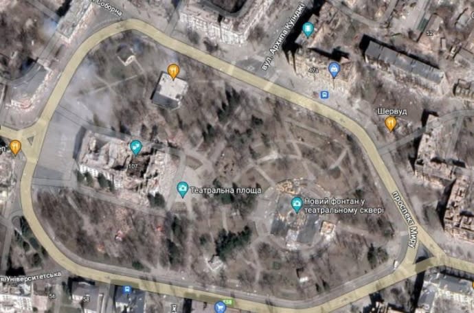
Theatre Square of Mariupol, where a theatre was located
Photo: Google Maps
Quote: "The areas are visually larger in size than the mass graves in the settlement of Vynohradne or the settlement of Manhush. It was closed for a long time (approximately until mid-July) and was under the control of the occupiers," Petro Andriushchenko emphasises.
According to him, it is currently unknown who was buried there and when. The relevant information could only be reliably established after the liberation of Mariupol.
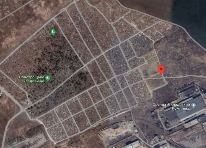
Novotroitske Cemetery
Photo: GoogleMaps
Dmytro "Orest" Kozatskyi, a soldier of the Azov regiment and one of Azovstal Mariupol steel plant defenders, even recognised his burning house on GoogleMaps.
"The last few weeks have been particularly sad. Every day is either someone's death anniversary or the birthday of one of my friends, brothers-in-arms [that remain] in captivity. Even GoogleMaps contributed today with the updated map. The photo shows my house, smouldering," Orest wrote on Twitter.
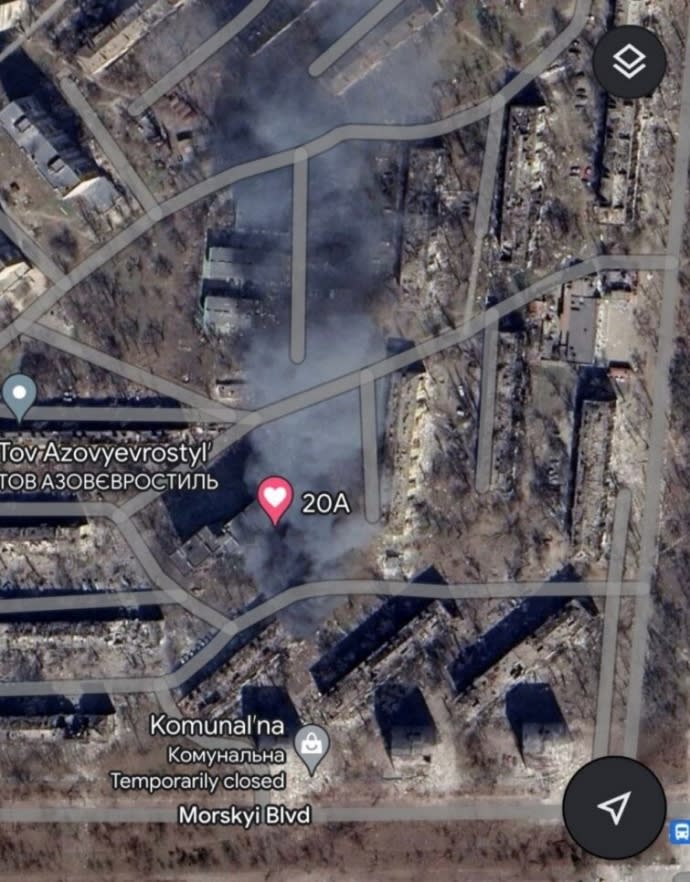
"Orest's" house.
Photo: Google Maps
Google also updated the map of Kyiv Oblast. Particularly, the map shows the destroyed bridge that crossed the Irpin River.
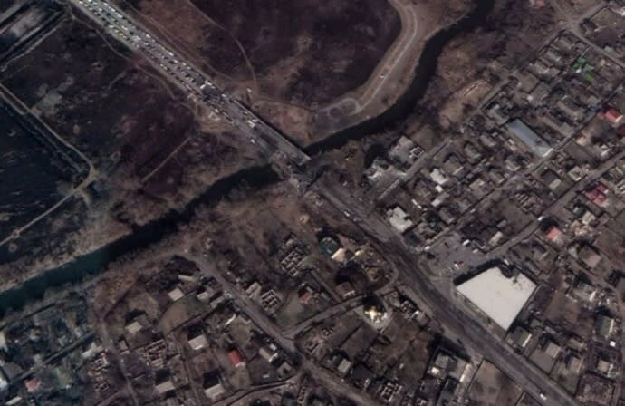
Bridge that crossed the Irpin River
Photo: Google Maps
Three bridges were blown up to stop the passage of Russian troops in the north-western direction of Kyiv on 25 February 2022. The Hostomel airport, destroyed in the first days of the full-scale invasion, can also be seen on the maps.
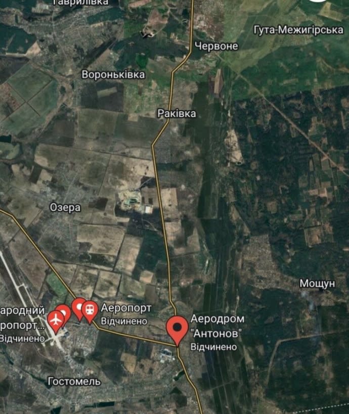
The Hostomel airport
Photo: Google Maps
In addition, the map shows a logistics terminal and a bridge blown up on 26 February 2022 near the village of Stoianka. Four people died then, and the same number were injured.
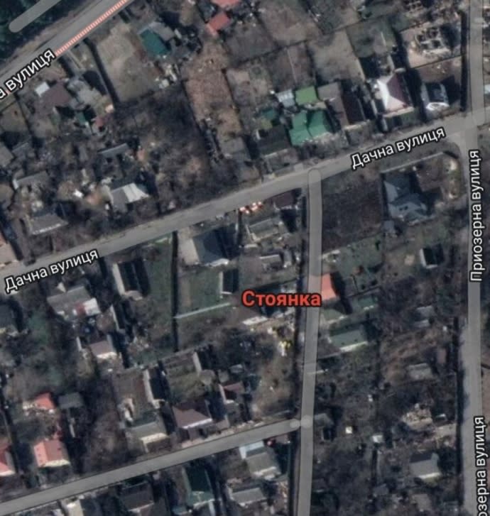
The village of Stoianka
Photo: Google Maps
The map also shows a burning house in the village of Mosuchun, which is 15km from the city of Kyiv. The settlement suffered greatly from the occupation of the Russian Federation.
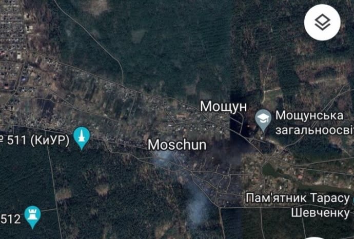
Village of Mosuchun
Photo: Google Maps
Background: Russians in Mariupol damaged or destroyed at least 80% of the medical infrastructure – 82 out of 106 medical facilities.
Journalists fight on their own frontline. Support Ukrainska Pravda or become our patron!

