Martin County updates: Hurricane Ian impacts Wednesday in Stuart, Jensen Beach, Palm City
Editor's note: Here are live updates for Thursday, Sept. 29.
TCPalm has staff across Stuart, Jensen Beach, Palm City, Port Salerno, Rio and more to provide updates on Hurricane Ian’s impact Wednesday to Martin County.
9:05 a.m. Trees down in Stuart
Trees are down in the St. Lucie Crescents neighborhood of Stuart. City crews are busy trying to clear the aftermath.
City of Stuart Public Works team removing downed trees in the St. Lucie Crescents neighborhood. pic.twitter.com/yj1ujV0xJi
— City of Stuart (@CityofStuartFL) September 29, 2022
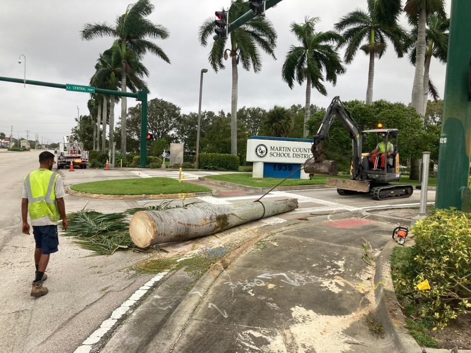
8:50 a.m. Vegetation blown near roads
U.S. 1 south of the Roosevelt Bridge to SE Monterey Road is lightly traveled and dry, unlike Wednesday when the roadway was slick from rain. Signs of blown down vegetation. Crews used heavy equipment to remove a downed palm tree in front of Martin County School District headquarters as downed palm fronds scattered in grass area in front of the building.
7:49 a.m. Stuart assessing damage
The city of Stuart was deploying crews early to determine the extent of damage across the city.
City teams out doing damage assessment. Please stay home and off the roads if possible. Many obstacles in the roads. More reports to follow as they roll in. pic.twitter.com/eiVDFWSPNN
— City of Stuart (@CityofStuartFL) September 29, 2022
5:57 p.m. - Weather conditions to deteriorate overnight
There is a tropical storm warning in effect for the Treasure Coast Wednesday evening, with conditions expected to deteriorate overnight, according to the National Weather Service’s Melbourne office.
The entire Treasure Coast is also under tornado and flood watches.
Conditions will deteriorate tonight. TS to hurricane force winds are expected. The threat of significant to catastrophic flooding is expected to develop tonight-Thu for areas from N Osceola & N Brevard north including metro Orlando. Flooding can be especially dangerous at night. pic.twitter.com/BZ0R9ilRyr
— NWS Melbourne (@NWSMelbourne) September 28, 2022
5:15 p.m. - Fewer power outages reported
There are approximately 390 FPL customers currently without power in Martin County. Power has been restored to about 3,600.
4:40 p.m. - Fishing in the wind
Willie Davis, 63, of Lake Worth, and his son, Donell Davis, 41, were fishing off the Stuart Causeway about 4:40 p.m. as a strong wind blew north. They started their day at Blue Heron Bridge in Palm Beach County, where the elder Davis reported they caught a few blue runners and grunts.
“That’s about it, so that’s why we came up here,” Willie Davis said, noting they hadn’t caught anything to brag about. “Better than being stuck in the house all day.”
4:25 p.m. - Tornado watch reissued
The National Weather Service’s Melbourne office has issued a tornado watch for all of Martin County through 1 a.m. Thursday. The previous watch ends at 5 p.m. Isolated wind gusts of up to 60 miles per hour are possible, as is half-inch-sized hail.
More than 3.9 million people are affected by the watch, which stretches from Volusia to Martin counties.
A tornado watch has been issued for parts of Florida until 1 AM EDT pic.twitter.com/IqgD6fjwfD
— NWS Melbourne (@NWSMelbourne) September 28, 2022
4:16 p.m. - Already dry
Unlike a few hours earlier, U.S. 1 near Southeast Monterey Road in Stuart is dry, reports Will Greenlee.
What a difference a few hours can make. U.S. 1 near SE Monterey Road in #Stuart is dry about 4:10 p.m. earlier today was dark and wet. #TCWeather pic.twitter.com/y2s1hzsVL9
— Will Greenlee (@OffTheBeatTweet) September 28, 2022
4 p.m. - Traffic light amid periodic showers
As showers fell on and off Wednesday in Palm City, Stuart and Port Salerno, most streets appeared passable and areas prone to flooding remained clear through the afternoon.
A little rain isn’t bothering this gaggle of happy birds near the Palm City Bridge Wednesday #tcweather pic.twitter.com/z80wczKbkP
— Melissa E. Holsman (@MHolsman) September 28, 2022
In Palm City near the St. Lucie River, Mapp Road, Southwest Cornell Avenue and All American Boulevard showed some pockets of pooled water but traffic, while light, moved along unimpeded from the effects of Hurricane Ian.
Roadways in Rocky Point, near the Manatee Pocket and along Old Dixie Highway in Port Salerno were clear Wednesday and traffic seemed lighter than usual for the afternoon.
3:45 p.m. - Cleveland Clinic closes ambulatory offices
Cleveland Clinic Martin Health, which encompasses a number of Martin County facilities, will close its ambulatory clinics, including urgent care clinics, through 10 a.m. Thursday. Ambulatory surgery centers will reopen at noon.
Click here for a complete listing of area closures and cancellations.
3:30 p.m. - Relatively few power outages reported
There are approximately 620 FPL customers currently without power in Martin County. Power has been restored to about 3,090.
1:23 p.m. - Stuart sand bags now pick-up only
Stuart public works staff this morning were delivering sandbags to residents who live in the city limits by request, but now the sand bags only are available for pick-up at the public works garage at 407 S.E. Martin Luther King Jr. Blvd. in Stuart.
There is a limit of 10 per household, said city spokesperson Misti Guertin.
In unincorporated Martin County, garbage and recycling services are paused Wednesday and Thursday.
1:14 p.m. - Some high school football games moved
The impacts of Hurricane Ian are being felt along the Treasure Coast and for high school sports, there won’t be much action.
Martin, St. Lucie, Indian River and Okeechobee counties are all off from school Wednesday and Thursday, which will force the postponements of all extracurricular activities due to the anticipated heavy rainfall and tropical storm-force winds for the area.
Martin County schools will update later this week if school and athletic events will take place on Friday.
12:27 p.m. - Wind kicks up at Bathtub Beach
South winds are blowing at a steady 25 miles per hour at Bathtub Beach, estimates reporter Ed Killer. Onlookers crowd the gazebo and take photos of the wild surf.
Bathtub Beach in Martin County open. High tide over top of reef. South winds feel like about 25 moh steady. #tcweather pic.twitter.com/G7T52HLgCU
— Ed Killer (@TCPalmEKiller) September 28, 2022
12:01 p.m. - Overcast Jensen Beach
Reporter Ed Killer spots a “gnarly north drift” at Jensen Beach.
Jensen Public Beach with a gnarly north drift going on #tcweather pic.twitter.com/ZbV2jzEUu2
— Ed Killer (@TCPalmEKiller) September 28, 2022
11:57 a.m. - Palm City flooding
Sea Captain Drive in Palm City is flooded, reports Ed Killer. Water spilled over onto sidewalks and lawns.
Flooding of Sea Captain Dr. in Palm City #tcweather 📸by Mike Glynn pic.twitter.com/HzdeW9NrOe
— Ed Killer (@TCPalmEKiller) September 28, 2022
11:30 a.m. - Tropical storm warning still in effect
Martin County remains under a tropical storm warning, according to the National Weather Service office in Melbourne.
Coastal and inland areas can expect below tropical storm-force winds of 30-40 miles per hour, with wind gusts of up to 60 miles per hour possible. Localized storm surge may potentially reach 2 feet above ground through early Saturday morning.
Inland, people are advised to “prepare for significant wind damage.”
11:27 a.m. - Tuesday night tornado?
Bobby Chanthavong, 34, of Martin County, tells TCPalm a tornado ripped off part of his roof. However, the National Weather Service confirmed only high winds had plagued the area.
A resident of SE. Fork Dr. on Wednesday picks up a portion of his roof that he says was ripped off by tornado. #tcweather pic.twitter.com/GFxxLN7Ymb
— Will Greenlee (@OffTheBeatTweet) September 28, 2022
11:27 a.m. - Park full of downed palm fronds
Palm fronds litter Hosford Park near Cove Road and Kanner Highway, reports Will Greenlee.
Plenty of downed palm fronds i#amd standing water at Hosford Park this morning near Kanner Highway and Cove Rd. #tcweather pic.twitter.com/Uxyoevcheh
— Will Greenlee (@OffTheBeatTweet) September 28, 2022
11:18 a.m. - Some Stuart eateries remain open
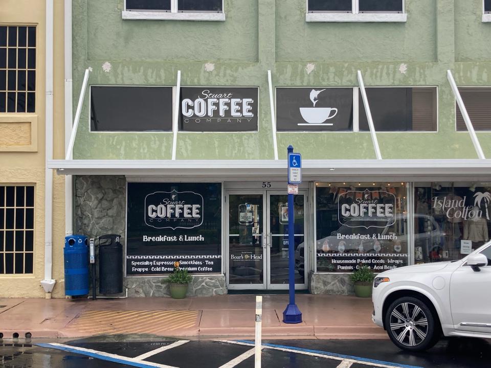
While schools and all Martin County government buildings were closed Wednesday in anticipation of what Hurricane Ian could bring to the area, that wasn’t the case everywhere.
Three Little Birds Cafe, in a plaza at U.S. 1 and Kanner Highway near downtown Stuart, was open and ready for diners.
“I think people want a place to eat, and I don’t think it’s going to be that bad over here on this coast,” owner Joseph Salzberg said. “I think that we’re going to have some people that are going to be coming from the west coast and they’re going to be staying in hotels, and they’re going to be hungry.”
10:5 a.m. - Body in the water
The body of a 34-year-old man was discovered Wednesday morning in about 10 inches of standing water in a residential area along Southwest Lost River Road, Martin County Sheriff’s officials reported.
Crime scene investigators are at the scene looking into the circumstances of the unidentified man’s death, according to Christine Christofek, a sheriff’s spokesperson.
Unidentified man found dead in standing water in Martin County Wednesday #TCweatherhttps://t.co/xU59yqm4EF
— Melissa E. Holsman (@MHolsman) September 28, 2022
“The man was said to be working on some construction early this morning,” she said via text. “There is no visible trauma to the victim.”
Reached Wednesday, Martin County Sheriff William Snyder said the man had come to a house to do some construction work for the homeowner when it appeared he died of natural causes at the scene.
10:16 a.m. - From Maine to hurricane
Martin County is experiencing high tides and some rain, according to reporter Mauricio La Plante. He captured Maine tourist Dave Arsenault standing on a rocky shore.
A wave crashes onto the rocks and splashes around Dave Arsenault, visiting the Treasure Coast from Maine. High tides and some rain in Martin County. #tcweather pic.twitter.com/pD2QK3Ddbj
— Mauricio La Plante (@mslaplantenews) September 28, 2022
9 a.m. - Emergency shelters remain closed
Can’t see the Google Map above? Click here to view Treasure Coast emergency shelters.
All 10 Martin County emergency shelters, including the one for people who require medical support (often called a “special needs shelter”), remain closed.
8:37 a.m. - Rough waves at Ross Witham Beach
Photographer Crystal Vander Weit captured white-capped waves sloshing the rocks at Ross Witham Beach.
Current conditions at Ross Witham Beach 🌬 🌊 #tcweather @NewsyLindsey pic.twitter.com/y3lzb1h49k
— Crystal Vander Weit (@TCPalmCrystal) September 28, 2022
8:15 a.m. - Empty plazas in dreary weather
Plazas such as Regency Square are sparsely populated as gray skies hover over Stuart, per reporter Will Greenlee.
There weren’t many vehicles in a number of plazas, such as Regency Square. The skies were gray. Little traffic on northbound U.S. 1 shown here about t8:15 a.m. south of SE Monroe Street. #tcweather pic.twitter.com/SduKCPXUDl
— Will Greenlee (@OffTheBeatTweet) September 28, 2022
8:13 a.m. - Wet roads in Stuart
Traffic is light on U.S. 1 in Stuart, as water collects in drainage areas north of Pomeroy Street, reports Will Greenlee.
U.S. 1 through much of Stuart was relatively lightly traveled about 8 a.m. The roadway was wet and water collected in drainage areas alongside portions of it north of Pomeroy Street. A Pollo Tropical restaurant at U.S. and Southeast Monterey Road was boarded up. #tcweather pic.twitter.com/eVdnvmzeel
— Will Greenlee (@OffTheBeatTweet) September 28, 2022
7 a.m. - EOC now level 2 activation
The Martin County Emergency Operations Center is now at a level 2 activation, according to Emergency Management Director Sally Waite.
“Level two (entails) select staff that deal with issues such as flooding and high winds,” she said. “We don’t expect the severe weather to come in until around 1 o’clock this afternoon.”
In Stuart, public works staff are delivering sand bags by request to residents who live in the city limits, said city spokesperson Misti Guertin. There is a limit of 10 per household.
Residents can request sand bags at 772-600-1260, which is the same number to report flooding, Guertin said.
4:58 a.m. - Tornado watch issued
The National Weather Service’s Melbourne office has issued a tornado watch for all of Martin County through 5 p.m. While no hail is expected, the agency warned of likely tornadoes and isolated wind gusts of up to 60 miles per hour.
More than 12.2 million people are affected by the watch, which stretches from Orlando to Miami and as far west as Sarasota.
A tornado watch has been issued for parts of Florida until 5 PM EDT pic.twitter.com/td2qarojOj
— NWS Melbourne (@NWSMelbourne) September 28, 2022
This article originally appeared on Treasure Coast Newspapers: Hurricane Ian: Tropical storm warning for Martin County, Florida

