Will 'massive' storm targeting parts of US impact Rochester?
Will Rochester be impacted by a large storm expected to bring a wild weekend of weather to much of the central and eastern part of the country?
The predicted storm, expected to reach the Northeast this weekend, includes rain, snow, wind and a chance of severe thunderstorms and tornadoes.
"From gusty winds to dangerous thunderstorms and even snow, a massive storm will affect 180 million people in the eastern half of the United States this weekend," said AccuWeather senior meteorologist Alex Sosnowski.
In short, yes. Rochester will see some heavy rain as a result of this storm, according to the National Weather Service in Buffalo.
The storm and its trailing cold front also will put an abrupt end to the unusual warmth that sent temperatures soaring to near-record levels across the central U.S. on Wednesday and Thursday.
What does the winter storm mean for Rochester NY?
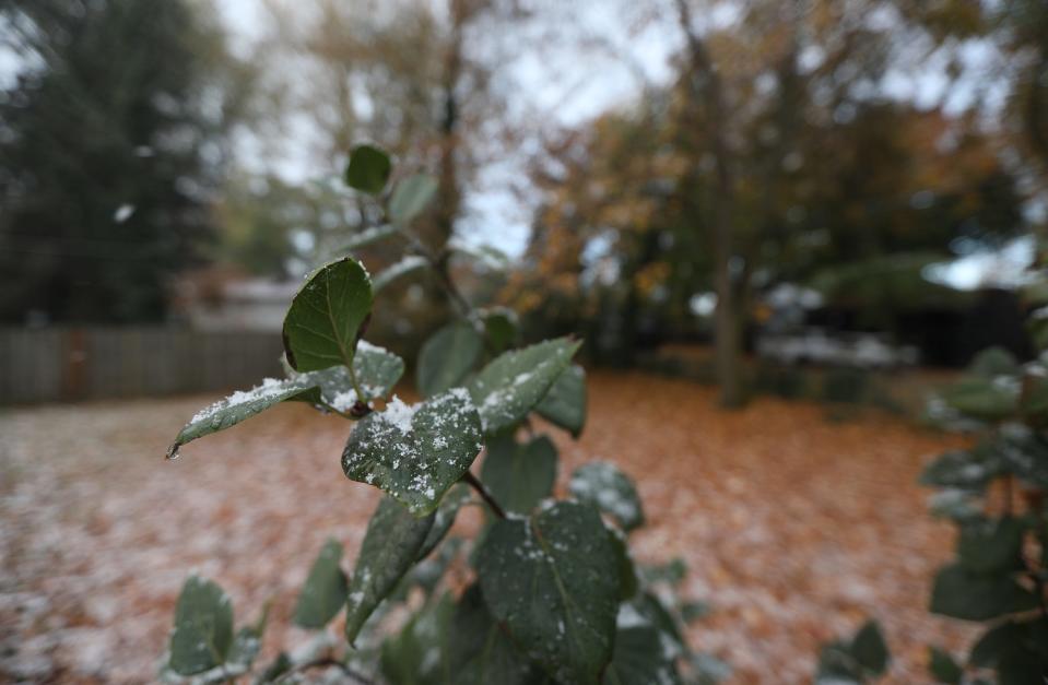
Starting Saturday night, the Rochester region is expected to be doused with rain, said Weather Service Meteorologist Liz Jurkowski. The rain will be heavy at times and is predicted to last all day Sunday until it transitions to snow late Sunday into Monday, she said.
Flurries are expected early Monday - roughly a half inch of snow is predicted - and could make for a sloppy Monday morning commute, Jurkowski said.
Lake effect snow is also possible late Sunday or early Monday south of Buffalo and near Watertown, but that forecast could change.
The high temperature in Rochester will be unseasonably warm through the weekend before dropping back to the 30s next week. The predicted high on Friday, Saturday and Sunday is in the mid 50s. The normal high in Rochester at this point in December is just above 40 degrees, according to the Weather Service.
The high is expected to drop roughly 20 degrees to the mid 30s on Monday, Jurkowski said.
Clouds will clear from south to north today, and temperatures this afternoon will be in the 40s to lower 50s! Eyes are still on a large storm for this weekend, one that will bring rain Saturday night and Sunday, and then accumulating snow Sunday night into Monday. #nywx pic.twitter.com/MTpGLaSbIT
— NWS Buffalo (@NWSBUFFALO) December 8, 2023
How much snow will Rochester NY get?
According to Sosnowski, a narrow band of snow is likely Saturday from near the quad-state zone of Kansas, Missouri, Nebraska and Iowa to central and northern Michigan. Later in the weekend, the highest chance of accumulating snow will be in parts of the Appalachians and the interior Northeast, as cold air rushes in behind a strong cold front Sunday afternoon into Sunday night, AccuWeather meteorologist La Troy Thornton said.
In Rochester, anticipate flurries with a predicted snowfall of approximately half an inch, as mentioned by Jurkowski.
Additionally, there is a chance of lake-effect snow occurring late Sunday or early Monday, particularly in areas south of Buffalo and near Watertown.
Wind, rain for many in eastern US
For most of the eastern half of the nation, heavy rain and strong winds will be the primary threats from the storm.
Heavy rain, accompanied by strong winds and thunder and lightning in some cases, will douse the eastern third of the nation. The storm is expected to shift north Saturday night from northern Florida up to Ohio, across western Pennsylvania and into New York on Sunday, AccuWeather said. As the cold front moves East, the National Weather Service warned up to 3 inches of rain is possible in some areas, which could lead to flash flooding. In Western New York, forecasters warn of heavy rain on Sunday.
AccuWeather meteorologist Grady Gilman said "heavy rainfall will accompany the frontal passage and can cause flooding on streets and highways along with reduced visibility. Significant ground and air travel delays are likely as the heavy rain, strong winds and thunderstorms come together in the East from Sunday to Sunday night."
Wind will also be a major weather story, especially on Sunday. Gusts of up to 60 mph are possible along the Interstate 95 corridor on Sunday, which could lead to tree damage and scattered power outages. Winds could roar to as much as 75 mph along the Long Island and southern New England coasts, which is at hurricane-force levels.
Warmth, then cold in parts of US
A southward dip in the jet stream will usher in colder air from Canada across the Plains and Midwest, causing temperatures to drop 15-20 degrees from what was seen Thursday and Friday, AccuWeather said. Multiple cities along the I-95 corridor including Washington, D.C., Philadelphia and New York City will have temperatures peak on Sunday with highs in the 60s, which is around 15 degrees above the historical average. The dip in the jet stream will reach the East early next week, bringing temperatures back down near historical averages for December.
This article originally appeared on USA TODAY: Rochester NY Weather: Will winter storm targeting parts of US impact us?

