Massive winter storm creates power outage, holiday travel nightmare across country
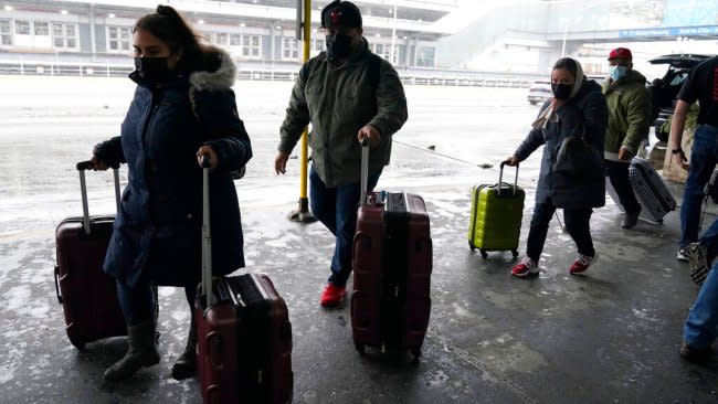
At least 47 were dead as extreme winter weather unleashed by a far-reaching bomb cyclone continued throughout the weekend. Over 1 million were left without power amid brutal cold on Christmas Eve, and tens of thousands were forced to deal with a holiday travel nightmare.
The Buffalo area was enduring brutal blizzard conditions that turned deadly, as at least 27 have died so far due to the storm in that area alone, WIVB reported. Some of the fatalities occurred as first responders became stuck in deep snow drifts while responding to medical emergencies. Extreme cold was a factor in other cases, as many became stranded on impassable roadways.
On Saturday morning, power outages topped 1.375 million at 7 a.m. EST, hitting primarily on the eastern coastline, according to PowerOutage.US as AccuWeather RealFeel® Temperatures plummeted as low as 30 degrees F below zero in the Northeast. By early Sunday morning, a reduction in energy demand led to fewer blackouts, with under 200,000 outages reported nationwide. New York was below 30,000 power outages as of Sunday afternoon while Maine remained above 45,000 customers without power. As of Monday morning, roughly 50,000 remain without power on the East Coast. Maine, New York and Virginia are the source of nearly all of these outages.
Weather alerts related to the storm covered over 60% of the U.S. population at the height of the storm on Friday with more than 200 million people under some form of warning or advisory related to the storm, from wind advisories along the mid-Atlantic to hard freeze warnings across the South. With the cross-country storm in the eastern two-thirds of the nation and the ice storm in the Pacific Northwest, over 41 million people were under a winter storm warning, and blizzard warnings were in effect for 11 million in the Northern Plains and along the Great Lakes.
More fatalities were reported in Colorado, Kansas, Kentucky, Missouri, New York, Tennessee, Wisconsin and Ohio, including four near Sandusky, Ohio, after a massive pileup on the Ohio Turnpike that involved at least 50 vehicles. Travel bans were in various locations, including New York and New Jersey, as high wind, winter storm and blizzard warnings cautioned of dangerous driving conditions.
Among the areas under blizzard warnings was Buffalo, New York, where bands of lake-effect snow dropped visibility to near zero.
"The core of the lake-effect snow band has now moved into downtown Buffalo," Extreme Meteorologist Reed Timmer reported from the area as he braced against the wind. "Prolific lake-effect snow happening here," he said, adding that it could be "one of the worst blizzards to ever hit the Buffalo area."
Extreme Meteorologist Reed Timmer checks in from the coastline of Lake Erie in #Buffalo, New York, where the #blizzard is progressing with high winds and storm surge. #NYwx
LIVE blog: https://t.co/l7ZPv0Aq7y pic.twitter.com/RpcZyUwDnp— AccuWeather (@accuweather) December 23, 2022
The National Weather Service reported low visibility to whiteout conditions since Friday morning as the rain transitioned into snow.
But it's not just the wind and the snow that are making for miserable conditions in the city. AccuWeather RealFeel® Temperatures dropped to 33 degrees Fahrenheit below zero on Friday as the actual temperature lingered at just 7 degrees.
Saturday saw record cold daily high temperatures in many cities across the country. In Philadelphia, the high only raised to 18 degrees, three degrees lower than the previous record of 21 degrees felt in 1906 and 1989. Other daily records broken along the east coast Saturday were in Wilmington, Delaware (high of 18), Trenton, New Jersey (high of 14) and Allentown, Pennsylvania (high of 13).
Farther south, record cold was felt in towns such as Knoxville, Tennessee (high of 22), Greensboro, North Carolina (high of 26) and Columbia, South Carolina (high of 28).
The governors of Georgia, Kentucky, North Carolina, New York and Oklahoma all declared a state of emergency in response to the storm, which had since exploded in intensity and developed into a "bomb cyclone" as of Friday.
A bomb cyclone refers to a storm that has undergone bombogenesis, or a rapid strengthening as the barometric pressure falls at least 0.71 of an inch (24 millibars) in 24 hours. With this intensification, these storms typically pack a multi-faceted punch, according to AccuWeather Senior Meteorologist Brian Thompson.
"Bomb cyclones are unique because the pressure falls so quickly as the storm intensifies," Thompson said. "The end result of these large pressure drops is a stronger storm that, in addition to the threat of heavy snow and rain, can produce strong, damaging winds and blizzard conditions. These more powerful storms are typically larger in size, which will produce significant impacts over a large area."
He added that these stronger storms usually also help draw down colder air from the north, as is playing out as temperatures across the nation plunge.
It wasn't the best idea to eat my lunch outside today pic.twitter.com/sKpkeeSwMd
— Brian Lada (@wxlada) December 23, 2022
"While we have seen more than a few bomb cyclones in recent years, this is probably the strongest we've seen in a while," Thompson said.
The most astounding part of the storm wasn't the snowfall totals for most areas, but the extent of recorded wind gusts that ranged from 50-60 mph, or higher, which Thompson said isn't something that's seen very often.
The National Weather Service Storm Prediction Center recorded 39 wind reports as of Friday evening, most of which were along the East Coast. The highest report was recorded in Buffalo, New York, where a gust of 79 mph was observed at the New York State Mesonet station on the Skyway.
The extent of the plunging temperatures was also of note.
"Temperatures dropped 30-40 degrees in some parts of the East in one day, which is extremely unusual," Thompson said. "The speed of this drop is what has led to the widespread flash freeze."
The bone-chilling temperatures won't stick around for long, however, with AccuWeather meteorologists calling for a warmup in most of the country for the final days of 2022.
Want next-level safety, ad-free? Unlock advanced, hyperlocal severe weather alerts when you subscribe to Premium+ on the AccuWeather app. AccuWeather Alerts™ are prompted by our expert meteorologists who monitor and analyze dangerous weather risks 24/7 to keep you and your family safer.
