Maui earthquake: Kilauea volcano remains on amber alert after 4.7-magnitude tremor

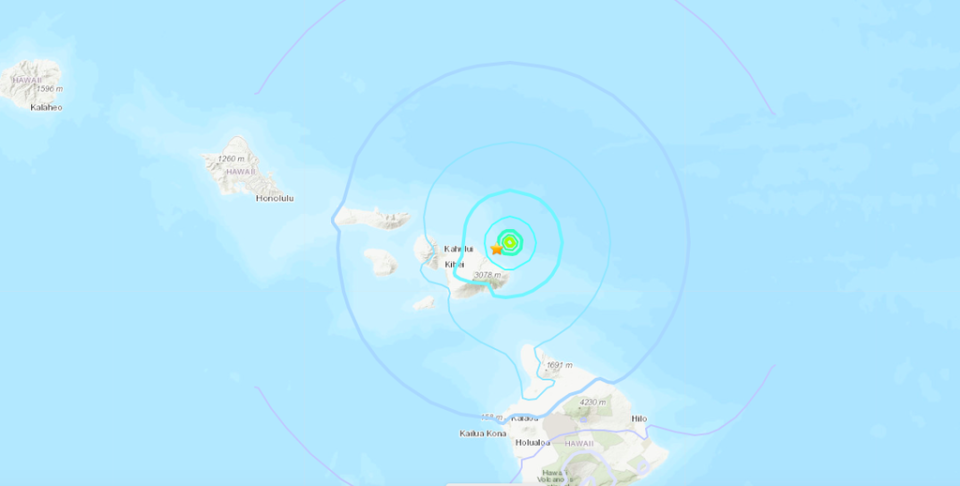
A 4.7 earthquake was recorded off the Hawaiian island of Maui early on Tuesday morning, six miles off the coast, at a depth of 25 miles – closest to Wailua, in East Maui.
Pacific Tsunami Warning Center has stated that no tsunami is expected but authorities will continue to monitor the KÄ«lauea volcano, which is on amber alert and has remained hazardous following a series of eruptions starting in September.
Within 25 minutes of Tuesday’s (25 January) earthquake, which happened at 12.51am, the USGS’s “Did You Feel It?” website recorded 100 responses. Almost 500 responses were recorded in the hour after the tremor.
“I always said an earthquake wouldn’t wake me but here I am – I thought something was slamming/shaking my bed!” said one Twitter user based in northern Maui, in the Haiku-Pauwela area.
The earthquake was felt island-wide and even in Honolulu on Oahu’s south shore, and in Hilo on the “Big Island” or island of Hawaii. There have been no reports of damage or injuries.
Hawaiian Volcano Observatory has said that this earthquake was not related to volcanic activity: “This earthquake was located off the coast of Maui at a depth indicative of oceanic plate bending due to the weight of the islands. This is a common source for earthquakes in this area and is not related to volcanic activity,” said scientist-in-charge Ken Hon.
An eruption at KÄ«lauea’s summit began at approximately 3.20pm HST on 29 September, 2021, on the island of Hawaii. Close up images recorded spewing lava at the volcano’s crater and active lava lakes on 21 January. The lava is confined to Hawai‘i Volcanoes National Park.

