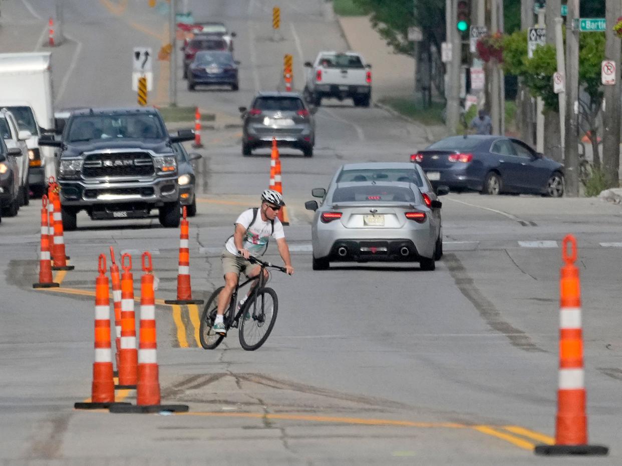
You may have noticed new lane markings on Highland, Walnut, North Avenue. Here's what's behind that
Milwaukee's bike lanes will only continue to multiply.
That means bicyclists and drivers must learn to navigate familiar city streets with new and sometimes unfamiliar markings.
The city's goal is to increase the number of bicyclists by making people feel safe and comfortable enough to traverse the city on two wheels, said Mike Amsden, Milwaukee's multimodal transportation manager.
He said building bike infrastructure is part of Mayor Cavalier Johnson's vision for the city.
"It's not just about the bike lane. It's about safer streets. It's about more vibrant streets. It's about keeping people in Milwaukee and attracting people to Milwaukee. It's about building healthy commercial corridors throughout the city," he said. "Studies prove time and time again that better walking and biking infrastructure can do all of that."
Here's what to know about Milwaukee's bike infrastructure — and how to navigate it:
Here's how to navigate Milwaukee's bike infrastructure
On the Department of Public Works' website is an explanation of a half-dozen or so types of bike infrastructure.
"Our primary goal, especially on busier streets where you have a lot of traffic and bigger types of vehicles, like buses and trucks, is really putting in what we call protected bike lanes," Amsden said.
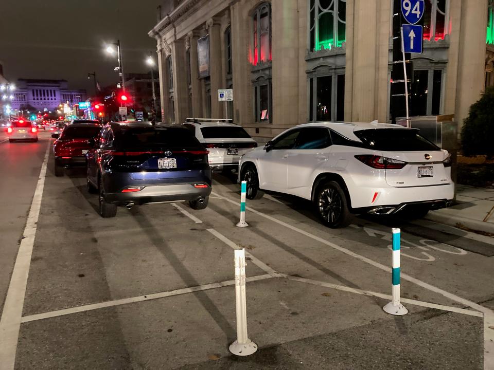
Those can come in many shapes and sizes, but the one thing they have in common is a physical barrier between bikes and moving vehicles, he said. Sometimes it's done with paint and flexible posts, like on East Kilbourn Avenue downtown. Other times, that separation may be achieved with big planters, like on East North Avenue on the city's east side.
The "marquee version of a protected bike lane" puts the bike lane at sidewalk height separated from the sidewalk with grass, like on West Walnut Street between North 20th Street to North 12th Street, he said.
Other types of bike infrastructure include:
Bike boulevards: Bike boulevards are lower-traffic neighborhood streets where various methods are used to slow vehicles and discourage drivers from cutting through the area, making it more comfortable for pedestrians and bicyclists.
Trails: These off-street paths include the city's Beerline and KK River trails, Milwaukee County's Oak Leaf Trail and the state's Hank Aaron Trail.
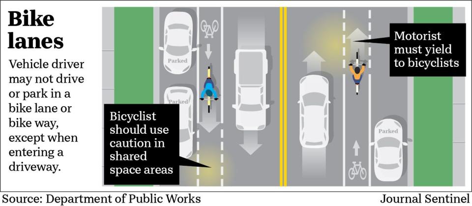
Bike lanes: These are areas in the street designated for bikes, including through pavement markings.
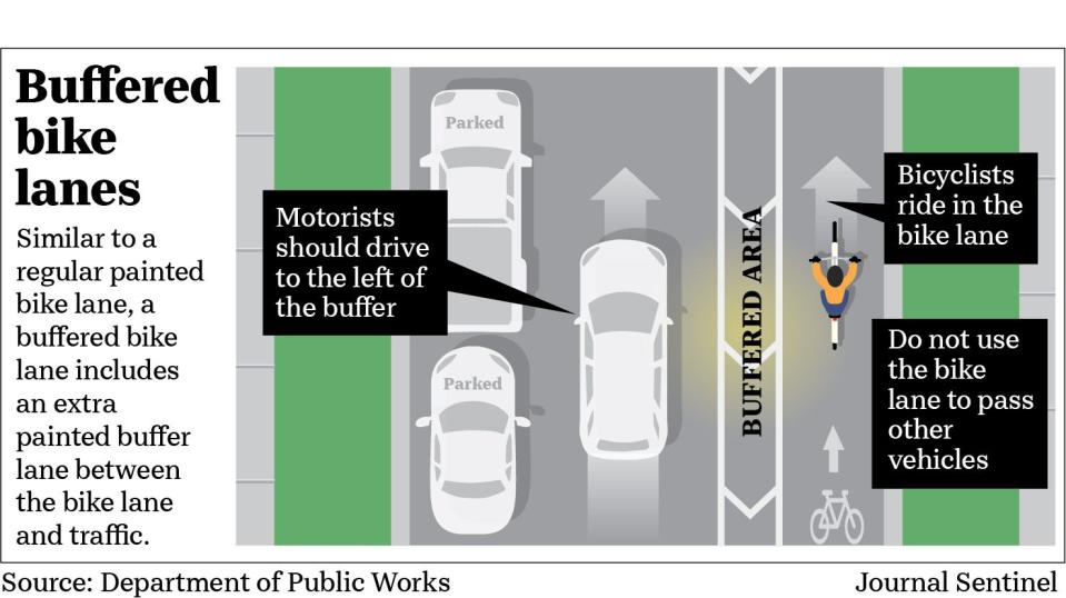
Buffered bike lanes: Similar to a regular painted bike lane, a buffered bike lane includes an extra painted buffer lane between the bike lane and traffic. (The city is not installing many of these at this point because they don't tend to get more people out biking, Amsden said.)
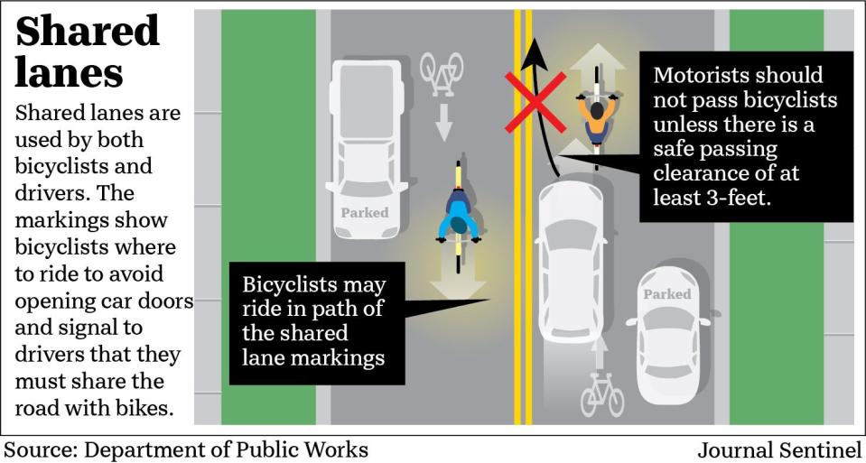
Shared lane markings (sharrows): These road markings indicate a shared lane for bicyclists and vehicles.
Where can I see some of Milwaukee's bike infrastructure?
West Highland Boulevard, West Walnut Street, West Kilbourn Avenue downtown and North Avenue on the east side provide a good taste of the bike infrastructure available.
There are bike boulevards in the area of North Fratney Street and East Wright Street and buffered bike lanes on West Roosevelt Drive and South Chase Avenue, according to a map on the city's website.
How many miles of bike infrastructure does Milwaukee have?
At the end of 2022, the city had 195 miles of bikeways, including traditional and buffered bike lanes, according to the Department of Public Works.
There were:
2.6 miles of protected bike lanes.
2.1 miles of bike boulevards.
43 miles of trails, including trails managed by the county and state.
At least 3½ miles of new protected bike lanes will be built in 2023, according to the department.
What is the bike lane network the city is working on?
Amsden said the city is focused on building protected bike lanes that connect off-street trails to create a "seamless, cohesive, very intuitive network."
The goal is not solely to connect to downtown but also to allow people to better access neighborhood destinations like larger parks, schools, job centers and more on their bikes, he said.
Johnson in his State of the City Address earlier this year set a goal for Milwaukee to have up to 50 miles of protected bike lanes under construction or in development by 2026.
It's hard to know, Amsden said, exactly when the network would be done.
"A lot of it is dependent on funding and opportunities that come up, but we expect in the next couple of years here to have a really solid network formed. I think then we can reassess and see what the next steps are," he said.
How can I plan a bike trip within Milwaukee?
A map on the city's website shows where various types of bike infrastructure have been installed and an interactive bike map for planning trips can be found at milwaukee.gov/bikemap.
And, Amsden said, as the city builds out bike infrastructure, the network will become more intuitive for bicyclists to simply follow when they're on the road.
There's also an agreement in place to keep signs across communities very similar so it's easier to identify bike routes, he said.
Can I ride my bike on the sidewalk in Milwaukee?
City ordinance allows children under 10 years old to ride on sidewalks that aren't next to a building. Others are allowed to ride on sidewalks only in areas clearly identified by signs or other markings as being available for use by bicyclists.
Alison Dirr can be reached at @AlisonDirr.
This article originally appeared on Milwaukee Journal Sentinel: How to drive on new bike lanes in Milwaukee on North Avenue, Walnut

