Deadly lake-effect blizzard buries Buffalo in over 4 feet of snow
- Oops!Something went wrong.Please try again later.
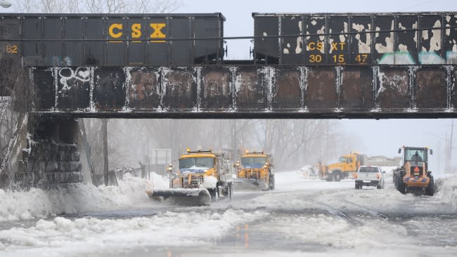
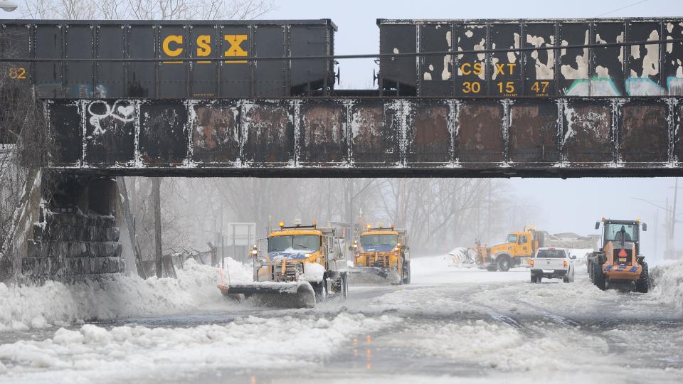
The same powerful storm that brought blizzard conditions and severe cold to a large portion of the central United States generated a major lake-effect snow event prior to Christmas. Conditions have turned deadly, with at least 27 fatalities reported in Erie County, New York, which includes the greater Buffalo area, amid just over 4 feet of snow.
Erie County Executive Mark Poloncarz stated that 14 of the fatalities in Erie County, where Buffalo is located, were due to exposure to the extreme cold. Poloncarz noted that three people were found dead in their vehicles, four died without heat, three died from shoveling or snow-clearing related cardiac events, and that three died after EMS services were delayed.
"I am aware of additional bodies that have been recovered and are being brought to our temporary morgue," Poloncarz told CNN on Monday. "We've had so many bodies that various hospitals are full and we're just having to go through and determine if the individuals have died from a blizzard-related death."
Members of the National Guard were dispatched to Erie County Saturday morning to get people out of stranded cars, targeting the hardest-hit spots in the Buffalo metro area.
During Friday and overnight Saturday, local first responders and emergency equipment were unable to reach hard-hit spots, including Buffalo. They were unable to "even go a few blocks" according to Poloncarz.
The storm began as a rain event for Buffalo, with the city receiving 1.98 inches on Friday, breaking the prior daily record of 1.73 inches that had stood since 1878. As Arctic air rushed in, however, rain changed to heavy snow Friday morning. The Buffalo airport recorded zero-mile visibility for nearly 16 hours from midday Friday to the early morning hours of Christmas Eve.
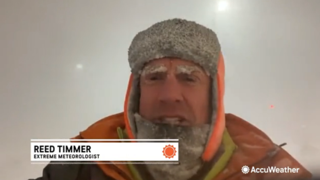
"One of the most extensive, most intense blizzards I've ever covered," Extreme Meteorologist Reed Timmer said amid the snowstorm.
 |
Reed Timmer braves the epic blizzard and Arctic cold in Buffalo, New York, late Friday, Dec. 23, 2022. |
"Just a feeling out here of helplessness not being able to see anything, losing your sense of up versus down," Timmer explained as the wind-driven snow howled around him.
So far, 50 inches of snow has been reported at Buffalo Niagara International Airport, located just northwest of downtown. On Friday alone, the airport received 22.3 inches, followed by another 17.9 inches on Christmas Eve.
The National Weather Service office in Buffalo posted a picture on Twitter showing the massive mounds of snow piled outside of their building. "Many (many) cars are still buried throughout the area," the post said.
The lake band is still raging, but it's now south of the airport. Here's a view of our office with some rather impressive snow mounds in the foreground. Many (many) cars are still buried throughout the area. pic.twitter.com/owto22GbF6
— NWS Buffalo (@NWSBUFFALO) December 25, 2022
The conditions initially forced a closure of the airport until at least 11 a.m. EST Monday, per New York Gov. Kathy Hochul. On Monday afternoon, it was announced the airport would remain closed until 11:00 a.m. EST on Wednesday. Snow plowing equipment is being sent from Pittsburgh International Airport to assist cleanup in Buffalo.
On Christmas morning, the city of Niagara Falls lifted its travel ban but urged people to use extreme caution while heading out to their holiday destinations.
The blizzard warning that was in effect for the metro areas was allowed to expire early Sunday morning, but a Winter Weather Advisory remains in effect with some lake-effect snow still falling over western New York as of Monday morning.
 |
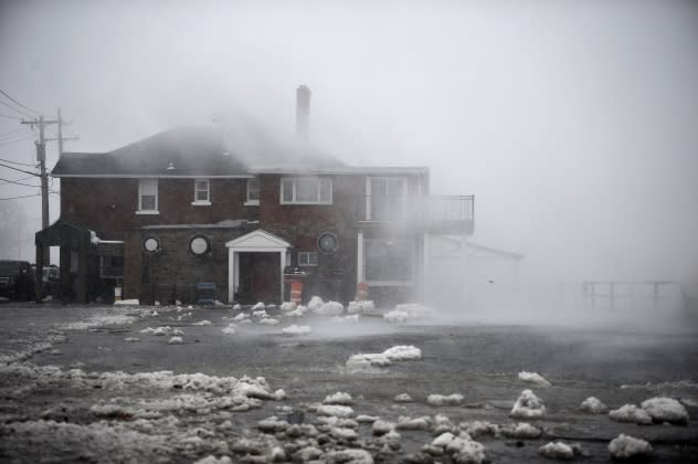
Lake Erie waters wash over the shoreline on Dec. 23, 2022, in Hamburg, New York. The Buffalo suburb and surrounding area are expecting wind gusts over 70 mph battering homes and businesses throughout the holiday weekend. (Photo by John Normile/Getty Images) |
"Power outages are possible across the City of Buffalo and the Western New York region throughout the duration of the storm," Buffalo Mayor Byron W. Brown said in a press conference earlier this week. As of early Tuesday morning, over 5,000 customers remain without power in Erie County.
Vehicles were still abandoned across Buffalo on Sunday afternoon, including Oishei Children's Hospital. Abandoned cars around the city were hampering emergency rescue and response efforts.
Prior to this lake-effect event, AccuWeather meteorologists correctly predicted that more than 3 feet of snow would fall in the Buffalo metro area, likely putting this blizzard as one of the worst in the city's history.
"The snow, coupled with wind gusts approaching hurricane force [74 mph or greater], will create enormous drifts and impossible travel," AccuWeather Meteorologist Jake Sojda said ahead of the first snowflakes in the city.
A blizzard is defined by the National Weather Service as sustained or wind gusts to 35 mph or greater with visibility of one-quarter of a mile or less in snow or blowing snow for at least three consecutive hours.
More recently, the snow event from mid-November brought a storm total of 81.2 inches in Hamburg and 80 inches in Orchard Park, New York. These locations are towns south of Buffalo. However, the band of heaviest snow with this latest event often aimed farther north, bringing extensive impacts to the downtown area and some of the towns on the Niagara Peninsula.
Even after the worst of the snow is over, anyone that attempts to venture out and travel may face a high risk of becoming stranded.
Where the power goes out, "people could be stuck in homes with no heat or running water," Sojda said. There is the risk that exhaust pipes from those stuck in cars or homes could become blocked, which can substantially increase the risk of carbon monoxide poisoning.
 |
Areas downwind of Lake Ontario have already received a healthy helping of fresh snow just in time for Christmas, with Watertown, New York, recording 22.5 inches as of Sunday morning. In western Michigan, 1-2 feet of snow has been common near Grand Rapids as well as in northern Lower Michigan and the Upper Peninsula.
The amount of snow that has fallen around the Great Lakes, especially off lakes Erie and Ontario, may require heroic means to remove for some communities to have access to highways and emergency services in the days ahead. It could take days for some neighborhoods to dig out.
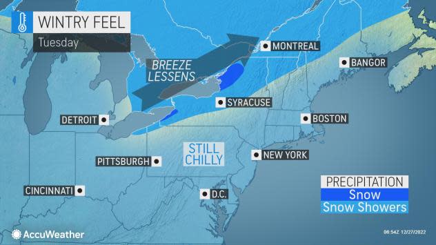
Fortunately, the weather will begin to cooperate this week with a day-to-day warming trend and a break from major storms on the way. Temperatures will climb well above freezing across a large area of the country later in the week and for the New Year's weekend.
Want next-level safety, ad-free? Unlock advanced, hyperlocal severe weather alerts when you subscribe to Premium+ on the AccuWeather app. AccuWeather Alerts™ are prompted by our expert meteorologists who monitor and analyze dangerous weather risks 24/7 to keep you and your family safer.
