Memphis weather: Tornado warning for Shelby County lifted; area now under tornado watch
This story is being offered for free. Consider becoming a subscriber to help power our ongoing coverage.
The National Weather Service in Memphis lifted the tornado warning for Shelby County three minutes before 6 p.m., right before it was set to expire.
A warning means a tornado has been indicated and to seek shelter immediately.
The area remains under a tornado watch until 8 p.m.
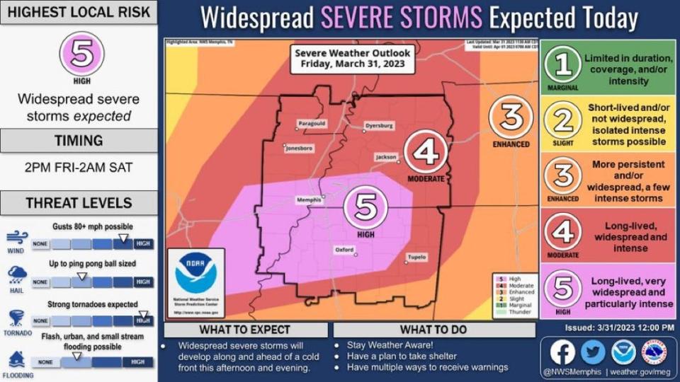
The Memphis area was upgraded from a moderate risk to a high risk for severe weather Friday and will likely see severe storms with the possibility of tornadoes and hail, according to the National Weather Service in Memphis.
As of 12:30 p.m. Friday, NWS issued a tornado watch for the Mid-South until 8 p.m. with forecasts of several strong tornadoes, scattered hail up to tennis ball size and high wind gusts.
Beginning at 3 p.m. Friday until 2 a.m. Saturday, the Mid-South will see the highest risk of severe weather with a high chance for strong storms, according to NWS Memphis. Storms could be capable of producing strong tornadoes, damaging winds and large hail.
SEVERE WEATHER: 'Large and destructive tornado' hits near Little Rock; tornado emergency in eastern Arkansas: Weather updates
NWS Meteorologist John Sirmon said the Memphis area has not seen a level five risk in "a couple years," and residents should expect all modes of severe weather including large hail, wind gusts "in excess of hurricane force which is greater than 70 mph," and "long-lived, long-tracked violent tornadoes."
Sirmon said the tornadoes "have high potential" to resemble the tornadoes that ripped through Mississippi March 24 and killed at least 26 people.
From Friday morning until midnight, Memphis will see thunderstorms, showers and wind gusts blowing between 30- 70 mph, NWS Memphis said. Temperatures Friday will range from the high at 77 degrees to the low at 56 degrees, according to the weather service.
NWS Memphis also issued a wind advisory beginning at 7 a.m. Friday until 1 a.m. Saturday.
The Memphis area is at high risk, meaning the severe weather could be "long-lived, very widespread and particularly intense," with damaging winds and storms developing Friday afternoon, according the weather service.
Portions of Mississippi and Arkansas are also at a high risk for severe weather.
NWS recommends residents have a shelter plan and find ways to receive weather updates.
Sirmon said people in the Mid-South should start preparing now for the severe storms and tornadoes.
STORM PREPARATION: How to prepare for severe weather conditions
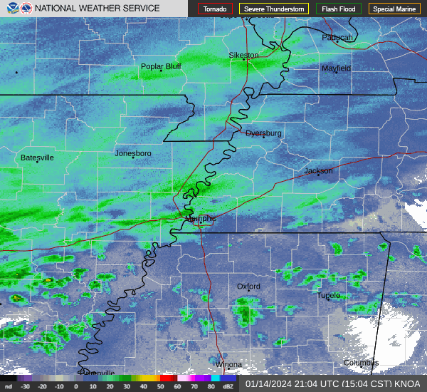
Memphis-area weather radar
Memphis weekend forecast
The weather should clear by Saturday morning as NWS Memphis predicts clear skies and a slight breeze with the highest temperature at 66 degrees and the lowest at 42 degrees.
Sunday will also remain clear and sunny with the high at 69 degrees and the low at 56 degrees, but by Sunday night Memphis will see a chance of showers going into Monday morning, according to NWS Memphis.
Dima Amro covers the suburbs for The Commercial Appeal and can be reached at Dima.Amro@commercialappeal.com or on Twitter @AmroDima.
This article originally appeared on Memphis Commercial Appeal: Weather in Memphis: Shelby County tornado warning lifted

