Mexico's Baja California braces for Hurricane Norma's landfall
Oct. 21 (UPI) -- Hurricane Norma was nearing landfall along Mexico's Baja California Peninsula on Saturday morning as the region braced for life-threatening impacts.
Despite its decline in wind intensity, the storm remains a formidable threat and could help to fuel an outbreak of drenching rain in parts of the United States in the coming week, AccuWeather forecasters said.
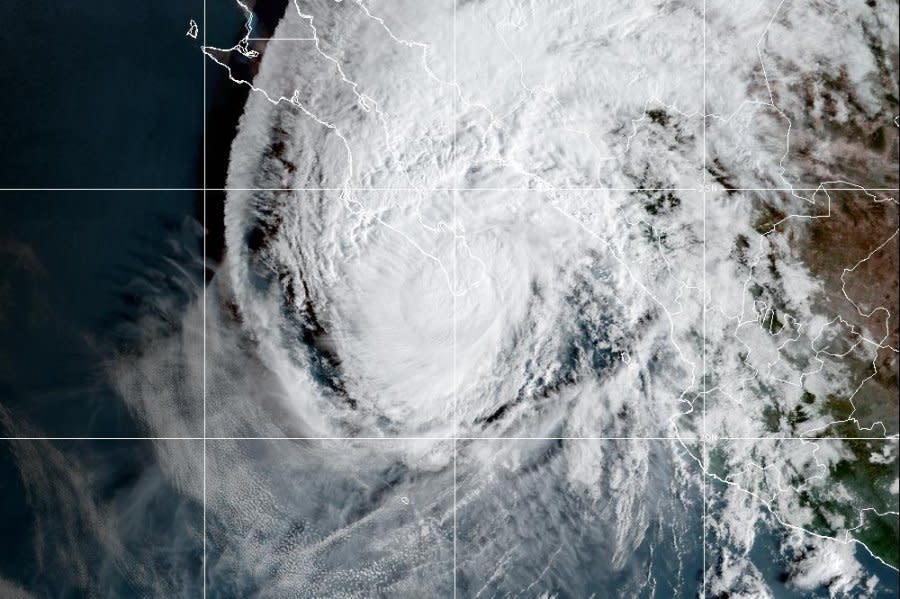
Norma rapidly intensified into a major hurricane over the East Pacific from Wednesday to Thursday morning, as accurately predicted by AccuWeather meteorologists. The now Category 2 hurricane had maximum sustained winds of 110 mph as of Saturday morning while swirling 40 miles south-southwest of Cabo San Lucas. Norma was moving to the north at a speed of 9 mph.
Norma to unload heavy rain in Mexico
Norma will not make landfall in Mexico as a major hurricane as the last tropical system to hit the country did just weeks ago. Major Hurricane Lidia struck Mexico as a Category 4 hurricane on the Saffir-Simpson Hurricane Wind Scale just to the south of Puerto Vallarta. It had maximum sustained winds of 140 mph as it crashed ashore on Oct. 10.
"Norma will continue to lose wind intensity as it encounters land and cooler waters," AccuWeather Tropical Meteorologist Alex DaSilva said.
The storm can make two landfalls in Mexico, with the first being on the southern tip of the Baja California Peninsula at the start of the weekend and the second possibly as a tropical storm on the western coast of the country's mainland.
Heavy, tropical downpours are likely along Norma's path even as the storm's wind intensity steadily declines.
The first round of dangerous and damaging conditions will occur over the southern part of the Baja Peninsula, including the city of La Paz, Mexico, into Sunday.
Heavy rain could lead to incidents of life-threatening flash flooding, mudslides and washouts from the southern part of the Baja Peninsula to the west-central coast of mainland Mexico.
AccuWeather's team of tropical experts are calling for up to a foot of rain in part of the region with an AccuWeather Local StormMax™ of 17 inches.
Powerful winds can knock down trees and power lines, as well as damage some structures near where Norma makes its first encounter with land on Saturday.
The second landfall and corresponding second round of torrential rain with life-threatening conditions will likely unfold in the zone from Mazatlán to Culiacán spanning Sunday to Monday. Locally damaging winds can occur in these areas as well, but heavy rain will remain the greatest risk to life and property.
What will happen to Norma next week?
The guiding forces of Norma into next week will be complex and largely dictated by non-tropical weather features. A big player will be the position of the jet stream over the western United States into next week, said AccuWeather Senior Meteorologist Joe Lundberg.
"If that jet stream dips far enough to the south, it will pick up Norma and fling it swiftly northeastward and into the interior Southwest and southern Plains of the U.S. next week," Lundberg explained. "But, if that jet stream dip is more shallow, Norma could miss the tug and may hover near the coast of Mexico much of next week while slowly diminishing over churned-up cooler waters."
AccuWeather meteorologists are favoring a solution that brings at least some rain into the south-central United States during the first part of next week. In this scenario, the main core of Norma's circulation would diminish over western Mexico.

