Miami’s weekend forecast includes more gusty winds and heavy rain. When will it stop?
People in South Florida might be over the inclement weather plaguing the region since Wednesday, but the storms are not done with them, the National Weather Service in Miami said Friday morning.
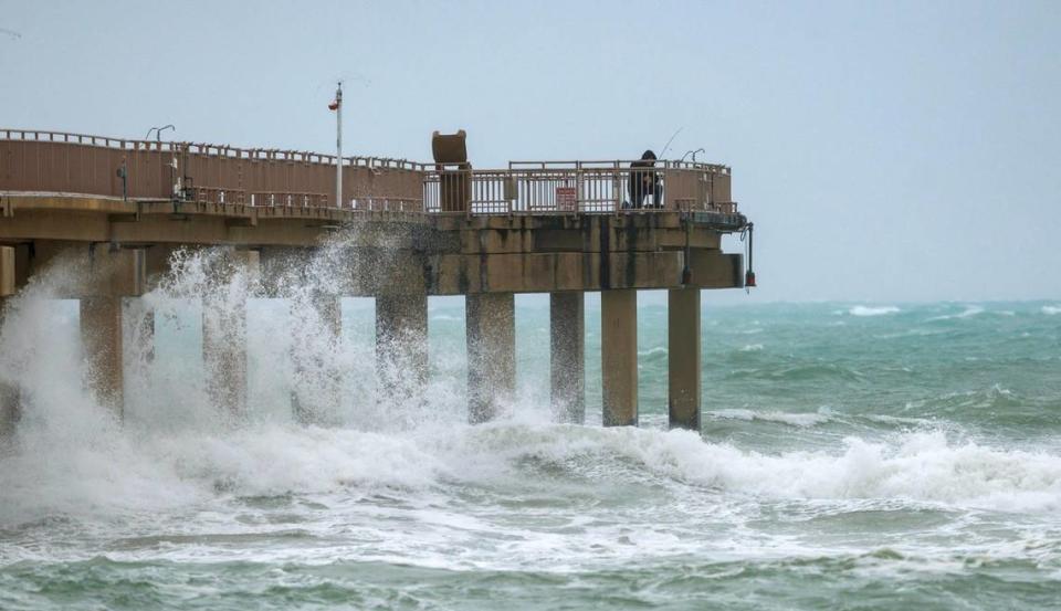
Near tropical storm-force wind gusts, heavy rainfall, flooded streets and other hazards are forecast to continue over the weekend in Miami, Fort Lauderdale, Palm Beach and the Florida Keys, the weather agency warned.
When will this weather madness cease? The short answer: not soon enough.

Forecasts for Miami-Dade, Broward and Palm Beach
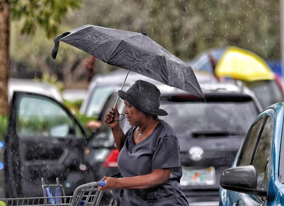
Periods of heavy rainfall are expected to continue through the weekend, which could result in some street flooding.
“A low-pressure system will approach Florida on Saturday, with increasing chances for rain throughout the day,” the National Weather Service said. ”This could result in localized flooding concerns across southeastern Florida.”
UPDATE: Tourists, workers brave tropical storm-like wind gusts from Miami Beach to Cutler Bay
Up to 5 inches of rain is forecast in Miami, Fort Lauderdale and West Palm Beach from 7 a.m. Friday to 7 a.m. Monday. In a worst-case scenario, the region could receive up to 6 inches
Flooding is possible on low-lying roads and property near the South Florida coast until 1 p.m. Friday.

Gusty winds are expected for the next several days with sustained winds up to 35 mph and gusts up to 45 mph or more along the South Florida coast.
A wind advisory is in effect for the metro and coastal areas of Miami-Dade, Broward and Palm Beach counties through Sunday 7 a.m. Sunday.
“Unsecured items could blow around,” the weather agency said. “Hazardous driving conditions for high-profile vehicles” is expected.
Rough seas are also forecast.
The U.S. Coast Guard ordered on Friday morning the temporary closure of the Port of Palm Beach to inbound traffic because the agency is expecting sustained winds up to 40 mph and seas up to 15 feet in the area.
”The restrictions will be lifted upon improved conditions,” the Coast Guard said on X, formerly Twitter, around 9 a.m.
.@USCG Sector Miami Captain of the Port has ordered the temporary closure of @PortofPalmBeach to inbound traffic due to adverse weather conditions. @NWS has forecasted sustained winds of 30-40 mph and seas of 10-15 foot. The restrictions will be lifted upon improved conditions. pic.twitter.com/VcG8X5mVDe
— USCGSoutheast (@USCGSoutheast) December 15, 2023
Other potential hazards to monitor
Heavy rainfall, gusty winds, coastal flooding and rough seas are not the only hazards on this weekend’s weather menu in South Florida.
Here’s what else you should know:
▪ Hail: There is a marginal risk for thunderstorms with frequent lightning, gusty winds, and small hail on Saturday.
▪ Lightning: Shower and thunderstorm chances could start to increase Friday night into this weekend. The risk of lightning hazards is forecast to clear by Monday.
▪ Surf: There is an extreme risk of high surf along Palm Beach and Broward beaches, and an elevated risk for Miami-Dade’s with large breaking waves of 7 to 12 feet in the surf zone. A high Surf advisory is in effect until 7 a.m. Sunday.
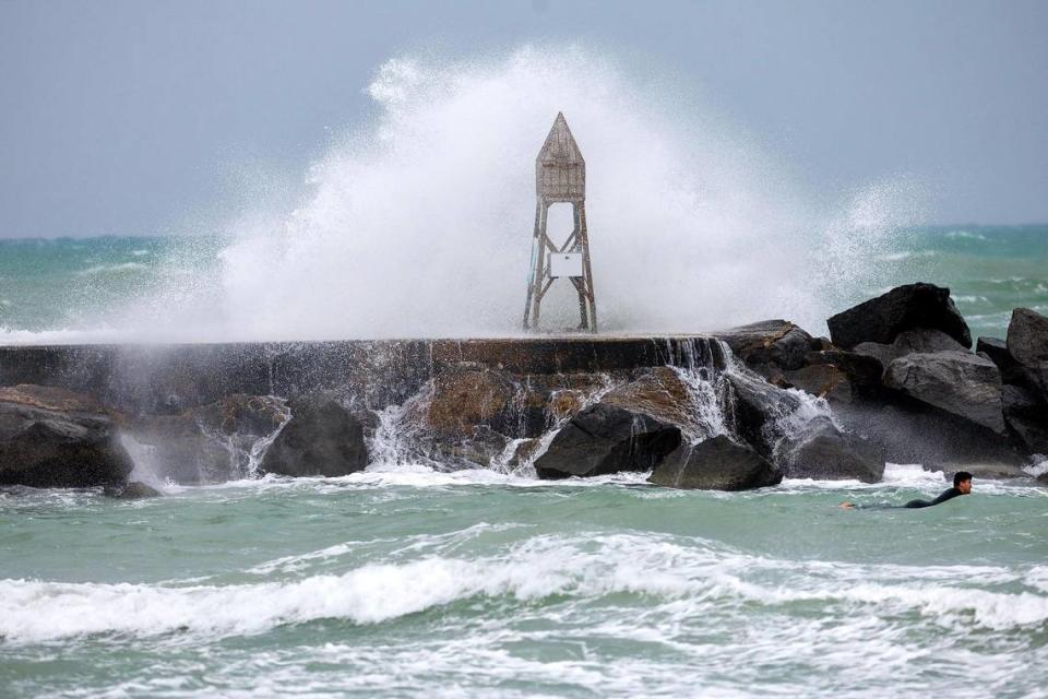
▪ Rip currents: There is a high risk for strong rip currents along the Atlantic beaches. A high rip current risk is in effect through Sunday evening.
▪ Marine hazards: Winds will remain strong to gusty for the next several days, keeping an elevated to extreme marine hazard threat level through the weekend. A gale warning with winds 25 to 35 knots with gusts up to 40 knots and seas 1 to 3 feet is in effect until 7 p.m. Sunday.
▪ Coastal flood: Minor coastal flooding may be possible along the Atlantic coastline through the remainder of the week due to persistent northeasterly winds.
Additionally, beach and marine conditions will remain very dangerous today due to gale-force winds, high waves, high surf and rip currents. Exercise extreme caution if you have boating interests today! pic.twitter.com/blsmn6HFnU
— NWS Miami (@NWSMiami) December 15, 2023
What about the Florida Keys?
The Florida Keys on Thursday saw sustained winds of around 20 mph, with gusts up to 25 mph, said National Weather Service Key West meteorologist Nancy Barnhardt.
The windy weather — which was blamed for a power outage that impacted tens of thousands of people Thursday morning across the Keys — is expected to stick around at least through Saturday, she said.
A gale warning, with winds up to 35 knots and gusts up to 45 knots, and seas up to 13 feet, is in effect for the Keys coastal waters. A wind advisory with winds near 25 mph, and gusts up to 35 mph, is in effect for the islands until 11 a.m. Friday.
National Weather Service forecasters say the high winds experienced during the week will be paired with heavy rains starting Friday morning and last until Saturday, when the heaviest downpours are expected, totaling 4 to 8 inches in parts of the Keys.
A flood watch — meaning that flooding is possible — is in effect for the Florida Keys through late Saturday night.
A Wind Advisory or the island communities remains in effect, as does a Gale Warning for the Florida Keys coastal waters. #keywest #floridakeys #flwx #flkeys #marathonflorida #keylargo
— NWS Key West (@NWSKeyWest) December 15, 2023

