Mid-week severe thunderstorms roll through Ontario and Quebec
While eastern Ontario and southern Quebec had a waterlogged start to the week, the fun continues for more even more parts of Ontario and Quebec as we coast through the mid-week. And don't hold out too much hope for a dry weekend, either.
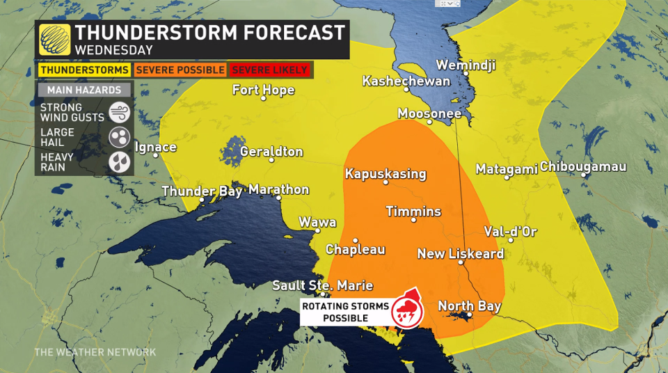
WEDNESDAY
Locations: Northeastern Ontario
Timing: Afternoon hours
Weather: Severe thunderstorms are possible through most of northeastern Ontario on Wednesday afternoon.
SEE ALSO: Why some roadways are designed to flood during storms
Sudbury and surrounding towns in the Greater Sudbury Area will be the bullseye for these storms, bearing the brunt of heavy downpours and large hail. Additionally, there is a slight chance of rotation within some stronger, isolated cells, which will be carefully monitored by forecasters throughout the day.
Motorists along Highway 1 should be aware of slower driving conditions. Heavy downpours can reduce visibility on the road to near-zero. If you find yourself in hazardous weather, find a safe place to pull over and use your four-way blinkers to wait things out.
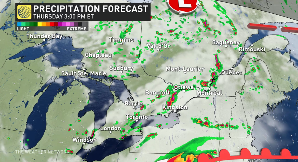
THURSDAY
Locations: Southern Ontario and Quebec
Timing: Afternoon and into the evening
Weather: The same instability causing stormy weather in northeastern Ontario on Wednesday will weaken, but continue to trigger scattered thunderstorms across the Greater Toronto Area, as well as Ottawa and Montreal Thursday afternoon and evening. These storms should remain non-severe in nature, luckily, although heavy downpours and large hail are still risks to look out for.
There is some uncertainty in the forecast at this time, however, as a low develops stateside that could shake things up.
More heavy rainfall is expected up the St. Lawrence heading into Friday, where many areas have already reached their average monthly rainfall totals. Quebec City, who has already experienced their rainiest day on record Tuesday, as well as the Gaspe area will be at a particularly higher risk for localized flooding from this system.
BEYOND
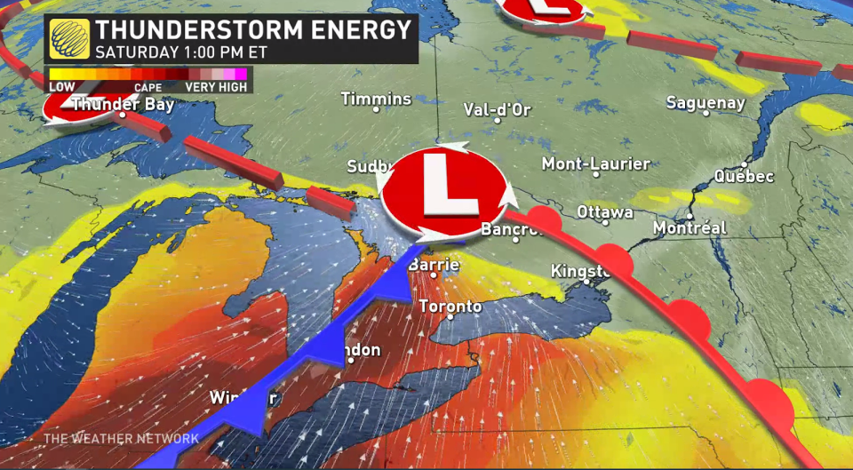
Forecasters are closely watching another stormy system approaching southern Ontario for Saturday. While it’s too far out for any specifics, what we know now is a new low will pull in an abundant amount of thunderstorm energy, increasing the risk for severe storms over the weekend.
ALSO READ: Canada’s historic wildfire season only halfway done: A checkpoint
Be sure to be flexible with your weekend plans, especially if they involve outdoor activities, and check back with us as continue to refine your weekend forecast.