Middle TN weather: Tornado watch for Maury County issued as severe storms bring flooding, high winds possible Wednesday, Friday
With several rounds of potentially severe storms moving into Nashville and Middle Tennessee that could dump a lot of rain and bring a threat of flooding, a tornado watch was issues for Maury County, according to the National Weather Service.
"The weather is about to get a little temperamental," NWS Nashville said in a Twitter post Wednesday morning. "Unfortunately, there is a threat of severe storms and flooding from tonight until Friday morning."
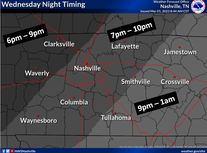
The first wave of storms will reach the area starting at 6 p.m. Wednesday before ultimately moving out after 1 a.m., the forecast showed. Damaging winds, hail and isolated tornadoes are all possible.
Shortly after 7:30 p.m. Wednesday, NWS issued at tornado watch until 2 a.m. for parts of Tennessee and Alabama that included Bedford, Giles, Lawrence, Lewis, Marshall, Maury, Perry, Wayne Counties.
A tornado watch has been issued for parts of Alabama and Tennessee until 2 AM CST pic.twitter.com/bI41YvSKA4
— NWS Nashville (@NWSNashville) March 2, 2023
Nashville is under a marginal risk (level 1 of 5) for severe weather Wednesday night, while the areas south of Interstate 40 are under a slight risk (level 2 of 5).
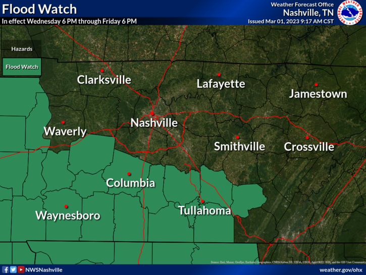
Flash flooding is also possible, NWS cautioned, with rain totals of 1-3 inches in some areas. The southwestern part of the region, including Columbia and Tullahoma, is under a flood watch from 6 p.m. Wednesday through 6 p.m. Friday.
Forecast: Severe weather threat low Thursday, ramps back up Friday
The warm front will continue north through Middle Tennessee on Thursday, NWS said. A few isolated strong storms are possible throughout the day Thursday. However, the threat for severe weather is low.
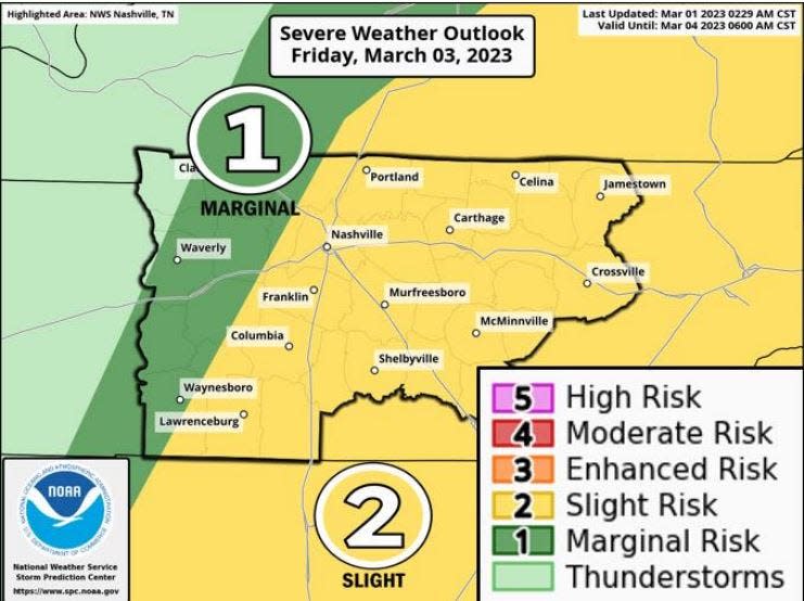
Friday brings another round of storms, with most of the region under a slight risk for severe weather (level 2 of 5) from 6 a.m. through noon. Areas east of Interstate 65 have the greatest risk of severe storms, the forecast showed.
"Hazards include straight-line winds, isolated tornadoes and localized flooding," NWS said. "While severe weather is possible Friday, winds will be the biggest hazard. Strong winds — sustained 20-30 mph with possible gusts of 45-50 mph — ahead of the front are likely."
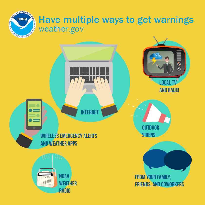
National Weather Service urges weather awareness
As always, it's important to remain weather aware, NWS said. There are multiple ways to get weather alerts, including cell phone push alerts from local media and weather apps; social media updates; local news coverage; and NOAA weather radios.
NWS recommends having an emergency kit you can quickly grab in case of an emergency. It should include essential supplies like food, water, flashlights, batteries, medicine, extra clothing and shoes, toiletries and solar-powered chargers for electronic devices.
Learn more about how to prepare for severe weather and make an emergency plan at ready.gov/plan.
Nashville-area weather radar
Nashville forecast
Wednesday night: Showers and thunderstorms possible through the evening and overnight hours. Some storms could bring heavy rainfall. Chance of precipitation is 100%. High: 78; Low: 57
Thursday: 40% chance of showers, mainly after 4 p.m. More showers and a possible thunderstorm overnight and into Friday morning, with an 80% chance of precipitation. High: 67; Low: 58
Friday: Showers and thunderstorms possible before noon. Chance of precipitation is 90%. High: 72; Low: 42
Saturday: Mostly sunny. High: 60; Low: 40
Sunday: Sunny. High: 66; Low: 45
This article originally appeared on Nashville Tennessean: Nashville weather: Risk of severe storms, flooding Wednesday to Friday

