Rain on tap for tomorrow; Lots of clouds for weekend, showers nearly daily into next week
QUICK-LOOK FORECAST:
Widespread rain Friday
Lots of clouds this weekend and beyond
At least a few showers almost every day
>>TRACK THE LATEST CONDITIONS: Live Doppler 7 Radar
DETAILED FORECAST:
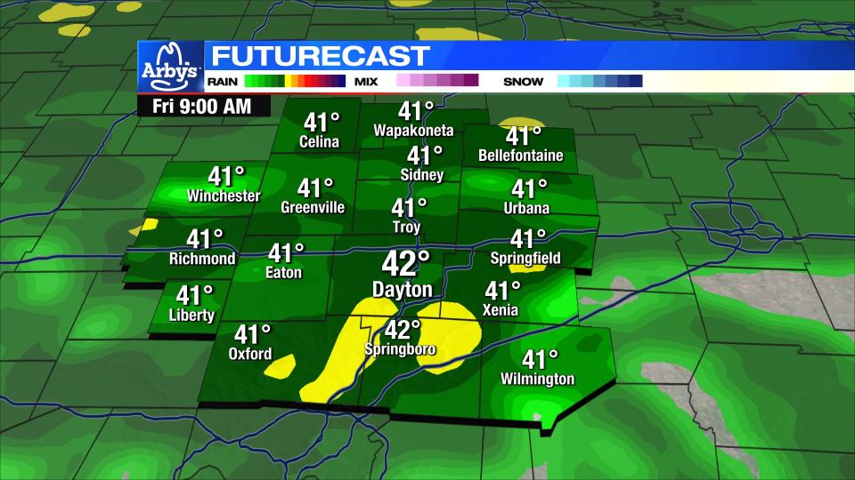
THURSDAY NIGHT: Clouds increase with a few showers possible late tonight. Much better rain chances arrive early Friday morning. Not overly cold tonight with lows in the lower 40s.
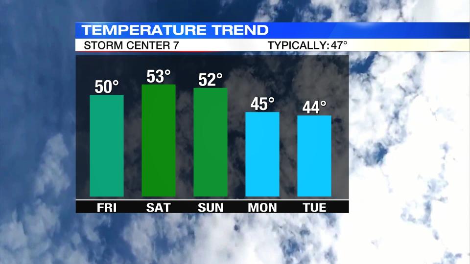
FRIDAY: Soaking heavy to moderate rain throughout the morning. Rain becomes more scattered during the afternoon. Rainfall totals around .25″ to .5″. Much of the day will be spent in the 40s. We may briefly get to 50 late in the evening.
SATURDAY: Mostly cloudy skies with highs in the upper 40s and lower 50s. A stray shower can’t be ruled out. Anything that does fall will be light.
SUNDAY: A few showers around. Otherwise, mostly cloudy. Cool with highs in the lower 50s.
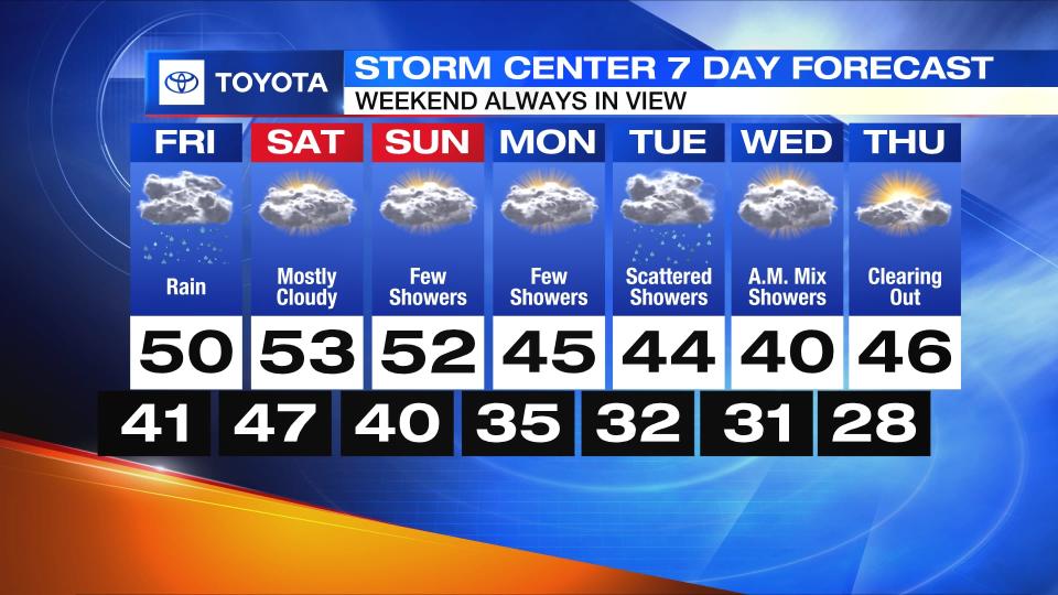
MONDAY: Mostly cloudy with a few more showers possible. Highs in the mid to upper 40s.
TUESDAY: Cloudy with a slight chance for showers. Colder with highs in the lower 40s. Some of the rain showers may mix with or change over to snow showers Tuesday night into Wednesday morning.
WEDNESDAY: Partly cloudy. On the chilly side with highs in the middle 40s.


