Milwaukee, Sheboygan, Fond du Lac could get 1 to 4 inches of snow through Monday; Green Bay and northern counties to see 4-8 inches
Much of Wisconsin is enduring its third snow system in just the first two weeks of March as a long-duration snowstorm is expected to persist into Monday afternoon.
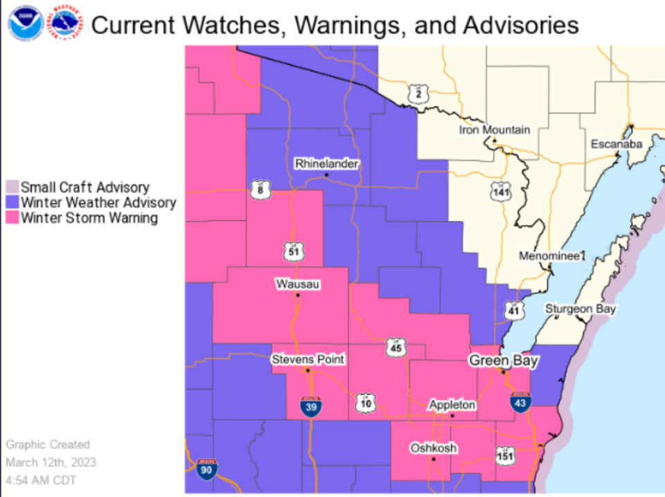
This system is having minimal effects on southeast Wisconsin, where most places expect 1 to 4 inches of snow, but up north is a different story as many counties have been placed on a winter storm warning with 4 to 8 inches expected.
Here's what to know as another band of snow is expected to moved through the state tonight.

Milwaukee, Sheboygan, Fond du Lac to see on and off snow showers through Monday afternoon
Snow started on Saturday night in southeastern portions of the state and has continued into Sunday morning with minimal snow accumulation.
Paul Collar, a National Weather Service meteorologist, said that southeast portions of the state can expect on-and-off snow showers as late as Monday afternoon, although an additional band of snow could affect some areas more significantly.
“We’re thinking Fond Du Lac and Sheboygan County will be the most susceptible to that band overnight, but the rest of the area will mostly see on-and-off snow showers,” said Collar.
Unlike the storm that dropped as much as ten inches of snow in the southeast part of the state last week, Collar said this storm is mostly dropping lighter snow that isn’t expected to affect travel conditions significantly.
Outagamie, Brown, Manitowoc counties and more are now under winter storm warning
Shawano, Outagamie, Brown, Winnebago, Waupaca, Calumet and Manitowoc counties have all been placed on a winter storm warning and surrounding counties have been placed on a winter weather advisory.
The weather service is tracking an additional band of snow that is expected to move through Wisconsin’s northern and central counties into Monday morning. Collar said this band of snow is predicted to drop 4 to 8 inches of snow in these areas.
The weather service has said that travel conditions are expected to be heavily affected as the remaining snow steadily falls into Monday morning
Rain in the forecast later this week
Collar also pointed out that once this system passes, temperatures in some parts of the state are expected to rise slightly.
With another weather system already headed toward Wisconsin, this means rain could be on the horizon — possibly giving Wisconsinites a taste of spring at the end of next week.
Despite this early forecast, Collar said it was too early to make predictions on rain totals as the weather service will learn more as the system moves closer.
Our subscribers make this reporting possible. Please consider supporting local journalism by subscribing to the Journal Sentinel at jsonline.com/deal.
DOWNLOAD THE APP: Get the latest news, sports and more
This article originally appeared on Milwaukee Journal Sentinel: Winter storm drops 1-3 inches snow in Milwaukee, 4-8 in Green Bay

