Winter returns! Prairies to see snowy weekend, frosty week ahead
El Niño left its fingerprints on this season across Western Canada. Long periods of above-seasonal temperatures and dry weather have ruled the roost this winter—and that’s in spite of the bitter chill we saw in January.
Never say never when it comes to the weather, and winter certainly isn’t done with us yet.
A pattern flip looming over the western half of the country will bring a touch of wintry weather back to the Prairies heading into this final weekend of February.
DON’T MISS: Earth just experienced its hottest 12 months in recorded history
Temperatures have been pretty mild so far this season, with one of the warmest Decembers on record seeping into the swingy extremes of January.
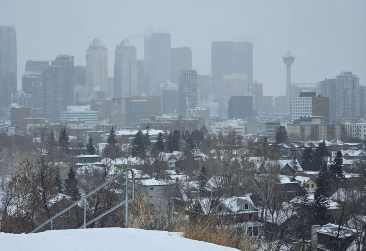
The persistent warmth and relatively calm pattern has taken a toll on snowfall totals across the Prairies, with most of the region coming in solidly below seasonal through this point in the month. Edmonton has only seen 35 percent of its normal snowfall this winter.
We’ll see a brief reprieve from our months long monotony as a system tracking across the region this weekend precedes a dose of cooler air.
This weekend has incredibly dynamic temperatures across Alberta, with temperatures near double-digits across the south while edmonton begins to accumulate snowfall.
Snow is in the forecast for the Rockies and foothills through Saturday afternoon, but the main attraction is a low-pressure system developing next door in British Columbia.
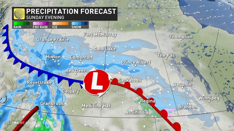
This developing low will track east into Alberta by Sunday afternoon, bringing snow to central Alberta through the evening and overnight hours. Folks in and around Edmonton should expect to wake up to a blanket of snow on the ground by Monday morning.
Snow will continue across central Saskatchewan and east toward the Manitoba lakes as our low-pressure system moves east through the day Monday. The heaviest snow will fall to the north of the low, largely missing southern sections of the Prairies.
MUST SEE: What is a sluff? These common slides spell danger in the mountains
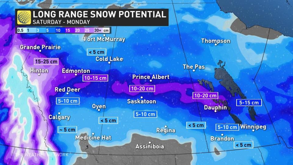
Expect a swath of 10-20 cm of snow to fall along the Yellowhead Highway and east toward Manitoba, including Hinton, Edmonton, and Prince Albert. Folks down the QE2 toward Red Deer and Calgary could pick up about 5 cm by Monday, while a dusting of less than 5 cm is in the cards toward Medicine Hat and Regina.
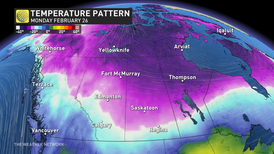
Northerly winds moving in behind the system will drag colder temperatures across the Prairies to start the week. This will deliver a wintry feel with the fresh snow on the ground. The coldest temperatures will linger through the first half of the week, with slightly below seasonal readings continuing toward next weekend.
A major temperature change will occur across southern Manitoba from Monday to Tuesday, with freefalling temperatures forecast as a 30 degree temperature range sits over the eastern Prairies.
Check back for all the latest on your forecast across the Prairies.

