Will Mississippi River see record lows in Memphis again this year? | Know Your 901
What do you want to know about Memphis?
Know Your 901 is a new initiative launched by the know-it-alls at The Commercial Appeal that will seek to answer your questions about the Bluff City and the Greater Memphis region.
Readers, we want your queries and your input! All subject matter is welcome: Culture, art, history, geography, celebrity, TV, music, food, and et cetera. Send questions to knowyour901@commercialappeal.com and we will try to give you an answer in a future column.
Today's column answers a question that probably has occurred to anyone who has gazed to the west from the Memphis bluffs, to wit...
What's up with the Mississippi River?
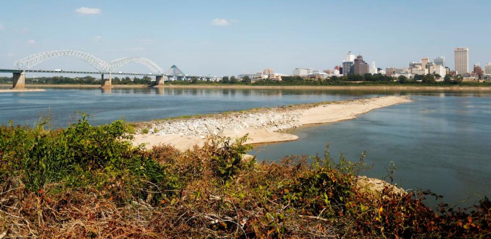
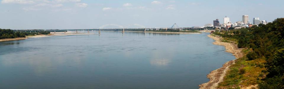
For many, many weeks now, the Mighty Mississippi, as viewed from Memphis, has looked relatively puny.
Long stretches of Arkansas shoreline that typically are submerged beneath the rolling muddy currents have been exposed to the beating sun.
Structures known as "dike fields," built to assist river commerce and traffic by helping to funnel the water into navigable channels, have emerged from the dropping water like bony fingers.
In fact, the section of the Mississippi that the U.S. Army Corps of Engineers refers to as the "Memphis District" — the roughly 360-mile stretch (in sometimes curvy river miles) between the Ohio River confluence to the north and the Arkansas River confluence to the south — has been experiencing record water-level lows at several points, with more lows to come.
“You’re seeing a lot more land than you’re used to seeing,” said Sarah Girdner, 33, water control section chief in the hydraulics and hydrology branch of the Memphis District of the Corps of Engineers.
Girdner called 2022 "very historic” because eight of the 10 "stream gauges" that measure water level in the Mississippi in the Memphis District set record lows.
This year promises to be as rough or even rougher. So far, five of the 10 gauges have set low-stage records.
“Low water doesn’t happen very often, so to have two low water years back to back is unprecedented,” Girdner said.
MEMPHIS' RIVERFRONT: How Tom Lee Park was transformed into a public space 'unlike any in the world'
Last year, Memphis set a low-water record on Oct. 21, when the Memphis gauge — a structure mounted near a commercial barge dock just south of the Memphis-Arkansas bridge — registered a new low, with the water at negative 10.81 feet.
This year, the water has fallen to negative 10.23 feet, but observers believe it may dip below 10.8 before long. "September is historically a very dry month," Girdner said.
The low river level is due to the drought that has been plaguing Missouri, Illinois, Ohio and other areas north of here. "Rain replenishes the river, and if you're not getting rain, you're not getting your routine water flows," said Gene Rench, 81, a longtime Mid-South meteorologist and hydrologist who watches river data the way a baseball fanatic scans box scores. "The small streams and the bigger streams, just like the rivers, have been experiencing record lows, from St. Louis to New Orleans."
As a result, the Corps of Engineers has had to increase its dredging operations, in an attempt to keep channels open and river traffic flowing. Some of the rivers that feed into the Mississippi can control water flow with locks and dams, but dredging — literally scraping away river bottom, to increase depth — is just about the only response available to those trying to affect the flow of the Mississippi in the Memphis District.
"Our goal is to keep navigation and industry moving on the river on all times," Girdner said.
However, life on the Mississippi, as Mark Twain put it, is not always a priority for engineers on other rivers.
"It's a very complicated system with competing interests," Girdner said. "Kentucky needs power, Ohio needs navigation." For example, operations on the Ohio River affect river stages on the lower Mississippi.
Rench said the low levels near Memphis are "very impactful" on river commerce, as barges find it harder to navigate the narrower and shallower channels. If the relative lack of water keeps up, factories and companies may have to use trains to transport materials that typically travel the river, he said.
MISSISSIPPI RIVER IN MEMPHIS: Historically low Mississippi River allows Memphis history to peek through
Girdner said the drought is likely to continue at least until February. Is this due to the phenomenon identified by many scientists as "climate change"? Whatever the cause, the trend is troubling, she said.
"In the water management community, a large concern to us has been the trends we've seen in the past 15 to 20 years," Girdner said. The river gauge system dates to about 1880, but "we are seeing more extremes" in recent years, she said.
"We've seen some of our most extreme flood events and some of our most extreme drought events. It's definitely something on our brains and on our minds."
This article originally appeared on Memphis Commercial Appeal: Will Mississippi River see record lows in Memphis? | Know Your 901

