Mistaken flash-flood warning sent in L.A. hours before polls close as storm batters Southern California
A flash-flood warning mistakenly went out to a far larger area than intended Tuesday as a heavy storm continued to lash Southern California, killing at least one person and forcing multiple swift-water rescue attempts.
The warning, which was meant for about 1,500 people in the Fish fire burn area east of Duarte, went wide when a "glitch" changed the small, targeted area to all of L.A. County, according to the National Weather Service. The warning was canceled, and a corrected warning was sent to those in the burn scar area.
Although the weather service issues such warnings, the alerts that are sent to cellphones come from a separate, federally managed system that the weather service does not control, said John Dumas, a meteorologist with the Oxnard office.
After the countywide alert was sent in error, the weather service was only able to notify county agencies that it was canceled and sent the second, correct alert to residents around the burn scar, Dumas said.
The L.A. County registrar's office sought to keep voters from being deterred to heading out to polls, noting in a tweet at 4:40 p.m. that officials confirmed the flooding threat was "for a very isolated area."
"Vote Centers and Ballot Drop Boxes remain open until 8PM and voter participation is encouraged," the tweet said.
Tuesday morning, one person was killed and two people were missing after rushing stormwater washed away a group of people in Ontario as rain pounded the region.
The incident was reported around 9:45 a.m. in the wash in the 1200 block of East 4th Street in Ontario, officials said.
Six people, who were believed to have been living in the wash, were swept up in a flash of water. Rescuers lined the wash for a search and rescue operation and pulled three people out of the water by noon.
An unidentified man was found dead in a drainage basin, officials said. Two people remained unaccounted for as search efforts continued throughout the afternoon and early evening.
Firefighters suspended their search Tuesday night and plan to resume operations at 7 a.m. Wednesday, said Ontario Fire Battalion Chief Scot Roeber.
In the San Bernardino Mountains, heavy rainfall caused a creek bed to swell near the Cajon Pass on the 15 Freeway, between Fontana and the high desert, where the San Bernardino County Fire Protection District's swift water team rescued a man whose vehicle was overcome by water.
The surge forced the man out of the sunroof and eventually swept the car nearly a quarter of a mile down the road, said Mike McClintock, battalion chief with San Bernardino County Fire. The man was not injured, McClintock said.
Crews were also searching Tuesday evening for a person in the Los Angeles River.
Los Angeles city firefighters responded to a report of a person in the water near Boyle Heights around 5 p.m. By 6 p.m., the L.A. County Fire Department had taken over the operation and was searching for the person downriver in the Bell Gardens-South Gate area.
Firefighters did not find the missing person Tuesday night, an L.A. County fire dispatcher said. Further information was not available.
The storm, which is expected to last until Wednesday, was driven by a lower-pressure system off the coast, meteorologists at the National Weather Service in Oxnard said.
As of 5 p.m., downtown Los Angeles had received 1.56 inches of rain, Los Angeles International Airport received 1.38 inches and the Van Nuys Airport received 1.24 inches, according to two-day rainfall totals from the weather service.
Mountain and foothill areas received significantly more precipitation, with Crystal Lake in the Angeles National Forest recording 6.93 inches of rain. Mt. Baldy received 4.75 inches, Claremont got 3.34 inches and La Cañada-Flintridge recorded 2.75 inches of rain.
L.A.’s central and coastal areas generally received about 1½ inches or less of rain.
“This is a storm we normally see in January,” said Todd Hall, a meteorologist with the weather service in Oxnard. “It’s a great opportunity for some rain.”
In Northern California, the National Weather Service's Sacramento office reported that a weak tornado with winds of 70 mph had touched down around 1:40 p.m. near Galt, southeast of Sacramento. A barn's tin roof was blown off, windows on a bus were blown out, and some power lines were downed, according to preliminary law enforcement reports.
A winter storm warning was in effect for the mountains of Los Angeles and Ventura counties through 10 a.m. Wednesday, with gusty winds and heavy snowfall in the forecast. Snow was expected at elevations at or above 7,000 feet. Eight to 14 inches was expected in the Los Angeles County mountains, and about 20 inches could fall on the highest peaks.
Snow levels could drop to around 5,000 feet Tuesday night, creating potentially hazardous conditions along the Tejon Pass on the 5 Freeway and the Soledad Pass on the 14 Freeway between Santa Clarita and Palmdale, meteorologists said.
Isolated snowfall could occur overnight through early Wednesday, but significant snow accumulation is not expected on the Grapevine or other passes below 5,000 feet, said Dumas, with the weather service's Oxnard office.
Snowfall data were not available Tuesday night.
A high wind warning for the Antelope Valley was in effect until 10 p.m. Tuesday, the weather service said. Southwest winds of 30-45 mph, with gusts up to 70 mph, were expected.
Orange County and portions of the Inland Empire were also soaked Tuesday. The weather service issued a flash-flood watch for the Bond and Silverado burn scar areas through Wednesday morning.
The Orange County Sheriff’s Department escalated voluntary evacuations warning Tuesday morning into mandatory evacuation orders for Silverado Canyon, Williams Canyon and Modjeska in the Bond fire burn area, in the foothills of the Santa Ana mountains.
The communities of Oak Glen, Forest Falls, Mountain Home Village, Angelus Oaks and Northeast Yucaipa in the Apple and El Dorado fire burn areas were placed under an evacuation order midday Tuesday, Yucaipa police said in a tweet.
The San Bernardino Mountains received significant rainfall, with the middle fork of Lytle Creek recording 8.47 inches as of about 6 p.m., and Panorama Point receiving 5.87 inches, according to two-day rainfall totals from the weather service's San Diego office.
Santiago Peak in Orange County received 5.79 inches of rain.
The rain also affected operations at several Southern California amusement parks. Legoland in Carlsbad and Knott's Berry Farm in Buena Park were both closed on Tuesday, and several rides at Disneyland, including Alice in Wonderland and the Jungle Cruise, were not operating because of the rain, park officials said.
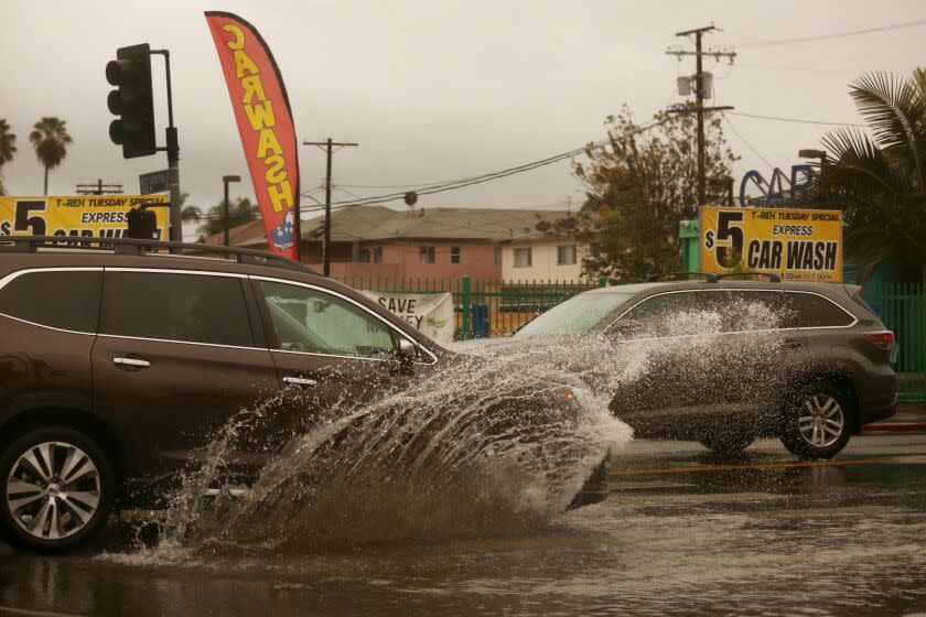
Several roads were underwater on Tuesday.
According to the California Department of Transportation, two hotspots were State Route 110 at Via Marisol near Highland Park, where flooding across all lanes led to stopped traffic. A vacuum truck was called in to clear the road, and all traffic was being diverted at Avenue 60, according to a spokesperson for Caltrans District 7, which includes Los Angeles and Ventura counties.
The drainage system had become clogged, and the roadway remained closed as of 4 p.m., officials said.
While snow was not an issue on the 5 Freeway, an overturned big rig nonetheless snarled traffic on the southbound side of the roadway near Lebec.
All southbound lanes were closed past Vista Del Lago Road with vehicles being rerouted to the 134 as of 5 p.m.
Another major concern is the wind, said Casey Oswant, a weather service meteorologist in San Diego.
“We are expecting strong winds from the coast into the deserts,” Oswant said. Gusts of up to 45 mph are expected for coastal Orange County, enough to topple trees. Gusts reaching 70 mph could tear through the San Bernardino County mountains.
“The two main impacts are the rain and the wind,” Oswant said. “Snow will still be an impact but not until later tonight, and it will mainly be above 6,000 or 7,000 feet.”
In Northern California, heavy snow hit the Sierra Nevada, and a winter storm warning was in effect through Wednesday morning, weather experts said. At least 17 inches of snow hit King Vale along Interstate 80 west of Truckee, and 16.3 inches was recorded at the UC Berkeley Central Sierra Snow Laboratory in Soda Springs, with more snowfall expected to accumulate throughout the day.
It's not unusual for a storm to dump snow on the Sierra this time of year, said Scott Rowe, a meteorologist for the National Weather Service. Once the storm passes, it's likely to "be the season’s heaviest snowfall to date," Rowe said.
Times staff writer Gregory Yee contributed to this report.
This story originally appeared in Los Angeles Times.

