Modesto and Turlock irrigation districts contend with the violent swings of climate change
This is the first of two stories focused on climate change impacts affecting Modesto and Turlock irrigation districts. The first is about changes in the Tuolumne River watershed, and the next is about impacts on hydropower generation and electric services.
As they try to adapt to climate change, the Modesto and Turlock irrigation districts have closely watched the changes in hydrology in the Tuolumne River watershed, which is a vital source of water for farms and cities in Stanislaus County.
The districts today cope with volatility in the massive watershed, characterized by atmospheric river storms in wet years and droughts that are getting drier and lasting longer.
TID officials said five of the most severe droughts on record occurred in the last 35 years. But the most abundant water year for the region and the third wettest on record occurred in the last seven years.
Studies conclude the average maximum daily temperature will increase 4 to 5 degrees in the San Joaquin Valley by 2050, raising temperatures above 105 degrees more than 20 days in some years, serving to increase demand for everything from farm irrigation water to energy consumption.
With climate change, more precipitation is expected to fall as rain in the Sierra Mountains and less as snow. While there’s much agreement over temperature projections in the coming decades, dramatic changes in average precipitation in California are less certain and may not happen until the second half of the century, according to a consultant’s study for Stanislaus County, Modesto and four other cities.
The Sierra snowpack is expected to shrink by 30% between 2070 and 2099, according to one scenario, and a worst-case model suggests 80% snowpack loss by 2100, if nothing is done to reduce greenhouse gas emissions that are trapping heat in the earth’s atmosphere.
The Union of Concerned Scientists analyzed climate studies that are informing decision-making in California, concluding in 2020: “The top ten climate models used by the state government agree there will be nearly complete snowpack loss at lower elevations statewide by the end of the century, if heat-trapping emissions continue to rise as currently expected.”
One study completed for TID and the San Francisco Public Utilities Commission, looking at simulations for 2040, 2070 and 2100, projected less snow accumulation in the Sierra and also predicted Tuolumne River runoff occurring earlier in the spring. The river flows are expected to decline in spring and summer, when demand for irrigation water on 210,000 acres of farmland is higher.
The study predicted marginal to significant decreases in total annual runoff under the climate scenarios.
Michael Frantz, a board member for TID, said the district is most concerned about managing the violent swings between dry periods and especially wet years, which is a challenge for a water and power utility.
“The big thing that jumps out with climate change is the potential to make our water supplies less reliable,” Frantz said. “The TID has tracked precipitation for almost 140 years, and our records indicate that average rainfall from year to year is still about the same. But the swings are much more violent.”
Wes Monier, chief hydrologist for TID, said it’s a fair statement that the TID and MID water storage system was not designed for the changes in hydrology.
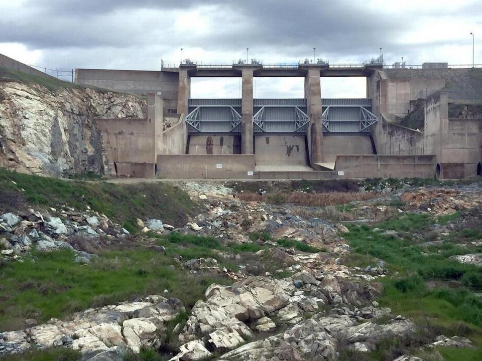
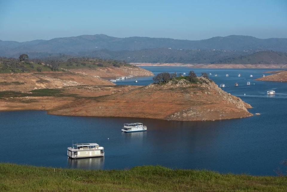
The design for the new Don Pedro Dam, completed in 1971 with capacity to store 2,030,000 acre feet of water, was based on precipitation and runoff patterns before 1960, Monier said. Soon after the reservoir was filled, the districts began seeing volatility in the Tuolumne watershed: It had the lowest natural flow in 1977, a record wet year in 1983 and a punishing drought from 1987 to 1992.
Monier said the irrigation district “didn’t understand what we had” with the 1997 “Pineapple Express” rain storms, which caused Don Pedro to spill, sending a record 65,000 cubic feet of water per second through Modesto and flooding a vast area in Stanislaus and San Joaquin counties.
The volatility has continued, as 2012 to 2015 were the driest years on record.
In a bold attempt to adapt to climate change, TID and MID jointly applied in January 2022 for 2.7 million acre feet in “flood water rights.” The plan includes proposals to capture and store more river water in especially wet years before it flows out to the ocean.
Folded into the application are proposed storage projects such as raising the Don Pedro spillway, smaller offstream reservoirs and underground storage and groundwater recharge basins, said Josh Weimer, a spokesman for TID. The plan would improve the reliability of irrigation and drinking water supplies during the longer dry spells in this century.

No response yet from the state
The State Water Resources Control Board has not yet responded to the districts’ application, which faces a multi-year approval process. The state water board has actually tried to reduce diversions by MID and TID to keep more water in the river for environmental purposes.
In terms of coping with climate change, a lot is riding on the water rights application. “The ramifications (if the proposals are rejected) are that we are not able to adapt as well as we could to the changes,” Monier said. “If we can’t do this, then in all probability other (water agencies) in the state will not be able to do this.”
The districts are asking the state for permission to divert additional water from Nov. 1 to June 14 when the Tuolumne River is not “fully appropriated” to current water right holders. The irrigation districts contend that extra water, averaging 840,000 acre feet annually, was available for diversions in about half the years since 1998.
The new rights would be inferior to the historic Tuolumne River rights held by San Francisco and MID and TID, dating to the 1880s.
Climate change, caused by greenhouse gas emissions in Earth’s atmosphere, is projected to raise temperatures in the Northern San Joaquin Valley, serving to increase evaporation and boost demand for agricultural irrigation water.
A UC Berkeley study in 2014 suggested the reliability of surface water for irrigation in MID will decrease 75% or more under temperature-rise scenarios of 3.6 to 10.8 degrees Fahrenheit.
MID’s Agricultural Water Management Plan update in 2020 cited a projection that warming temperatures will decrease streamflow by 4.6% to 12% and cause snowmelt flows to arrive up to 21 days earlier, as water demands increase up to 6%.
New technology monitors the watershed
Since the 1997 flood, TID has invested in technology for storm forecasts and monitoring of the Tuolumne watershed to better manage the storage system for flood control, hydroelectric generation and water supply reliability.
The TID participates in an Airborne Snow Observatory program and partners with Cornell University and the state Department of Water Resources to understand the system’s vulnerabilities to climate change.
Monier said watershed-specific data during atmospheric river storms this past winter and in 2017, allowed for starting Don Pedro releases before the reservoir reached the level for mandatory flood control releases. Water managers were able to safely draw down the reservoir earlier, but also had information the snowpack was sufficient to meet customers’ needs later in the year.
While there’s uncertainty about the rate of climate change and the magnitude of the impacts, the irrigation districts say they will monitor the indicators and keep using technology to adapt.
“We are using technology to compensate for volatility,” Monier said. “I am optimistic that TID can deal with (climate changes) as well as anyone else.”