Monroe County drainage system a map to local history
As residents of Monroe County, most of us probably drive past our county drains every day without thinking about them, unless we notice one was recently cleaned out, or maybe we got a notice of assessment for the one near our property. But before we dismiss the drains as just one more cost of homeownership, it’s worth taking a moment to understand and appreciate how these drains came to exist and the benefits they provide.
More than 200 years ago, the land of Monroe County and the entire state of Michigan looked very different than today. An 1815 survey of the territory claimed: “Michigan apparently consists of swamps, lakes, and poor, sandy soil not worth the cost of surveying.” Settlers arriving to the area in the 1820s and 1830s found acres of low-lying marshland and a high prevalence of mosquito-borne illnesses such as malaria.
Still, the hardy folk arriving from the East were determined to conquer the land and make it produce. They turned to the government for help, and the creation of a drain code was the logical step to make the state’s land usable for farming and living. The fact that Michigan’s drainage laws are among the oldest state statutes shows just how important they were to the state’s development.
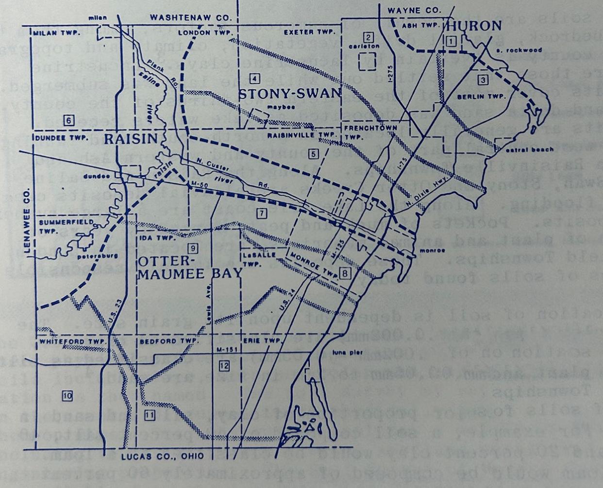
From 1830 to 1850, Monroe County’s population increased fourfold. During this time, the county held the nickname “The Black Swamp,” and with good reason: an 1859 map of the county shows large areas of land designated as marsh. Drainage was needed for health and economic reasons, and the farmers made use of the new drain statutes to help them.
Today, if a new drain is needed, there’s a structured process that ensures that all affected parties have their say: a meeting of practicality, a petition to determine necessity, public notices and a board of determination. When a drain is deemed necessary, studies are made, remediation is determined, the project is designed and, finally, the drain is built and assessed. In early days of the county, the process was very different. According to current Monroe County Drain Commissioner David Thompson, “Back then, the farmers would get together and have their meeting on a street corner, maybe at the nearest crossroad out in the field.”
Today’s process to determine which properties should be part of a drain’s watershed might involve topographical surveys or even lidar measurement, but Thompson says the practices of the 1800s were much less exact.
“Somebody might have gone out and viewed water going that way, or maybe farmers would just say, ‘Hey, throw my 40 acres in for that drain, I'll get a benefit.’”
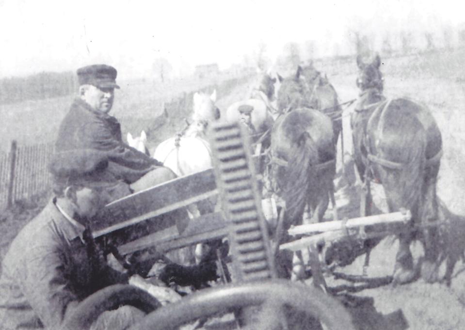
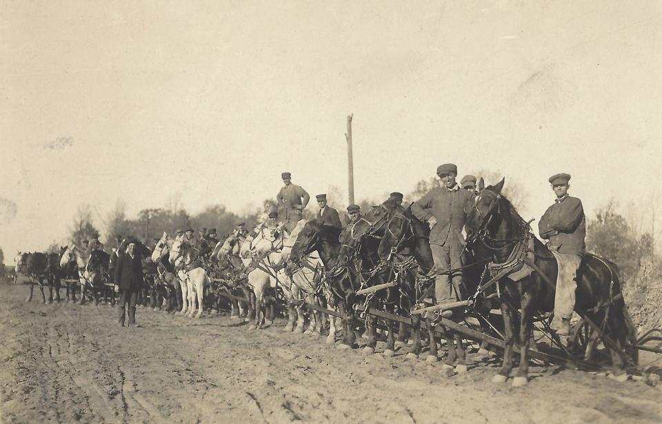
Back then, installing the drain was much more primitive. Most drains were hand dug, often by the property owner, or they might have used horses or oxen and a drag tool for the larger drains. “I've got old contracts in the office where they would pay each property owner so many cents per foot to hand dig their drain,” Thompson says. During the Great Depression, many drains were installed by the Works Progress Administration as part of President Franklin Roosevelt’s New Deal to provide relief for the unemployed.
Since the early days of Monroe County, hundreds of drains have been created. Most of them still exist today, bearing the names given when they were constructed. According to Thompson, a drain was often named for the original petitioner who requested it or the largest landowner in the drain’s watershed, although this was not always the case. For example, in Bedford Township, the Burton, Winson and Maury Drain was named for the drain commissioner (Burton), the attorney involved (Winson) and the petitioner (Maury).
We can see a history of county residents throughout time by simply looking at the waterways on a current Monroe County roadmap. In Berlin Township for example, Langton and Blanchett are names of early pioneer families that still reside there today. Other names are less familiar, like Root and Uden, but a look at historic maps will show that these were farmers whose land has been transferred to others over time, but whose legacies live on in their participation in helping turn Monroe County from swamp to farmland and beyond.
Stephanie Hawkins is the president of the Berlin Charter Township Historical Society. She can be reached at info@berlintownshiphistory.org.
This article originally appeared on The Monroe News: Monroe County drainage system a map to local history

