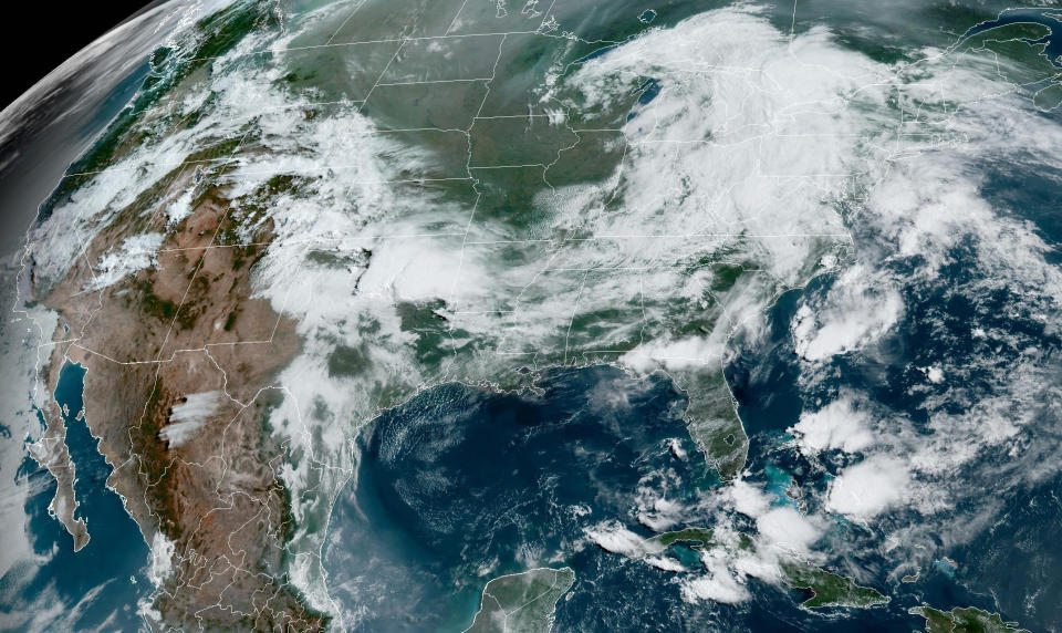
More than 26 million people across the country under the risk of severe storms
Severe storms will affect multiple parts of the country this week, including the mid-Atlantic, the southern Plains and the Southeast.
A severe thunderstorm watch out for portions of northern New Mexico, northern Texas and southern Oklahoma were in effect Monday by 7 a.m.
More than 26 million people are under a risk for severe storms Monday across two distinct areas of the country: portions of southern Colorado, northeastern Texas, northern Louisiana, southern Arkansas, southern Mississippi, southern Alabama; and a secondary area across the mid-Atlantic, including parts of eastern Virginia, eastern Maryland, and Delaware.
Cities that have the highest chance of getting hit by the severe storms capable of possible tornadoes, large hail exceeding 2 inches in diameter, and damaging winds include Dallas, Waco, and Meridian in Texas. The timing of the storms will be this afternoon into this evening.
For the mid-Atlantic (including the I-95 corridor), the timing of the storms capable of damaging winds and hail could be during the peak of Monday evening's rush hour. Washington, D.C., Philadelphia and New York City, while not in the zone of highest risk for severe storms, could experience an isolated strong storm or two.
On Tuesday, almost 17 million people are under a risk of severe storms across portions of northeastern Texas, southern Arkansas, northern Louisiana, central Mississippi, central Alabama, and southern Georgia.
Cities that have the highest chance of seeing severe weather including large hail and damaging winds are Dallas; Shreveport, Louisiana; Jackson, Mississippi; Birmingham, Alabama; and Columbus, Georgia. The timing of the storms will be afternoon and evening.
The risk continues into Wednesday, when more than 6 million people are already under a risk of severe storms across portions of central Mississippi, southern Alabama and southern Georgia.
Cities that will need to be on guard Wednesday include Montgomery and Tuscaloosa, Alabama; Jackson, Mississippi; and Savannah, Georgia. The timing of the storms will once again be Wednesday afternoon into evening.
In addition to the risk for severe storms, flash flooding will be a concern across parts of the Plains, as well as the Southeast.
On Monday morning, there was a flood watch for much of northeastern Colorado, including the Denver and Colorado Springs metro areas.
With several rounds of severe storms expected in many of the same areas across parts of the southern Plains and the Southeast, flood concerns will be an issue.
In portions of northern Texas, southern Oklahoma, southern Arkansas, central Mississippi, central Alabama and central Georgia, locally up to 4 inches of rain can be expected through Tuesday, with rainfall rates reaching 2 inches an hour at times. By the end of the week, some areas across the Southeast may pick up 4 to 8 inches of rain.
This article was originally published on NBCNews.com

