Thousands lose power in York, Lancaster SC as storm hits. Tornado watch issued
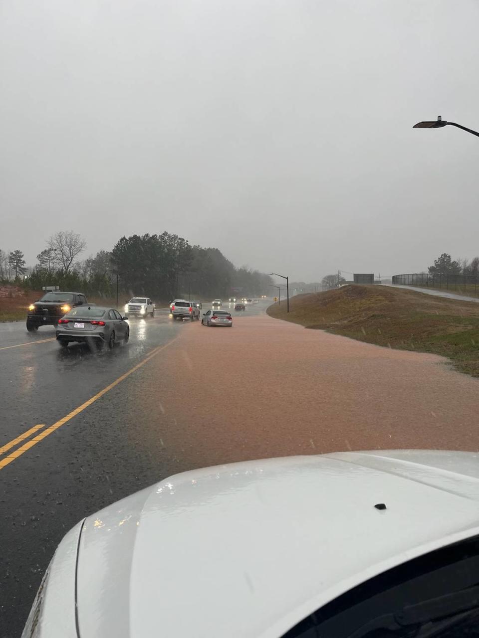
Thousands of customers lost power, creeks topped their banks and water pooled on roadways Tuesday as a severe storm with high winds and rain lashed York, Chester, and Lancaster counties.
The storm caused some roads to flood in the city of Rock Hill and swaths of York County — ranging from the northwest near the North Carolina border to near the Catawba Indian Reservation along the county’s eastern edge at the Catawba River.
The rain pelted the areas strong enough for the National Weather Service to issue a flash flood warning was issued for northeast York County just after 1 p.m. The areas included Lake Wylie, Fort Mill, Tega Cay, and Clover. The flood warning expired at 5 p.m.
Chuck Haynes, York County Emergency Management Director, said at 5 p.m. all areas of the county received heavy rains and pockets of flooding. No injuries or fatalties were reported, Haynes said.
“This really affected all of York County,” Haynes said.
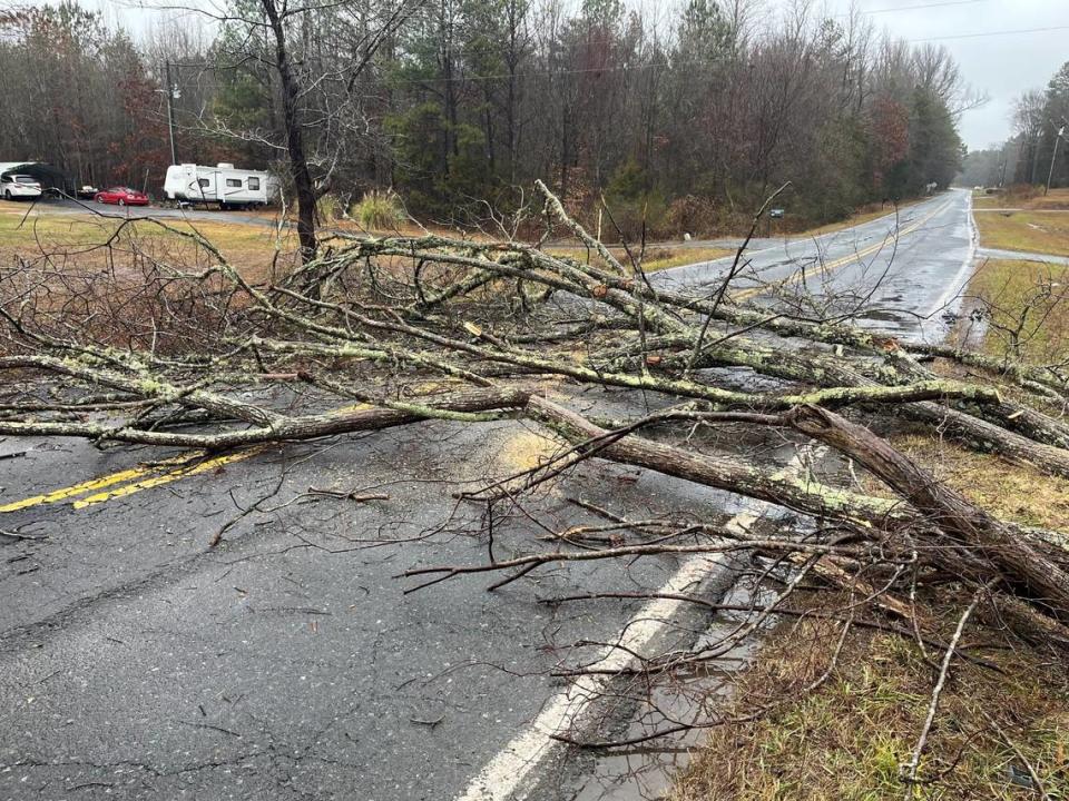
Haynes urged the public to remain vigilant through Wednesday, because trees weakened by the water could still fall.
Deputies with the York County Sheriff’s Office continued to monitor roads as of 5 p.m. and will be looking for problem areas overnight, said Trent Faris, spokesman for the sheriff’s office.
Where did it flood in York County?
Among the flooded roads: a busy stretch of S.C. 161, Celanese Road, near the York County airport.
High water was also reported near the busy intersection of S.C. 72, Saluda Road and S.C. 901, Heckle Boulevard.
The sheriff’s office also posted alerts of flooding at Springdale Road and Hopewell Road east of Rock Hill, and flooding in western York County at Kings Mountain State Park and areas near S.C. 55.
In the city of Rock Hill, police department officials urged caution for drivers. Police said on social media flooding was reported around 3:30 p.m. on Neely Road, part of Heckle Boulevard near Friedheim Road, the Dave Lyle Boulevard underpass at Interstate 77, and the Dave Lyle Boulevard ramps to Anderson Road.
Use caution if traveling and avoid these areas that are blocked due to flooding: Neely Rd at College Downs (pictured); Dave Lyle ramps from Anderson Rd; Dave Lyle underpass at I-77.
Northbound Heckle from Ogden to Friedheim is one lane. Please drive slowly. pic.twitter.com/g1RxYNQD3U— Rock Hill PD (@rockhillpd) January 9, 2024
A tornado watch for the area also was issued before noon for all three counties and much of South Carolina and the Charlotte area, according to the National Weather Service. The tornado watch was scheduled to last through 6 p.m., the weather service said.
TREE & POWER LINE DOWN: Another incident on Lincoln Rd. this time at the 1300 block of Lincoln Rd. York, SC. Deputies are helping with #traffic control while crews work to clear the road and get the power back on. #YCSONews #YOCONews #scwx #yocowx pic.twitter.com/ylryQ4e7w9
— York County Sheriff (@YCSO_SC) January 9, 2024
Power outages on Tuesday afternoon after 4 p.m. showed just over 4,000 customers without service in York , Chester, and Lancaster counties, according to PowerOutage.us, a website that aggregates live data from utilities across the country.
Where are power outages?
York Electric reported more than 480 outages in York County as of 4 p.m.., according to its outage map.
That number went down Tuesday afternoon from a number in the thousands earlier as repairs were made. York Electric Cooperative spokesman Marc Howie said crews are responding to the outages.
Duke Energy had more than 1,000 outages Tuesday morning but showed less than 50 outages after 4 p.m. in York County, according to its outage map.
Rock Hill Utilities’ outage map showed about 395 customers without power after 4 p.m.
Lancaster County had over 2,600 outages reported after 4 p.m. Tuesday, according to PowerOutage.us. Chester County had more than 275 outages.
Storm forecast
Schools in York and Lancaster counties decided Monday to hold virtual school because of the forecast.

Rain forecasts for the Rock Hill area for Tuesday were from 1 to 2 inches with the possibility of more, according to the Weather Service. Winds were expected to be 20-30 miles per hour, with guts of 45 MPH.
The area remains under a wind advisory and flood watch through 10 p.m. Tuesday, the weather service said.

