More than 250,000 without power as deadly winter storm brings icy hazards
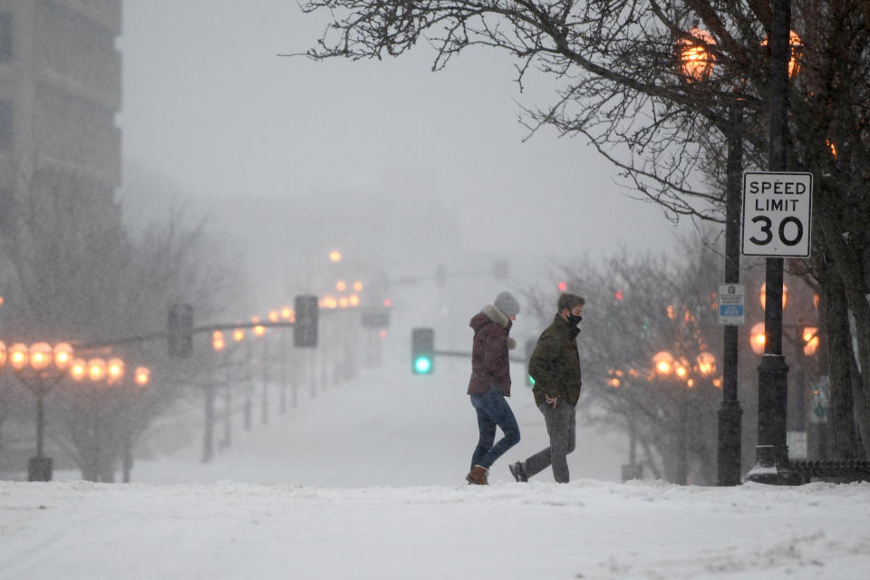
Hundreds of thousands of households and businesses were without power Friday as a deadly winter storm had 50 million people under winter weather alerts and left parts of the United States facing potentially "treacherous" buildups of snow and ice.
In Texas, conditions already proved hazardous, with scores of drivers left stranded for hours after multiple crashes were reported on a northbound stretch of Interstate 10 near Kerrville.
"Roads are still glazed. Like a doughnut," the Kerr County Sheriff's Office said in a statement. "Sing the chorus with us: “Please, stay home.”
Police in Kerrville, Texas, said Friday night that I-10 through the Texas Hill Country was still moving slow in both directions as a result of multiple big-rig accidents that shut down all but one lane in multiple sections.
"Adding your vehicle to the line of stopped traffic would be counterproductive for everyone," the sheriff's office said earlier.
Firefighters in Dallas have responded to at least 187 accidents since 9 a.m. Wednesday, according to Dallas Fire-Rescue.
The Texas Department of Transportation warned residents early Friday morning against driving “unless it’s necessary” as roadways remained slick. “Crews continue to spread deicer,” it said in a tweet.
As of early Saturday, about 188,000 customers were without power from Tennessee to New York, with snow and freezing rain weighing down tree limbs and affecting power lines, according to outage tracker PowerOutage.us.
The number of customers without without power in Texas early Saturday dipped to about 8,300, down from 70,000 on Thursday. Gov. Greg Abbott said Texas residents would not see a repeat of the power crisis they experienced last February.
"The Texas electric grid is more reliable and more resilient than it has ever been," he said.
Outages were reported in West Virginia, Ohio, Pennsylvania and New York, with close to 91,000 customers without power in Tennessee early Saturday.
In Oklahoma, a roadway fatality in Carter County on Thursday was attributed to the weather, according to the state Department of Emergency Management and Homeland Security.
In Memphis, icy road conditions caused a 15-vehicle crash on Thursday, according to the Memphis Fire Department. Twenty-one people were involved in the crash, and six people were hospitalized.
The storm system was also deadly in Alabama, where one person was killed after it spawned a reported tornado.
In Hale County, Alabama, a woman died and eight others were injured after the tornado, yet to be confirmed by the National Weather Service, appeared to tear through the area Thursday afternoon, according to Hale County emergency director Russell Weeden.
Damages were also reported across the county, which is roughly 35 miles south of Tuscaloosa.
The National Weather Service in Birmingham said a preliminary survey found damage consistent with tornadoes with EF1 and EF2 level winds, from 86 to 135 mph, was found in Sumter County, Hale County, and Sumter County.
The Tennessee Department of Health said one weather-related fatality had been reported in Haywood County, but it wasn’t immediately clear how the person died.
In New York, where more than 46,000 were without power early Saturday, Gov. Kathy Hochul warned in a tweet: "Commuters — if you don’t have to drive this morning, please avoid travel so our crews can keep roads safe."
"We have snow. We have freezing rain. We have sleet. We have icy roads. And so we’re looking at this combination here in Hudson Valley and Ulster County," she said during a morning news conference.
The National Weather Service in Albany said the sleet coming down "has been prolific!"
"We continue to see an icy mix of sleet, freezing rain, and/or snow between roughly I-90 and Poughkeepsie," the weather service said in a tweet, adding that residents should expect a transition to snow later on "as additional cold air allows for the wintry mix and snow lines to shift southward."
In New York City, people were warned to avoid slippery surfaces, wear boots that provide traction and use handrails, the city's department of emergency management tweeted.
In addition to causing outages, the storm prompted another day of flight cancellations, according to flight tracking website FlightAware. There were about 4,000 flights within, into and out of the U.S. canceled on Friday. The total number of cancelations by Friday night was 5,232.
The storm, which the weather service said has over the past week produced "heavy snow, crippling ice accumulations, flash flooding and severe weather" has entered its third and final day before exiting "right into the Atlantic Ocean this weekend."
Boston, Hartford and New York City are expected to continue to see a wintry mix of freezing rain and sleet Friday night, making for dangerous travel conditions on coastal I-95.
Interior regions of New York and New England have already reported a foot or more of snow: 15 inches have fallen in Randolph, Vermont; 14 inches in Manlius, New York; 13 inches in Whitfield, New Hampshire; and 12 inches in Augusta, Maine.
Parts of central Massachusetts could also see up to a quarter inch of ice by the time the storm makes its exit, while parts of the northern mid-Atlantic could see as much as a tenth of an inch of ice accumulation.
According to the weather service, "significant ice accumulation is possible," with snow, rain and freezing rain potentially making for "difficult conditions along with some power outages and tree damages.”
Temperatures in the single digits and teens are forecast to stick around in parts of Arkansas, Oklahoma and Texas, the weather service said.
That “bitterly cold air” is expected to move out of many of those regions by the end of the weekend and into the Ohio Valley and up to the Northeast, where below-zero temperatures and highs below freezing were possible, federal forecasters said.
Showers and thunderstorms were possible from southeast Virginia to northern Florida, with some thunderstorms having the potential to become severe.
If there's sunlight at the end of the tunnel, it will come in the form of quickly warming temperatures in the parts of the West, and parts of the High Plains and Texas, where a boost as high as 15 degrees above average daily high temperatures could strike by Sunday, the weather service said.

