More of Big Sur coast opens to drivers as Caltrans shortens Hwy. 1 closure
Just in time for Easter traveling, Caltrans has shortened the closed area of Highway 1 in Big Sur on Tuesday, and plans to soon open more of the northern area.
Travelers and residents at the northern end of the closure can now drive 10 miles farther south than they could before., with 5 miles more expected to open by the end of the week, Caltrans said in a news release.
The southern closure remains at Ragged Point Inn, at the northwestern edge of San Luis Obispo County, about 15 miles north of San Simeon.
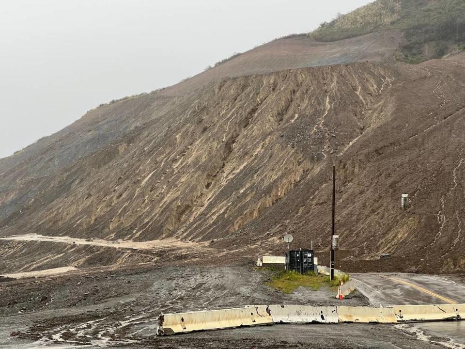
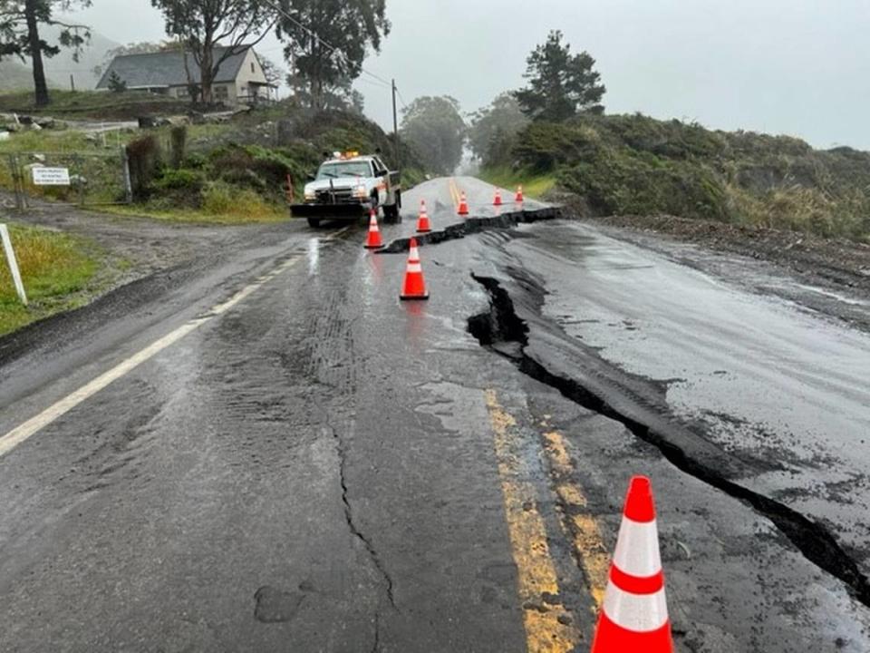
Fierce winter storms and torrential rain caused multiple slides of mud, rocks, trees and debris along the All-American Road, and some sections of the highway split, buckled or slid down the steep oceanfront cliffs.
Even after the storms slowed, the drenched earth continued to slide.
Kevin Drabinski, Caltrans spokesman, wrote in a press release Wednesday that “The northern closure limit of Highway 1 on the Big Sur coast was moved yesterday from Deetjen’s Inn in Monterey County … to Lime Creek,” which is about 42 miles north of the San Luis Obispo/Monterey county line.
He heralded the further reduction of the restricted area, saying, “The northern closure is expected to continue to move south by tomorrow afternoon to the Big Creek Vista Point,” about 27 miles north of the county line.
That would cut down the Highway 1 closure area by about 15 miles.
What made it possible to move the closure farther south, he said, was successful work to clear debris and stabilize slopes from slides south of Torre Canyon Bridge near Esalen.

Drabinski added that crews may need to perform more slope-stabilization, with one-way reversing traffic control in the area about 32 miles north of the county line.
He emphasized that travelers can still reach many of the area’s beautiful views and bustling coastal communities, including local businesses like the Ragged Point Inn, which are open.
Caltrans and contracted crews will work seven days a week, except during rain events, to continue making repairs, reducing closure limits, and eventually reopening the entire length of the Big Sur coast.
Drabinski didn’t give an estimate on when that ultimate goal might happen, but in said in March that it would take months.
For details on the closure, check Caltrans’ social media, such as Twitter at: @CaltransD5, Facebook at: Caltrans Central Coast (District 5) and Instagram at: Caltrans_D5. For other travel information, go to roads.dot.ca.gov/roadscell.php.