More haze from Canadian wildfires will make its way into Springfield area
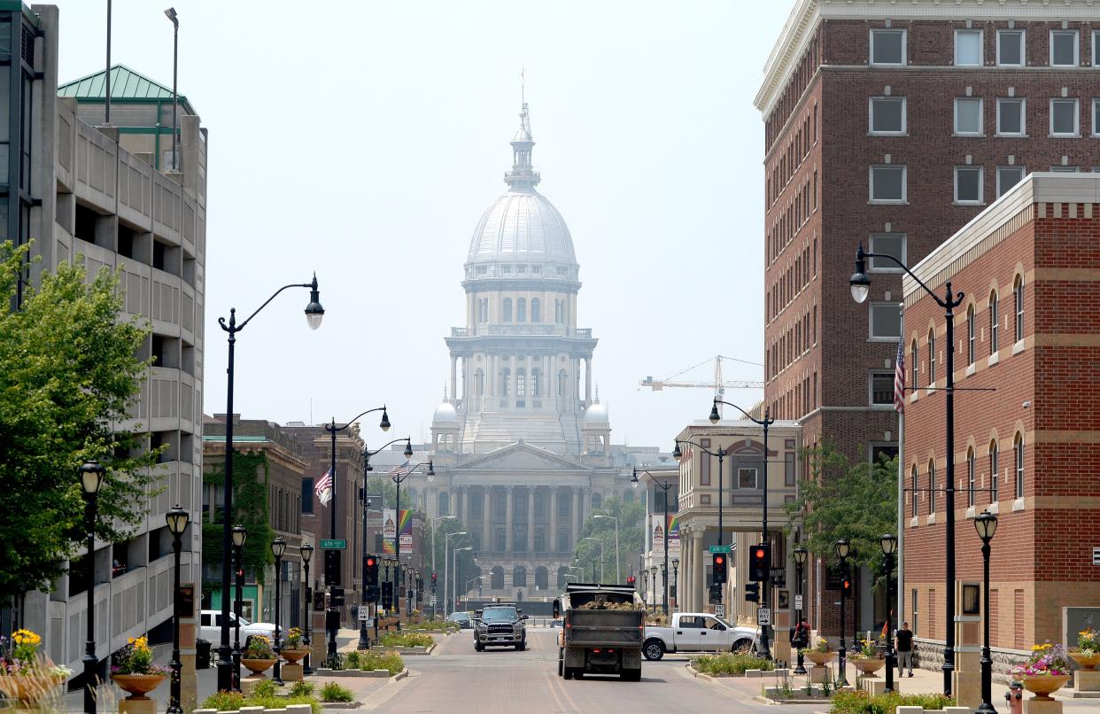
The air quality around central Illinois this weekend is again expected to degrade because of smoke from Canadian wildfires, said officials with the National Weather Service in Lincoln.
As of 4 p.m. Sunday, the air quality index (AQI) calculated by the Illinois Environmental Protection Agency was at 138 in Springfield, meaning the level is "unhealthy for sensitive groups."
An air quality alert for the entire state goes through midnight Monday.
Bailey's back. Who else is running for Congress in Illinois?
Air quality alerts are indicators the air is unsafe to breathe for certain people. Alerts are triggered by a number of factors, including fine pollutants in the smoke known as particle matter, or “PM 2.5," which can irritate the lungs.
Because of the alert, active children and adults, especially those with pulmonary or respiratory problems such as asthma, should limit their outdoor activities, said NWS meteorologist Daryl Onton. Any prolonged exposure could be a problem for sensitive individuals, Onton added.
It could impact the area over the next several days.
"It certainly looks like it's going to keep streaming in through Monday," Onton said. "There could be some breaks in it as flow patterns waiver a little bit, but our pattern looks to continue with a fairly constant north westerly flow for several days."
An Air Quality Alert is in effect Sat. 7/15-Sun. 7/16 for all of Illinois. Smoke from Canadian wildfires will move into the region later today. Residents should take precautions and follow doctor-prescribed regiments. For additional information, visit https://t.co/J38s93JemS.
— Illinois EPA (@ILEPA) July 15, 2023
Late in June, AQI readings in Springfield were in the "very unhealthy" category and were some of the highest in the state.
Visibility in the area could be reduced because of the haze, Onton said.
On top of it, the Springfield area could experience some severe weather Sunday with high winds and isolated hail threats, Onton said.
The risk looked "fairly disorganized," he added, though the most likely time for severe storms would be from 3 to 9 p.m. Sunday.
A heavy rain would filter a lot of that smoke out and wash it down to the surface, but that would be just temporary if flow patterns keep bringing smoke in.
"The best way to clear it out is to change the flow pattern to some direction that gives us some cleaner air," Onton said.
Disaster proclamation sends city workers scurrying to submit report
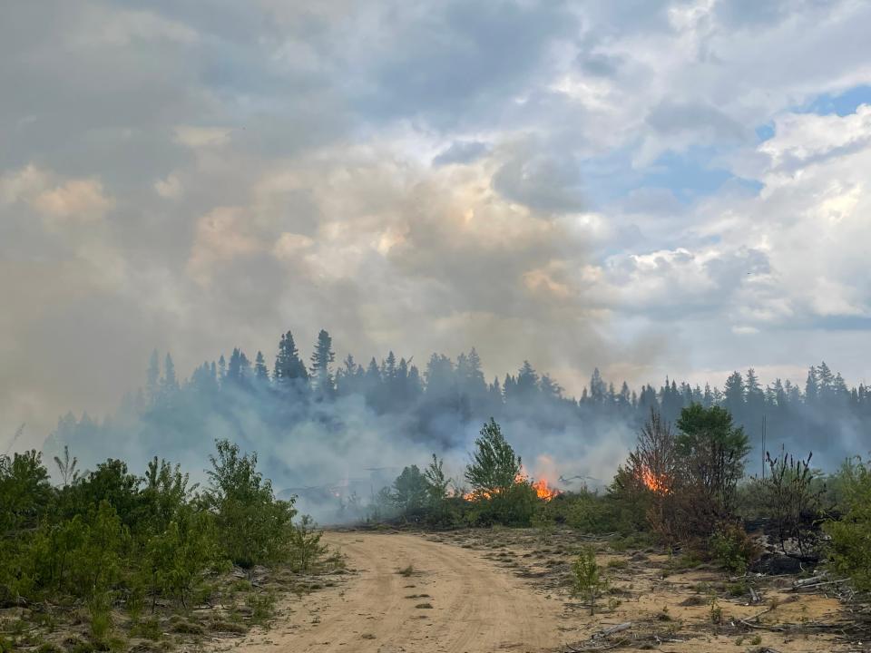
Ongoing wildfires in the Canadian provinces of Alberta and British Columbia are producing the thick blankets of smoke. Last month, smoke made its way into the area from fires burning in Quebec and Ontario.
According to the Canadian Interagency Forest Fire Centre, nearly 900 fires have burned as of Saturday.
Two more tornadoes confirmed
The NWS has confirmed that two additional EF1 tornadoes hit Christian County on June 29.
All told, seven tornadoes were confirmed in three different counties in the area, including four in Christian County. Sangamon and Logan were the other counties in the area where NWS confirmed tornadoes.
Satellite analysis showed a tornado touched down 1.2 miles south-southwest of Mt. Auburn and moved southeast.
Numerous trees and a farm building were damaged along N. 1500 East Rd. just north of the intersection with E. 2700 North Rd., where a car door was impaled by a piece of wooden debris.
More: Sentencing set for woman who pleaded guilty to charge in connection to death of Hunter Drew
The Mt. Auburn tornado packed winds estimated at about 100 mph with a path nearly a mile long.
Minutes later, satellite imagery showed that a tornado touched down 6.2 miles northwest of Palmer, about a half mile north of the intersection of N. 200 East Rd. and E. 1100 North Rd.
That tornado had a shorter path but was wider and generally traveled east-southeast through farm fields, lifting before reaching N. 300 East Rd.
According to the NWS, damage appeared limited to crops. Less than a mile beyond the track, evidence of a microburst was seen just north of 1100 North Rd. between 300 East and 420 East roads.
The damage from the derecho led Gov. JB Pritzker to issue a disaster declaration on Tuesday for Sangamon and Morgan counties.
Illinois @GovPritzker has issued a Disaster Proclamation based on the severe weather, tornadoes, and derecho that affected Sangamon and Morgan counties, along with six other counties, on June 29.#SJRBreaking pic.twitter.com/wAMLHSA896
— Steven Spearie (@StevenSpearie) July 11, 2023
Contact Steven Spearie: 217-622-1788, sspearie@sj-r.com, twitter.com/@StevenSpearie.
This article originally appeared on State Journal-Register: Air quality in central Illinois will degrade due to Canadian wildfires

