More heavy rain and 'isolated tornado threat' possible: Cape Cod under flood watch
Another round of heavy rain may be in the cards for Cape Cod, with a small risk of a tornado.
The National Weather Service has issued a Flood Watch for much of eastern Massachusetts, including Cape Cod and the Islands. The watch period runs from 2 p.m. Thursday through Friday morning.
According to the forecast discussion from the National Weather Service Boston/Norton office, a quiet "first half of (Thursday) will be followed by another heavy rainfall/thunderstorm and isolated tornado threat this evening into early Friday."
The heaviest rain may fall off-Cape, with one to two inches possible along the Route 95 corridor from Providence, R.I. to Boston. The Hyannis forecast calls for the possibility of between three quarters and an inch of rain.
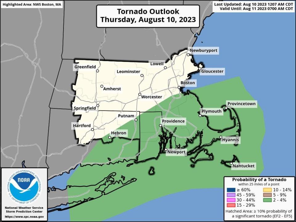
But Cape Codders should remain watchful. According to the forecast discussion: "In addition to the heavy rainfall threat, there continues to be a low risk for severe thunderstorms and (even) an isolated tornado. Right now the risk is greatest over The Cape and The Islands where the probability of a warm sector air mass will be the highest."
The forecast discussion further states that: "Given this environment isn`t all that dissimilar from the one that produced two tornadoes on Cape Cod this past Tuesday, we`ll be watching the .... radar closely for any rotating storms. Most of the action is expected to take place early in the evening. We should begin to see things wrapping up an hour or two after midnight."
Regarding the possibility of tornadoes during the time frame, Andy Nash, a meteorologist at the National Weather Service Boston/Norton office told the Cape Cod Times that "there is a small risk, it's a very low probability."
Part of the reasoning behind the flood watch is that much of the region received heavy rain during Tuesday's storm, saturating the ground and clogging drains in some areas. An additional dose of precipitation "will result in renewed flooding concerns, particularly in communities who received more than 3 inches of rain on Tuesday," according to the National Weather Service.
Here is the Hyannis forecast from the National Weather Service:
Thursday: Partly sunny, with a high near 81. Southwest wind 8 to 11 mph.
Thursday night: Showers and thunderstorms, mainly before 2 a.m. Some of the storms could produce gusty winds and heavy rain. Patchy fog before 1 a.m., then patchy fog after 2 a.m. Low around 67. South wind around 13 mph. Chance of precipitation is 80%. New rainfall amounts between three quarters and one inch possible.
Friday: Partly sunny, then gradually becoming sunny, with a high near 80. West wind around 10 mph.
Friday night: Mostly clear, with a low around 65. West wind 6 to 8 mph.
Saturday: Sunny, with a high near 81. South wind 5 to 9 mph.
Saturday night: A slight chance of showers after 10 p.m. Mostly cloudy, with a low around 69. South wind 10 to 14 mph. Chance of precipitation is 20%.
Sunday: A chance of showers before 4 p.m., then a chance of showers and thunderstorms between 4 p.m. and 5 p.m. Partly sunny, with a high near 82. Southwest wind around 14 mph. Chance of precipitation is 30%.
Eric Williams, when not solving Curious Cape Cod mysteries, writes about a variety of ways to enjoy the Cape, the weather, wildlife and other subjects. Contact him at ewilliams@capecodonline.com. Follow him on Twitter: @capecast.
Thanks to our subscribers, who help make this coverage possible. If you are not a subscriber, please consider supporting quality local journalism with a Cape Cod Times subscription. Here are our subscription plans.
This article originally appeared on Cape Cod Times: Cape Cod weather forecast: Heavy rain, tornado possible August 10

