More snow could come to Kansas City this week, weather service says
The National Weather Service has issued a warning for the Kansas City metro area that shows possible light snowfall and accumulation this week.
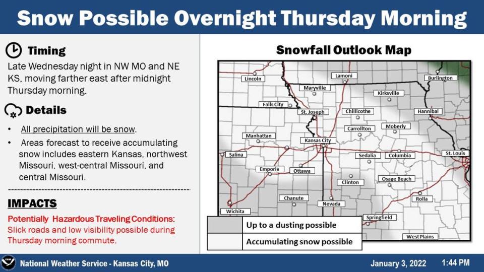
More snow could arrive late Wednesday night in northwestern Missouri and northeastern Kansas, causing potentially hazardous road conditions for commuters on Thursday morning. A map created by the weather service shows snow accumulation is possible for the entire metro area.
The weather service says potentially hazardous conditions may include slick roads and low visibility on Thursday morning.
The possible snow forecast comes a few days after the first snowfall in Kansas City this winter. The season was relatively mild until cold temperatures arrived in time for the new year.
Temperatures remained low Monday as Kansas Citians made their first commute of the New Year on Monday, with the wind chill making it feel below zero in some places. Higher temperatures are expected Tuesday before a shot of arctic air brings bitterly cold conditions Wednesday leading into Friday.
The Star’s Robert A. Cronkleton contributed to this report.