Ground blizzard expected Friday night through Sunday, NWS says
- Oops!Something went wrong.Please try again later.
1 p.m. Friday: A snow alert has been issued for the city of Sioux Falls.
The snow alert stated snow plow operations will be adaptable between emergency and residential routes due to sustained winds. All streets in Zone 3 are expected to be plowed Friday after emergency and secondary routes have been cleared.
The east-west streets in Zone 2 will be plowed from 8 p.m. Friday to 5 a.m. Saturday or until it’s done, whichever comes earlier. The north-south streets will be plowed from 8 a.m. Saturday ato 5 p.m. or until it’s done, whichever is earlier. And while the expected end time has been issued, any continuing snow removal operations may impact the use of the street for parking.
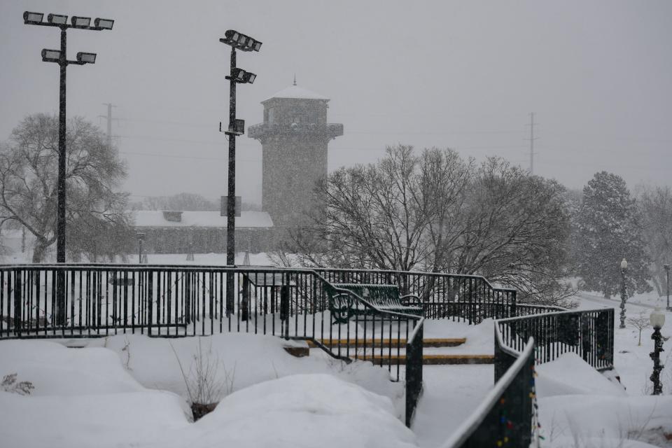
The weather conditions this weekend include snow, blizzard conditions, extreme cold and subzero windchills.
Check out the timeline below and be prepared and avoid unnecessary travel this weekend.#KeepSDsafe pic.twitter.com/bVd5juwDYj— South Dakota Department of Public Safety (@SDPublicSafety) January 12, 2024
Snow pickup operations in Zone 1 are set to begin Monday and vehicles will be subject to ticketing and towing in this zone between 1 a.m. and 6 a.m. Monday. Parking will be prohibited in Downtown Sioux Falls during this time.
Snow alert information can also be found on the city’s website, siouxfalls.gov/snow, or by signing up for email notificiations. Mobile notifications can be received by texting the number 888777 SNOWALERT. Snow alerts and updates will be communicated through the city’s accounts on X and Facebook, according to the press release.
11:15 a.m. Friday: City officials say a snow alert will be issued for Sioux Falls early this afternoon, ahead of impending blizzard conditions.
Roads and visibility in far southeast South Dakota have started to deteriorate as the system moves north, according to the NWS.
Mid morning road update:
Conditions continue to deteriorate with snow falling across parts of southwest MN, northwest IA, and far southeast SD.
Visibilities down to 1/4 to 1/2 of a mile have been reported in the falling/blowing snow.
Please use caution if traveling today! pic.twitter.com/3YQuVbXD1Y— NWS Sioux Falls (@NWSSiouxFalls) January 12, 2024
Mayor Paul TenHaken reminded residents to be patient ahead of the snow alert, given each storm system is different. The snow from the storm earlier this week that brought about a foot to the area was dry and easy to move, while snow this round may be more difficult to move with strong winds and frigid temperatures, Public Works Director Mark Cotter said.
The update came as part of a daily police briefing with media at 10:30 a.m. Friday. The city was plowed out in a little less than 36 hours with the snow alert Tuesday, but TenHaken said this next event may be more difficult than conditions earlier this week.
"We obviously run equipment that has to run well in all conditions in order to handle the snow events," TenHaken said. "And that's probably going to pose a bit of a challenge this weekend."
With 3,500 lane miles for city workers to plow, TenHaken urged for grace and understanding, asking residents to also remember to check on their neighbors throughout the storm.
"These sorts of dramatic weather events seem to be more and more common the last several years, more unpredictability to the events than we historically have seen," he said. "People always need to be prepared for that and ready for that."
Cotter said the city will have 100 operators working 12-hour shifts once the snow alert starts.
Overnight, the city saw another 2.5 inches of snow and another inch is expected at least through Friday as the system nears, he said.
"We like to have a really good understanding on what the progession and the pace of the event is going to be, so when we issue the snow alert we can be very specific and people can be very predicitive of when we will be in their respective zone," he said.
The weather conditions this weekend include snow, blizzard conditions, extreme cold and subzero windchills.
Check out the timeline below and be prepared and avoid unnecessary travel this weekend.#KeepSDsafe pic.twitter.com/bVd5juwDYj— South Dakota Department of Public Safety (@SDPublicSafety) January 12, 2024
Because this storm system will bring blizzard conditions with sustained winds, extreme cold and gusts of up to 45 mph, emergency routes will be plowed first, like other snow events, and secondary routes in Zone 3. That will allow workers to adapt if blizzard conditions change, he said.
A detailed plowing schedule is expected to be released by the city in the early afternoon. The exact timing was not given.
9:30 a.m. Friday: Southeastern South Dakota will see a blizzard warning tonight through Saturday night, according to the NWS.
The service has issued one, starting ad midnight Friday through midnight Saturday, for the area, including Lincoln and Minnehaha counties.
The area is already under a winter weather advisory until 6 p.m. Friday, and then a wind chill warning takes effect from 6 p.m. Friday to noon Tuesday.
Ongoing snow accumulations of 2 to 7 inches are possible through Wednesday, the NWS stated as part of its hazardous weather outlook.
"For the Winter Weather Advisory, snow. Additional snow accumulations of 1 to 2 inches. Winds gusting as high as 30 mph. For the Wind Chill Warning, dangerously cold wind chills expected," the alerts state. "Wind chills as low as 45 below zero. For the Blizzard Warning, blizzard conditions expected. Total snow accumulations of up to one inch Saturday. Winds gusting as high as 50 mph."
The NWS states residents should expect these impacts:
Plan on slippery road conditions today, plan on dangerous road condition once blizzard conditions develop tonight.
Widespread blowing snow could significantly reduce visibility.
The hazardous conditions could impact the morning or evening commute.
Gusty winds could bring down tree branches.
The dangerously cold wind chills could cause frostbite on exposed skin in as little as 10 minutes.
5:45 p.m. Thursday: Lincoln County is now under a winter storm warning from now until 6 p.m. Friday, according to NWS.
Total snow accumulations of 5 to 9 inches are possible, the warning states. Winds gusting as high as 35 mph on Friday afternoon and night are expected.
A wind chill warning will be in effect for Lincoln County as well, from 6 p.m. Friday to noon Tuesday, the NWS states.
Areas north are not yet under a winter storm warning, but Minnehaha County is now anticipated to get 2 to 7 inches of snow with this storm, NWS states.
Here's the latest snowfall forecast for the incoming winter storm.
The northern track solution has come together, so amounts have increased since yesterday.
Be prepared for heavy snow toward NW Iowa, followed by life-threatening cold! pic.twitter.com/ISRf3MyG20— NWS Sioux Falls (@NWSSiouxFalls) January 11, 2024
Southeast Technical College has moved classes to remote learning for Friday. The college closed Monday and Tuesday because of the winter storm earlier this week.
Sioux Falls School District has also canceled all activities and events for students for Friday evening and all of Saturday's events are being postponed, the distric announced via social media.
Classes have been moved to remote learning at Southeast Technical College for Friday, Jan. 12, 2024, due to weather. Students, check your email from instructors for class instructions. All employees should report at 10 a.m., safety permitting, or utilize their leave options.
— Southeast Technical College (@SoutheastTechSD) January 11, 2024
For the latest road conditions, check sd511.org.
4 p.m. Thursday: The University of South Dakota-Sioux Falls has announced its closure Friday ahead of the regional winter storm.
Check back for updates as other educational institutions make changes.
The University of South Dakota – Sioux Falls will be closed on Friday, January 12, 2024 due to the regional winter storm warning.
Classes will resume on Tuesday, January 16th.
Stay warm, be safe! pic.twitter.com/TGb9eOHXHA— University of South Dakota - Sioux Falls (@usd_siouxfalls) January 11, 2024
3 p.m. Thursday: A winter weather advisory is now in effect for Minnehaha County, until 6 p.m. Friday.
A wind chill warning is now also expected, from 6 p.m. Friday to noon Tuesday, according to NWS.
The advisory states total snow accumulations of 2 to 6 inches are expected for the county, which may trend higher as the storm moves through, with winds gusting as high as 35 mph on Friday night.
For the wind chill warning, dangerously cold wind chills as low as 45 below zero are expected, NWS states.
Snowfall amounts continue to trend upwards.
Locations within the red outlined will see another 2-3+ inches on top of what is in the graphic. pic.twitter.com/WDObL0gXxZ— NWS Sioux Falls (@NWSSiouxFalls) January 11, 2024
"Plan on slippery road conditions. Patchy blowing snow could significantly reduce visibility," the alert states. "The hazardous conditions could impact the morning or evening commute. Gusty winds could bring down tree branches. The dangerously cold wind chills could cause frostbite on exposed skin in as little as 10 minutes."
Areas to the east and southeast of Sioux Falls are already under a blizzard warning.
8 a.m. Thursday: Temperatures have officially dropped to 0 degrees in Sioux Falls, two days shy of the latest occurrence of the "first 0 degree temperature " during the winter season, according to the NWS in Sioux Falls.
And those temperatures are only expected to plummet through the weekend, as the second storm system this week brings more snow with the possibility of blizzard-like conditions and now what the weather service is calling life-threatening wind chills.
Wind chill warnings are likely Sunday into Monday, witn value of -20 to -40 degrees expected, the NWS said.
This upcoming storm system will bring two other threats with it.
1. High winds which could lead to ground blizzard conditions by late Friday into Saturday.
2. Life-threatening wind chills this weekend and into early next week. Wind chills as low as -45 may be possible! pic.twitter.com/V0Z0dh5Rh2— NWS Sioux Falls (@NWSSiouxFalls) January 11, 2024
And while conditions remain uncertain, the high winds that will come shortly before these wind chills could bring a ground blizzard Friday afternoon into Saturday, NWS stated.
A winter weather advisory will be in effect from noon today through 6 p.m. Friday, NWS states. The advisory predicts 3 to 6 inches of snow for Minnehaha County, with winds gusting as high as 35 mph by Friday afternoon.
Areas below Minnehaha County are already under a winter storm warning, which includes Lincoln County.
That warning takes place from noon today until midnight Friday, with 40 moh wind gusts and 4 to 8 inches of snow predicted. Locally higher amounts are possible, the warning states.
"Travel could be very difficult to impossible by Friday afternoon," the warning states. "Blowing snow could significantly reduce visibility. The hazardous conditions could impact the morning or evening commute. The cold wind chills as low as 25 below zero could cause frostbite on exposed skin in as little as 30 minutes."
The Sioux Falls area received more than 10 inches of snow between Monday and Wednesday, most of which occurred Monday, as its first major winter storm of the season moved through the area.
Yet another major storm is poised to impact the area later Thursday into the weekend.
There remains a high amount of uncertainty with continued indications snow amounts may trend upwards.
Here's a look at some of the potential with this storm system. pic.twitter.com/JWxFhMvyM7— NWS Sioux Falls (@NWSSiouxFalls) January 11, 2024
Earlier story: Significant snowfall and dangerous wind chills are in the forecast for Sioux Falls, according to the National Weather Service.
Another winter storm system is expected to affect the area from Thursday morning through Friday afternoon, with snowfall amounts between 1-3 inches currently being forecast for Sioux Falls.
Jim Murray, a meteorologist with NWS Sioux Falls, said there had been recent changes in weather models showing the storm shifting north, meaning potentially higher snowfall totals for the area.
"It was a surprise to us, too," Murray said. Much of southeastern South Dakota, including Minnehaha County, will be under a winter storm watch from noon Jan. 11 to 6 p.m. Jan. 12.
A NWS weather briefing Wednesday afternoon shows another possibility if the storm continues to shift north, with Sioux Falls potentially seeing between 8-12 inches of snow instead. But Murray said that's "a lower probability event, worst-case scenario," adding the chances of that happening were currently less than 10%.
Still, he recommended keeping an eye on the forecast as the storm's track becomes more clear.
Strong winds throughout Friday and Saturday will mean that snow, in addition to the more than 11 inches that's fallen throughout the city since early Monday, is likely to blow around, creating challenging driving conditions.
Those same winds will also contribute to bitterly cold temperatures through the weekend, with wind chills of -16 forecast on Thursday evening that could drop even further to -39 during parts of Sunday and Monday.
This article originally appeared on Sioux Falls Argus Leader: Life-threatening wind chills, blizzard conditions expected in Sioux Falls

