More storms are headed to the Charlotte area. Here’s the latest forecast.
For Friday’s weather forecast, click here.
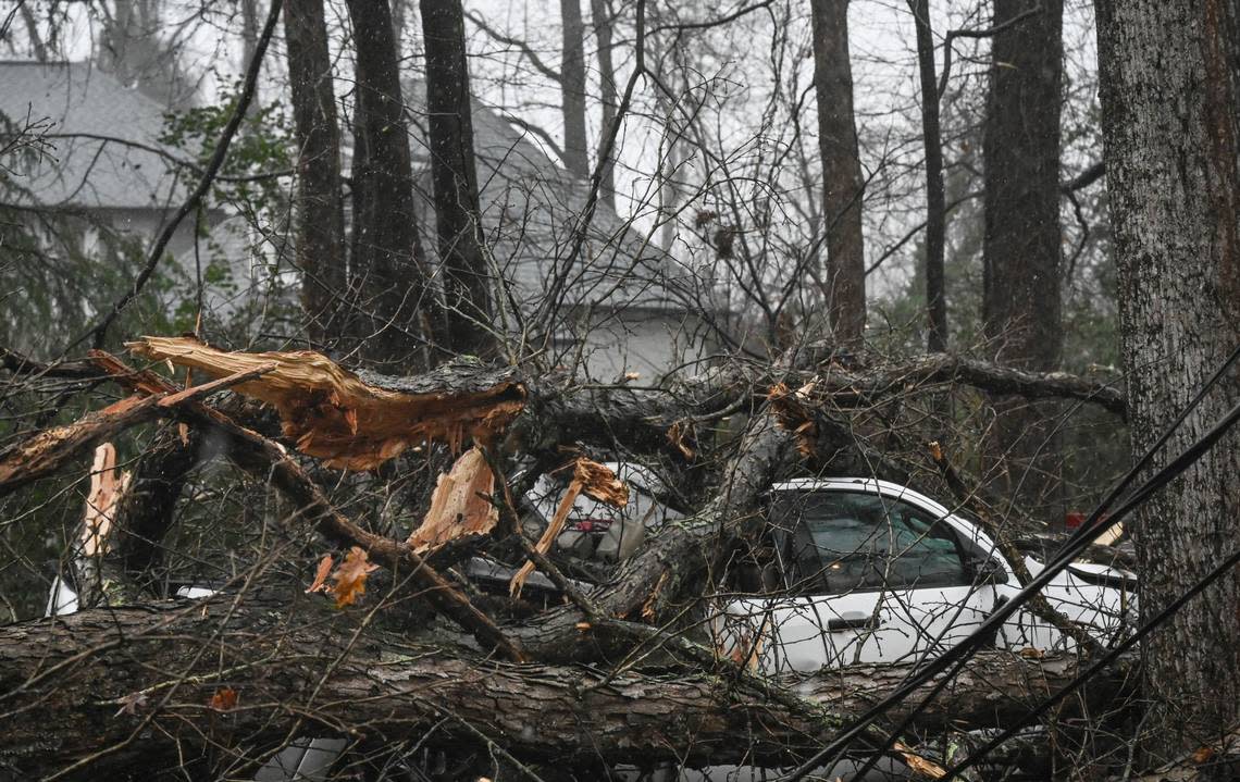
After a major storm spawned a deadly tornado, record-setting rains and heavy winds on Tuesday, more bad weather may be on the way.
Another storm system with possible damaging winds and enough rain to produce flooding could hit the Charlotte region on Friday, according to the National Weather Service.
Winds strong enough to “make driving difficult” are expected across the region between 1 p.m. Friday and 7 a.m. Saturday, NWS meteorologists said in a wind advisory bulletin at 4:15 a.m. Friday.
“Use extra caution,” forecasters urged drivers.
The expected system may dump less moisture and be less widespread than Tuesday’s destructive storm across the state, NWS meteorologists said on Twitter.
Still, people across the Charlotte region should stay alert to more flooding and wind damage, NWS forecasters advised.
“Gusty winds will blow around unsecured objects,” according to Friday’s wind advisory. “Tree limbs could be blown down and a few power outages may result”
Charlotte-area weather forecast for Friday
Winds in Charlotte could gust as high as 25 mph Friday and Saturday, according to the NWS Charlotte forecast at 8 a.m. Friday.
“Another in a series of low pressure systems will affect the western Carolinas and northeast Georgia on Friday and Friday evening,” according to a hazardous weather outlook bulletin issued by the NWS office in Greer, South Carolina.
The alert included Mecklenburg and surrounding counties, the Carolinas mountains and the N.C. Piedmont and foothills.
“This system will bring strong wind shear but weak instability ahead of a cold front during the day, which would raise the potential for a few severe thunderstorms, with damaging wind gusts being the main threat,” according to the alert.
‘When Jesus comes calling.’ NC community mourns man killed in Catawba County tornado
Where might the storms hit?
Areas along and south of Interstate 85 face the greatest risk of storms, NWS forecasters said. It all depends on how much instability develops, they said.
“Isolated heavy rainfall is also possible,” according to the NWS bulletin.
Charlotte has a 100% chance of showers throughout Friday, according to the NWS forecast. Any thunderstorms would likely emerge after 3 p.m., the forecast showed.
In Tuesday’s fierce storms, a tornado packing 110-mph winds killed a person in Catawba County, a National Weather Service team confirmed Wednesday.
Charlotte forecast
Saturday should turn sunny, with a predicted high near 49, according to the Charlotte forecast at noon Thursday.
Expect Saturday to remain breezy, with 17 to 22 mph winds and gusts as high as 32 mph, NWS forecasters said.
Sunday should be mostly sunny with a high near 51, while mostly cloudy skies are forecast to return on the Martin Luther King Jr. holiday.
Tuesday has a 40% chance of showers, while Wednesday should be most sunny, the forecast showed.
Highs are forecast to drop from 51 Sunday and 50 Monday to 43 Tuesday and 41 Wednesday.
Rain will develop across the region today and become heavy at times. Embedded thunderstorms may be strong, with isolated severe storms possible mostly along/southeast of I-85 from 2 pm to 10 pm. Expect gusty winds to develop, with a Wind Advisory in place for much of the area. pic.twitter.com/uHsaEj2tLj
— NWS GSP (@NWSGSP) January 12, 2024
A Wind Advisory starts on Friday and is in effect until 7 AM Saturday. The initial NPWGSP (text product) incorrectly had much higher winds across the mountains. A correction has been issued with the correct values. 25 to 25 mph with gusts to 55 mph. #ncwx #scwx #gawx pic.twitter.com/kL1NCe7ZYp
— NWS GSP (@NWSGSP) January 11, 2024

