From the mountains to Purgatory, here are 6 short-ish New England hikes with amazing views
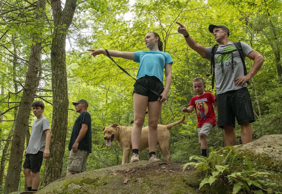
Not all of us are up for full-day or multi-day hiking excursions. But we still want to get that great view, right? Maybe just not 4,000 feet up.
Spring weather has arrived in New England and summer is just around the corner. The great outdoors is flooding once again with people seeking fresh air, respite and a little adventure.
You don't need to hike the Appalachian Trail to find that or spend an entire day summiting in pain — but immense kudos to those who can and do.
If your hiking patience is lacking, here are 10 shorter hikes around New England that pack a big punch — exercise-wise and return on investment, the views. From a White Mountains trek to a leisurely coastal trail with historic touches, there's something for everyone's outdoor preferences.
Mount Willard in New Hampshire
Located in the heart of Crawford Notch, Mount Willard is for hikers who want the rugged White Mountains feel, without the 4,000-foot elevation.
It's a 3.1-mile roundtrip hike with a steady, yet manageable incline. Along the wooded trail are water surprises and brook crossings. When emerging at the top at an open-ledge outlook, hikers come upon a valley-esque landscape that stuns with green in the summer and glowing foliage in the fall.
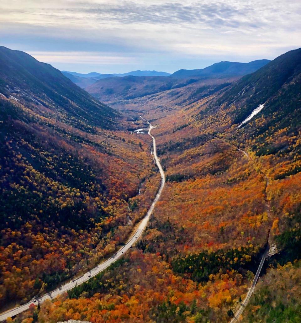
Be sure to bring snacks and a camera, as the summit is a prime spot for a break to take in the breathtaking views.
Mount Willard is also just a stone's throw around the corner from the famous Omni Mount Washington Resort. The trail starts behind the Crawford Notch Railroad Station.
Getting out and about: Hiking hasn't always been accessible to all, but these groups are opening up the outdoors
'Tis the season: Spring weather spurs searches for golf, gardening, hiking, boating, ziplining, water parks
Purgatory Chasm State Reservation in Massachusetts
Adventurers at Purgatory Chasm State Reservation can follow trails to rock formations named The Corn Crib, The Coffin, Lovers’ Leap and Fat Man's Misery.
Located in Sutton, the state-owned preserve and public recreation spot features 2 miles of trails for hiking, cross-country skiing and rock-climbing. It's most-known for a quarter-mile long, 70-foot-deep chasm of granite bedrock, which makes for great exploration.
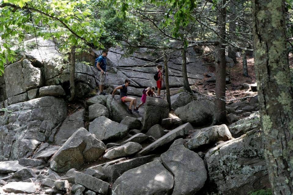
The chasm is believed to have been created by a sudden release of dammed-up glacial meltwater near the end of the last Ice Age, approximately 14,000 years ago, according to AllTrails.com.
AllTrails.com says the reservation's trails range from 82 to 715 feet in elevation gain, so hikers can select their level of activity, while still enjoying the mysteries and magic of the granite chasm.
In the middle of it all: Explore the great outdoors with these 10 trails in MetroWest, Mass.
Get out and walk: 8 top hikes on Cape Cod
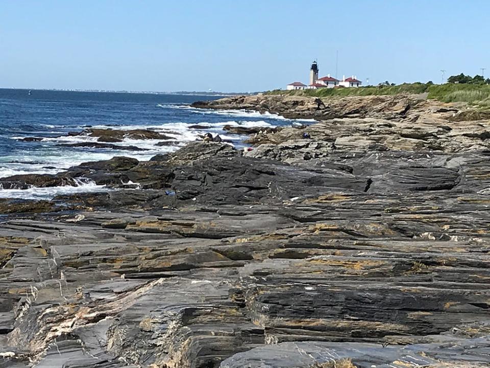
Beavertail State Park in Rhode Island
Are you an ocean person, looking for something more leisurely?
The 153-acre Beavertail State Park in Jamestown winds along coastal vistas and features an active lighthouse, one of the main attractions on site. The state park is also a destination for saltwater fishing and is loaded with historical artifacts and information.
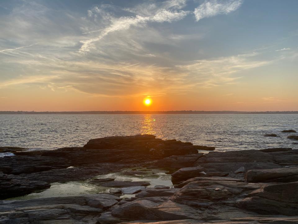
A 2.3-mile loop, the longest trail, takes walkers along rocky coastline, to outlooks, and through the woods, according to AllTrails.com, in less than an hour.
Beavertail is an undemanding excursion, and yet, gives visitors a front-row seat to the sights of Narragansett Bay, a World War II coastal fort and historic lighthouse.
Walking RI: A step-by-step guide to beautiful Stepstone Falls
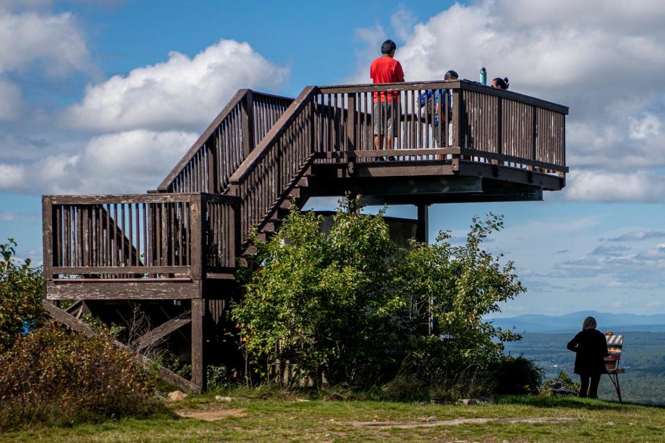
Mount Agamenticus in Maine
From the top of Mount Agamenticus on a clear day, visitors have a 360-degree view of the Atlantic Ocean, Boston's skyscrapers and the Presidential Range of the White Mountains.
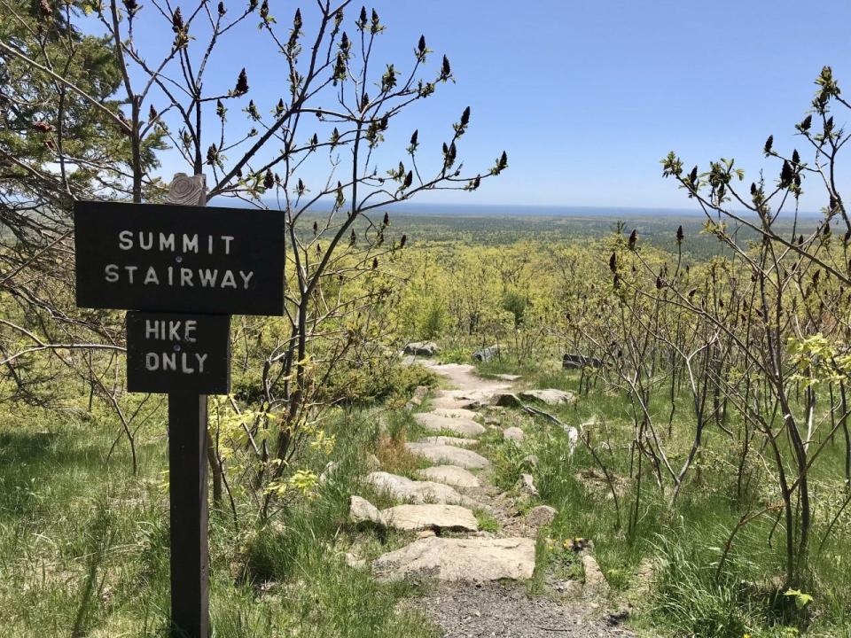
At this gem of a hike located in the coastal town of York, visitors have a multitude of trail choices to make it to the top, which sits at an elevation of approximately 692 feet. Trail names include Witch Hazel, Blueberry Bluff and the Porcupine Trail, and hikers can still find remnants of the "Big A" ski slope that operated on site many years ago.
Southern Maine hike: Mount Agamenticus offers views of White Mountains, Boston, ocean
Depending on the route taken, "Mount A" hikes can range from 45 minutes to three hours, and the summit is also accessible by car.
At the top, there are several wooden viewing platforms, picnic tables and a "learning lodge." On the clearest of days, visitors can see the quintessential Nubble Lighthouse, Boston's tallest buildings and Mount Washington.
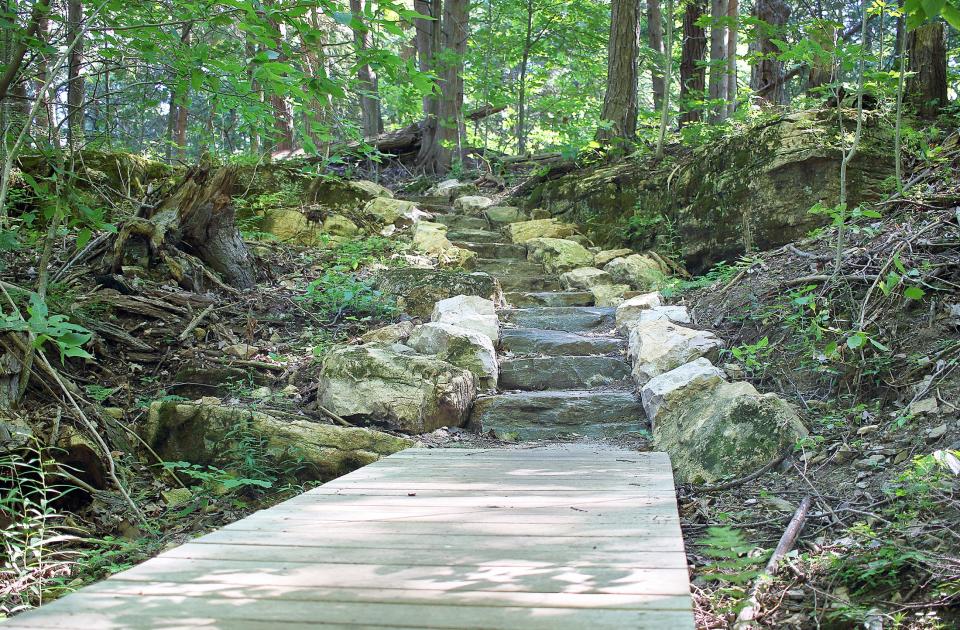
Rock Point Trail in Vermont
You need to obtain a trail pass before you go, but Rock Point in Burlington is worth the extra preparation.
Among 130 acres of conserved land owned privately by the Episcopal Diocese are 2 miles of publicly accessible walking and hiking trails along Lake Champlain. Rock Point, a nonprofit organization, calls its natural environment "a hidden gem in an urban setting."

Getting a leg up: Hikers kick up their heels at Rock Point's newly restored trails in Burlington
Rock Point's trails were restored in recent years. There are stone stairs, boardwalks and fenced overlooks bringing hikers to the breathtaking cliffs and shores of Lake Champlain. Hiking websites call Rock Point both "rugged and accessible."
It's currently "mud season" in Vermont, which means some hiking spots could have restrictions. Make sure to check before you go.
Vermont: Alternative hikes to Camel's Hump, Mount Mansfield and more
Devil's Hopyard State Park in Connecticut
"Could the round holes in the falls really be the work of the devil?" reads Connecticut's state website. "Or, just nature and water making their mark for future generations? Visit Devil's Hopyard and find your own answer to this age-old mystery."
For your to-do list: Five parks to hike, fish, swim, picnic and play in eastern Connecticut
Located in East Haddam, the highlight of the 1,000-acre park is Chapman Falls, a waterfall that drops 60 feet over a Scotland Schist stone formation.
Want a longer hike or one to do overtime: How 230 miles of hiking trails connect the suburbs of Boston
There's much folklore around where the park got its name, ranging from a man who grew a hops garden to brew beer, to potholes near the falls that the devil himself was rumored to have passed through.
AllTrails.com says Devil's Hopyard has eight hiking trails, the shortest being .4 miles and the longest 5.4 miles.
Bicycling, birding, camping, hiking, picnicking and stream fishing are all popular activities at the state park.
This article originally appeared on USA TODAY NETWORK: Shorter New England hikes with great views, good exercise

