Here’s how much snow fell in Wisconsin and how the storm forecast has changed
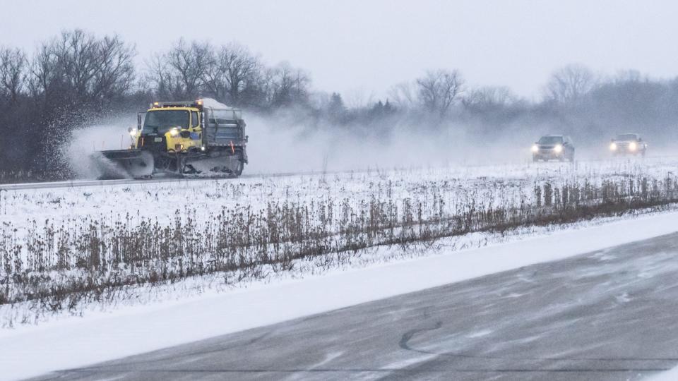
The blizzard conditions anticipated in the Milwaukee area never fully materialized Thursday, thanks in part to the limited amount of snowfall keeping visibility from dipping to a sustained dangerous threshold.
How much snow did Milwaukee and Waukesha get?
As of Friday late-morning, the National Weather Service of Milwaukee/Sullivan indicated that Milwaukee had accumulated 2.3 inches of snow since late Wednesday when the winter weather began.
At last check on the NWS snowfall map, Waukesha had seen 2.3 inches, as well, with virtually all of southeastern Wisconsin has seen less than 3 inches thus far.
More:Live updates: Extremely cold temperatures will continue overnight in Wisconsin; light snow for some
Winter Storm Warning downgraded to advisory through Saturday morning
Residents of southern Wisconsin woke up in the middle of a Winter Storm Warning on Friday, but by 2 p.m., that had been downgraded to the less-severe Winter Weather Advisory through Saturday morning.
The winter storm warning has been replaced by a winter weather advisory. That is in effect until 9AM Saturday. Blowing snow will continue to create slippery stretches especially in rural areas. Wind chills will remain dangerous all the way through the weekend. Stay safe! pic.twitter.com/0QlRuqYRRw
— Mark Baden (@Mark_Baden) December 23, 2022
Blustery west winds, blowing and drifting snow, and dangerous wind chills are ongoing across southern Wisconsin. Remember your winter driving safety tips. Be a good driver. #swiwx #wiwx pic.twitter.com/riljh40Sx5
— NWS Milwaukee (@NWSMilwaukee) December 23, 2022
The wind chill Friday was expected between minus 25 and minus 35 in some areas thanks to 45 mile-per-hour winds, wind speeds that will taper off only gradually through the weekend before finally getting back to single digits on Monday.
For comparison sake, the famous "Ice Bowl" on Dec. 31, 1967, dipped to minus 48 degrees.
What happened to the projected snowfall totals?
"We've been getting questions about 'what happened to all that snow?'" the National Weather Service out of Milwaukee/Sullivan tweeted early Friday. "The main reason is due to where the low pressure system tracked and deepened. Earlier this week, it looked like the low would be deepening just to our south. Now, it's doing that in Quebec. We had a number of days in a row earlier this week and over last weekend which was showing us the more favorable track. Over the past few days, that started to trend further east which then led to less of a chance of high snow amounts."
By midweek, the NWS expected only 2-5 inches of snow, anticipating that the high winds and freezing temperatures would become the bigger issue for residents.
"Note that we typically will only post snowfall accumulation maps within a day to three days out of a snow event," the NWS tweet thread continued. "The information that was shared at that time is what we had in front of us and we wanted to share with folks to make them aware."
Snow totals from around Wisconsin through Friday morning
Here is a sampling of snow totals around the state as of Friday morning, according to the National Weather Service:
Green Bay, 4.3 inches
Madison (Dane County Regional Airport), 3.9 inches
Racine, 1 inch
Janesville, 1.4 inches
La Crosse (French Island), 3.1 inches
Eau Claire, 5.5 inches
Wausau, 4.6 inches
Rhinelander, 6 inches
Where in Wisconsin got the most snow?
Door County's Washington Island saw 9.1 inches of snow.
Carlsville, also in Door County, got 9.0 inches.
What's ahead for Friday's forecast, and Christmas?
The NWS called for a chance of more snow showers after 5 p.m. Friday in Milwaukee, but total snow accumulation is expected to be less than half an inch.
A chance for flurries returns overnight, and blowing snow will be a problem throughout the day with wind chills only slightly better at minus 20 to 25.
The NWS forecast for Christmas on Sunday included sunny skies, a high near 11 degrees and winds from 10 to 15 miles per hour.
Around Wisconsin, the forecast is much the same: flurries, wind and low temperatures.
But if you can endure the deep freeze over the next couple days, you'll be rewarded with forecasted temperatures in the upper 30s and 40s by Wednesday and Thursday next week.
Doug Schneider of the USA Today Network - Wisconsin contributed to this report.
This article originally appeared on Milwaukee Journal Sentinel: Snow totals across Wisconsin from winter storm lower than forecast

