How much wind, rain did Idalia bring to the TC, and what happened to that return loop?
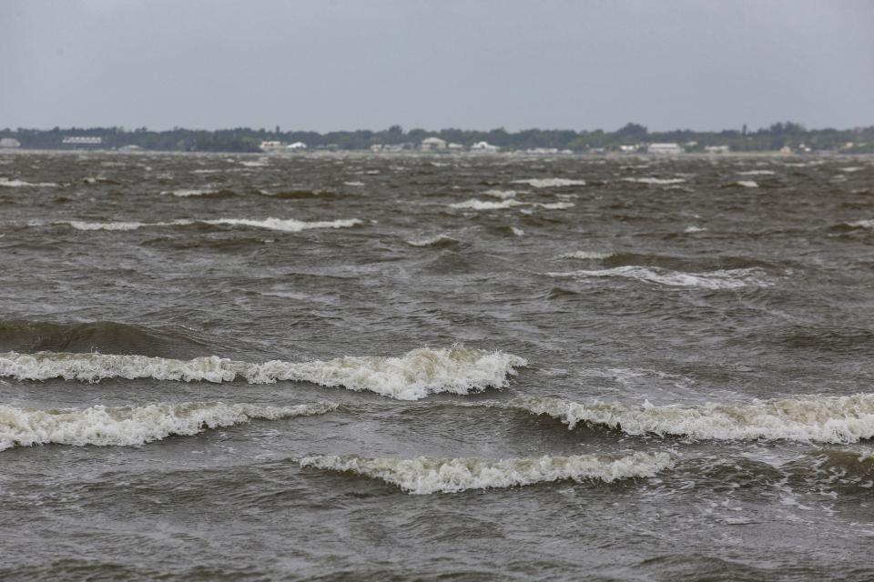
After landfall as a Category 3 major storm with near 125 mph winds in the Gulf Coast Big Bend region, local weather reports show Hurricane Idalia's outer bands brought 50 mph wind gusts and up to an inch of rain to areas of the Treasure Coast.
The strongest wind gust for the area was 52 mph recorded at the Vero Beach Regional Airport, according to the National Weather Service in Melbourne.
Wind gusts from 40 to 50 mph and a quarter to an inch of rain were reported in areas throughout Indian River, St. Lucie and Martin counties.
There were no reports of storm damage overnight Tuesday through Wednesday evening, said meteorologist Kole Fehling.
At its nearest point to the Treasure Coast, the storm passed roughly 125 miles west of Tampa at 11 p.m. Tuesday. Vero Beach, the closest of the main Treasure Coast cities to Tampa, is 140 miles east of Tampa.
Fehling said local effects were largely from outer bands of the storm as it pushed northeast over land Wednesday.
Changes in paths and predictions
As Hurricane Idalia churned through the Gulf growing into a Category 4 storm, early projections showed a possible landfall anywhere southeast of Tallahassee to just north of Tampa.
A few paths showed after landing in Florida and crossing the northern part of the state into Georgia, the system might loop in the Atlantic and head to Florida's east coast, according to weather reports from the National Oceanic and Atmospheric Administration.
More: A second Hurricane Idalia landfall on Florida east coast would be very weak, NHC says
Illustrations of the possible trajectory showed it move off the South Carolina and Georgia coasts and return south to central and southern Florida shorelines. By 11 a.m. Wednesday, however, NOAA prediction models ruled out any possibility of its “circulation curving back toward the U.S.”
Tropical Storm Idalia was just off the southern coast of North Carolina by roughly noon Thursday, said Robbie Berg, a senior hurricane specialist at the National Hurricane Center in Miami.
“The storm was on track for where we expected (it) to move,” said Berg. “There are no longer any models showing a potential for the system to curve back around toward Florida.”
The remnants of the storm are forecast to move east to Bermuda and further out into the western Atlantic away from the United States, he said.
“When we’re making a forecast, we don’t just latch on to one model,” Berg said. “We don’t just rely on one model or two models … we average them all together (and) sometimes the models are all very close and that gives us very high confidence in the forecast.”
A few days ago, however, he said, predictions showed the system moving “all over the place,” including potentially back toward South Florida.
The hurricane made landfall as a category 3 in the Keaton Beach area of Taylor County north of Steinhatchee at 7:45 a.m. with near 125 mph sustained winds. Storm surge pushed into coastal areas as far south as Tampa and reports of destruction stretched along its path from Cedar Key to Valdosta, Georgia, and into Savannah.
More: 'Couldn't believe it': Floridians emerge from Idalia's destruction with hopes to recover
The storm weakened from a Category 4 just before landfall, because of what is called an “eyewall replacement cycle,” according to NOAA.
That means the storm reached its highest intensity and the center, or eye, contracted as outer rain bands pushed inward, “robbing the inner eyewall of its moisture and momentum.”
NHC reports show by 1 p.m. Wednesday its sustained wind speeds were 90 mph. Berg said storms naturally weaken over land due to friction and primarily, “because they lose their heat source.”
The warmer waters in the Gulf likely contributed to its rapid intensification to a Category 4 storm in roughly 24 hours, he said.
Is climate change a factor?
Asked about the role of climate change in formation of storms like Idalia, he said each storm was “unique,” but added there has been a noted increase in frequency of major storms making landfall in the United States.
“It’s nearly impossible to attribute climate change to what a specific storm may do, however, we know the waters across the globe have been warming (and) we know the sea level has been rising,” he said.
Climate change, in general, refers to long-term shifts in temperatures and weather patterns. These shifts may be natural, but since the 1800s, human activities have been the main driver of climate change, primarily due to the burning of fossil fuels - such as coal, oil, and gas - which produces heat-trapping gases, according to the United Nations.
Climate change encompasses global warming, but refers to the broader range of changes that are happening to the planet, including rising sea levels; shrinking mountain glaciers; accelerating ice melt in Greenland, Antarctica and the Arctic; and shifts in flowers and plant blooming times.

Before 2017, Berg said "we hadn't had many major hurricanes making landfall" on a regular basis. But since then, he said a major storm had struck the U.S. gulf or east coasts just about every year.
NOAA records show in 2017 two Category 4 hurricanes - Irma and Harvey - struck Florida and Texas following a 12-year period without a major storm. In 2005 four Category 3 storms - Dennis, Katrina, Rita and Wilma - impacted Florida and Texas.
“Climate change seems to be making the hazards associated with these storms worse on the whole. We can say on the whole we have been seeing more storms intensify," Berg said.
Corey Arwood is a breaking news reporter for TCPalm. Follow Corey on X @coreyarwood, or reach him by phone at 772-978-2246.
More: Florida fishing: Snook action should start hot Sept. 1; mullet run starting
More: Moms for Liberty wanted these 33 books removed from school libraries in Indian River County
More: 'The Price is Right' host Bob Barker had ties to a Fort Pierce chimpanzee sanctuary
This article originally appeared on Treasure Coast Newspapers: How much wind and rain Idalia brought to the TC; climate change effect

