Severe storms continue across Alberta on Friday evening
An active spell of severe weather will continue into the holiday weekend across the Prairies as a vigorous setup spans the western half of the region.
Alberta will serve as the main focus for storm activity on both Friday and Saturday, with activity spilling into Saskatchewan and even north into the territories during the day Friday.
Pay close attention to watches and warnings if you’re on the Prairies during this long Canada Day weekend, and have a plan in place to get to sturdy shelter if threatening weather approaches your location.
DON'T MISS: Sunscreen or umbrellas: Flexible plans needed this Canada Day long weekend
Friday
Areas: Alberta, southern Saskatchewan, and Northern Canada
Timing: Afternoon and evening hours
Weather:
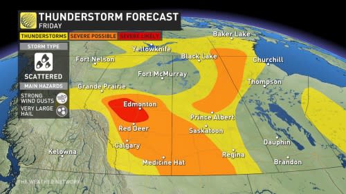
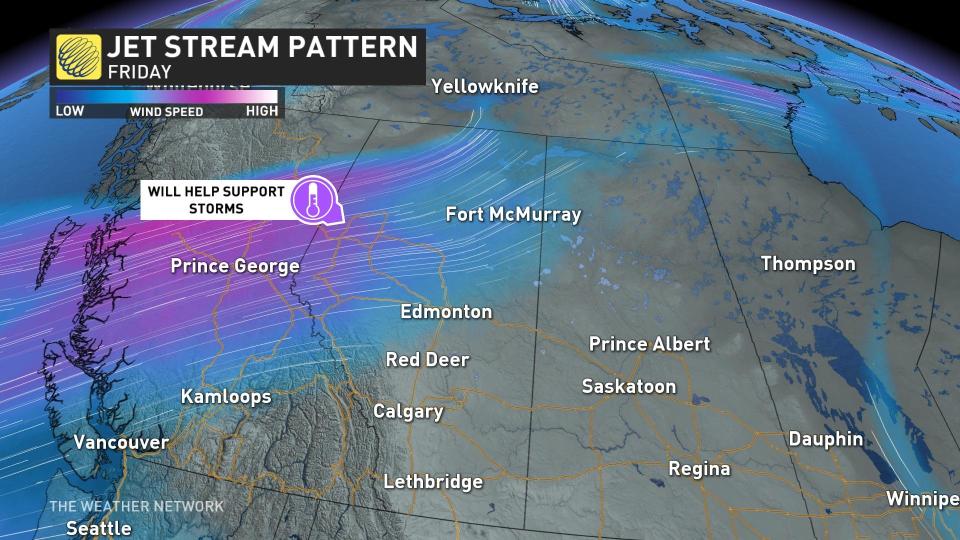
Widespread warmth and humidity will provide ample fuel for thunderstorms to develop and thrive, but the real boost will come from strong upper-level winds swooping over the Rockies.
This support from the jet stream will help to organize thunderstorms and push them beyond severe limits throughout Alberta. Severe storms are most likely from the foothills east into southern Saskatchewan, where the strongest storms will produce very large hail and strong wind gusts.
There is the potential for those in Alberta to see toonie to ping pong ball sized hail as the system sweeps through.
A centre of low pressure pushing into the far northern Prairies will trigger thunderstorms fuelled by temperatures hot enough to prompt heat warnings from Environment and Climate Change Canada.
The risk for severe storms will cover parts of northern Saskatchewan and Manitoba, stretching into relatively unpopulated portions of the N.W.T. and Nunavut.
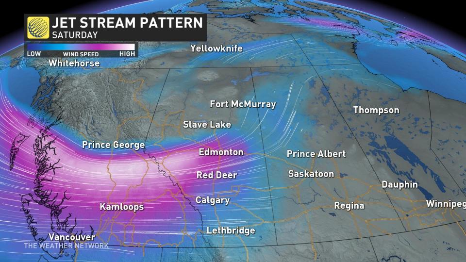
Saturday
Areas: Alberta, Saskatchewan and Manitoba
Timing: Afternoon and evening hours
Weather: The heat, instability, and upper-level winds will favour another active day of severe weather across the western Prairies for our Canada Day on Saturday.
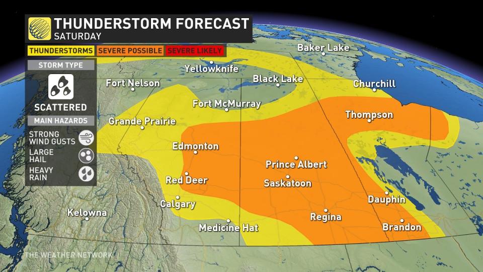
These ingredients will prime the environment to produce severe thunderstorms capable of producing large hail at the least. Alberta, Saskatchewan, and Manitoba are likely to see more intense weather Saturday due to the upper-level wind strength and trough heading through the region.
DON'T MISS: Don’t fall victim to these seven dangerous tornado myths
Not everyone will see these isolated, pop-up thunderstorms on Saturday, but any storms that do roll through could spoil any outdoor Canada Day plans.
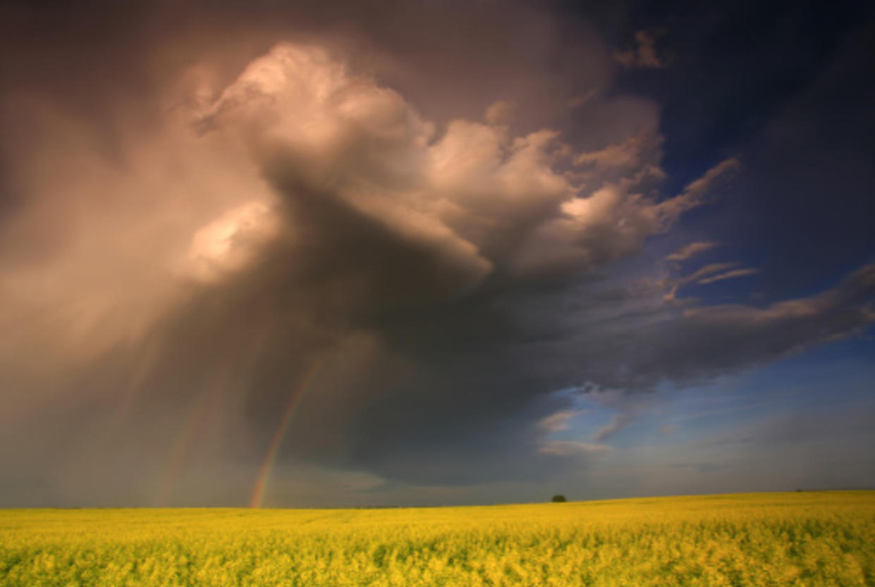
Thumbnail courtesy of Getty Images.
Keep checking back to The Weather Network for more forecast information and updates for your weather on the Prairies.

