Weekend storm train eyes Ontario, watching a major system
This weekend’s forecast has a little something for everyone. Mild temperatures, rain, a cooldown, and snow are all the way across the province.
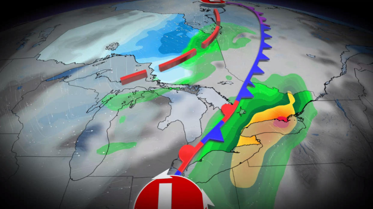
Rather than one big storm, this weekend’s energy split into three rounds. Each of these low-pressure systems will move through the region heading into the weekend, complete with a potential for lake-effect snow to round out the activity through Monday.
Visit our Complete Guide to Winter for an in-depth look at the Winter Forecast, tips to plan for it and much more!
After several days of disagreement due to the complex upper-level pattern blanketing the region, computer model guidance has finally started to agree on a probable outcome for the largest of the three systems arriving on Sunday.
At this point, the big system’s snowfall appears likely to miss southern sections of Ontario. However, drivers are still urged to plan ahead and adjust to the changing conditions. Continue checking back as forecasters update the latest information.
Round one: Snow hits northern Ontario through Saturday
Our first weekend system is an Alberta clipper that’ll track into northern Ontario through early Saturday. Heavy snow will blanket northwestern Ontario through the beginning of the weekend.
Luckily for travellers, the heaviest snow will remain north of the Trans-Canada Highway, with only a brief period of snow falling over the major thoroughfare.
Folks around Thunder Bay won’t see as much snow as their neighbours, with snow amounts tapering off along Lake Superior’s western shores. Blowing snow with reduced visibility is forecast in and out of Kenora. This forecast holds the most confidence.

A second round of rain and snow will target northeastern Ontario by Saturday morning, as a second low tracks near Sault Ste. Marie.
Between 5-15 cm of snow is likely along the Trans-Canada Highway from Sault Ste. Marie to Marathon, and extending north of Kapuskasing. This snowline may shift slightly leading into the weekend. To the south of this line, a mix of rain and snow will limit totals in Timmins and south.
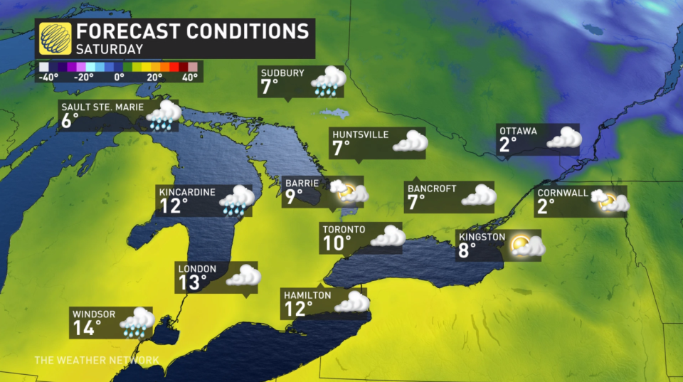
Conditions stay milder south and east, precipitation likely rain
With one storm to the north and another tracking south, southern and eastern Ontario have a very tricky forecast. Confidence has grown in mild and rainy conditions arriving this weekend, with lake-effect snow accompanying a cooldown by Monday.
DON'T MISS: Is it safe? How thick does ice need to be to walk or skate on?
There's confidence in the forecast that Saturday will start cloudy, with afternoon highs that will likely reach the double-digits in the south.
Rainfall will arrive later on Saturday, potentially growing heavy at times. Precipitation will linger into Sunday afternoon as the first system to the north retreats.
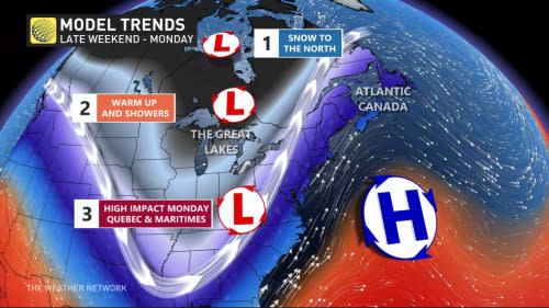
It’s the last of these three systems that’s surrounded by the most uncertainty, especially given its potent but narrow swath of storm ingredients.
Computer models continue to shift the storm's track, which will make all the difference when it comes to precipitation types. The current forecast places a low through the U.S. northeast, tracking a swath of heavy system snow away from Ontario at this time.

Lake-effect snow threat into Monday
Southern Ontario isn’t totally out of the snow threat altogether.
Cooler and more seasonal air will rush in behind the systems on Monday, kickstarting the lake-effect snow machine once again.

Snowfall combined with occasional wind gusts of 40-50+ km/h will bring a risk for reduced visibility and whiteout conditions that may affect travel on Monday, especially near the traditional snowbelts.
Going somewhere? Check out the current highway conditions before heading out!
Stay with The Weather Network for all the latest on conditions across Ontario.

