NASA Satellite Captures EPIC View of Earth's Clouds and More (Video)
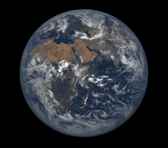
NASA's Earth Polychromatic Imaging Camera — or EPIC for short — is living up to its acronym, by producing visually stunning and scientifically fascinating images of Earth.
EPIC lives onboard NASA's Deep Space Climate Observatory (DSCOVR), which orbits the sun about 1 million miles from Earth — a perfect vantage point to take a snapshot of Earth's entire sunlit face every 2 hours. A new video from NASA explains how this location allows EPIC to track features like clouds, particulates in the air or volcanic ash clouds. It will also provide information about the energy budget of the planet — an important piece of information for climate models.
Today (Dec. 14), at the annual meeting of the American Geophysical Union, scientists released new images taken by EPIC, and described some of the science it will facilitate.[See more photos from NASA's Deep Space Climate Observatory]
"We've grown accustomed to seeing images of our planet from space," says the new video produced at the NASA Goddard Spaceflight Center. "But full Earth views […] have actually only been seen by astronauts on their way to the moon, and a handful of retreating probes, like Galileo, as they peered back toward home for the last time."
As most people are well aware, satellites orbiting the Earth provide "high resolution images of the planet every day," according to the video. But as the video explains, these satellites are too close to the surface of the Earth to capture its entire face at once. Instead, they have to take many pictures as they loop around and around Earth. The pictures are then compiled into a single image. But that means these images don't show changing features, like storms, at the same point in time. EPIC, on the other hand, provides a complete view of the Earth face in each image.
"It’s the only view we have like this where everything is at the exact same instant in time, even though the local times are different," Jay Herman, EPIC instrument lead investigator at Goddard, said in a statement from NASA. With this capability, it's possible for scientists to watch storms or clouds of dust as they move across the planet. "We can see the progression in real time," Herman said.
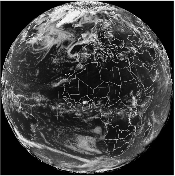
EPIC will produce gorgeous color images of the Earth, but it also take pictures in ultraviolet and near-infrared light, which are better for tracking some features, the scientists at the AGU meeting said. The science of EPIC is somewhat expansive, and will include helping to measuring Earth's energy balance (which is based partly on how much sunlight is absorbed and reflected by the planet). That information is used in climate models. Scientists are also "analyzing EPIC data to better understand vegetation, aerosols, ozone and other features of Earth and its atmosphere," according to the statement from NASA.
DSCOVR launched on Feb. 11 of this year, aboard a SpaceX Falcon 9 rocket. The location where it orbits the sun is known as the first Lagrange point, or L1, a place where the gravitational pull of the sun and the Earth "balance out," allowing spacecraft to stay relatively stable, the scientists said. It is also carrying instruments that will study the sun, and perhaps provide information that could help scientists predict solar flares and other dangerous space weather events.
Follow Calla Cofield @callacofield.Follow us @Spacedotcom, Facebook and Google+. Original article on Space.com.
Orbiting EPIC Camera Snaps 12 Whole-Earth Images Each Day | Video
Amazing Africa: Continent Spied from Space in Gorgeous NASA Pic
Copyright 2015 SPACE.com, a Purch company. All rights reserved. This material may not be published, broadcast, rewritten or redistributed.
