NASA’s Space Satellites Are Spying on Our Rising Seas
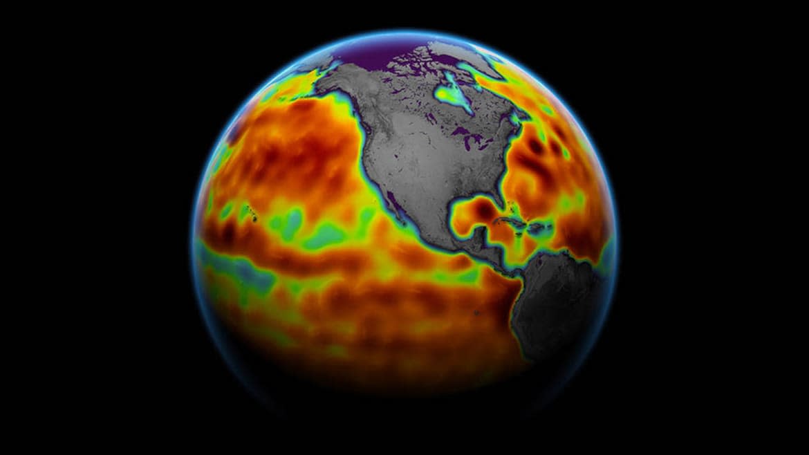
The seas are rising, and hundreds of millions of people live at or just above the current high tide lines. But it’s hard to know which parts of the world will be most at risk without knowing exactly how high the seas are right now—and how high they might get. Enter NASA and the European Space Agency’s newest satellites, which will help us measure sea surface height to an unprecedented degree.
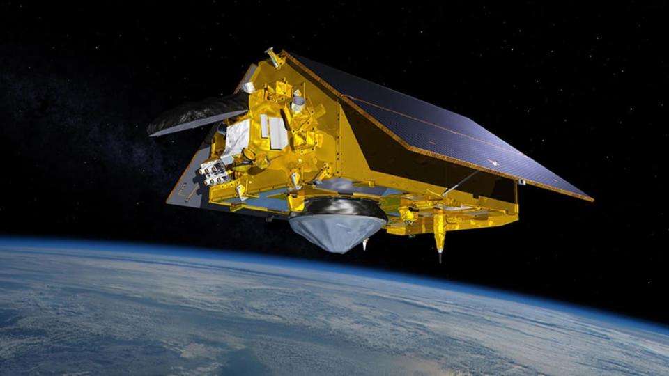
The Sentinel-6 Michael Frielich satellite, named for a former director of NASA’s Earth Science Division, launched last November, but last week it finished a months-long calibration and testing process and began providing data. Orbiting at about 830 miles above the planet, it can measure the sea surface height to within 1.2 inches—that’s like standing in Los Angeles and measuring something in Denver (Rockies notwithstanding) to within the diameter of a half-dollar coin.
The satellite is equipped with a radar altimeter known as the Poseidon-4. It measures sea surface height by sending out radio wave pulses and measuring the time it takes for them to bounce off the surface of the ocean and return.
The Mental-Health Burden of Climate Change Continues Long After the Storm
“With the high-level of accuracy achieved by the altimeters, we can begin to make good assessments of both the rate and acceleration of global sea level rise,” said Benjamin Hamlington, a research scientist at NASA’s Jet Propulsion Laboratory. “This is critical information from a planning perspective, as it allows us to assess the trajectory of sea level rise we are on and gives us independent comparison to model projections.”
After the Sentinel-6 Michael Frielich launched in 2020, it spent months trailing along just 30 seconds behind its predecessor, the Jason-3, both moving at a healthy clip of about 4.5 miles per second. This tandem flight was done in order to maintain a continuous flow of data as the Jason-3 neared the end of its lifespan, and to allow NASA and the ESA—the latter of which actually provided the altimeter on board the satellite—to ensure the new version was working properly. Craig Donlon, a scientist with the ESA’s Earth and Mission Science Division based in the Netherlands, told The Daily Beast that the Sentinel-6 altimeter offers about a 50 percent improvement in accuracy over its predecessor.
“The instrument employs on-board calibration and back-end digital electronics that also help ensure the measurements are very stable in time—which is important when making measurements of very small changes in global mean sea level of [about] three to four millimeters per year,” Donlon said. It also uses a package of tools to offer what’s known as a Precise Orbit Determination—knowing exactly where the satellite itself is as it throws and catches the endless radar pulses is a crucial part of an accurate measurement.
Four millimeters per year may not sound like much, but another thing the satellite data tell us is that the rate of sea-level rise is accelerating. Donlon points out that the rate of rise differs around the world, with the thermal expansion of the oceans playing more or less of a role in some spots and glacial and ice cap melt more involved in others. Knowing exactly how fast the sea is rising in particular locations could help with coastal planning and efforts to stave off the worst effects of rising oceans.
Sentinel-6 Michael Frielich’s first data offerings are actually not yet its most accurate. One data stream now available is accurate to within 2.3 inches and can be accessed only hours after the satellite collects it; if you can wait two days from collection, the accuracy improves to 1.4 inches. The best version, with 1.2 inches of accuracy, will be available later in the year.
Hamlington said that the new altimeter is also capable of providing more accurate sea surface height measurements closer in to the actual coast than the Jason-3 and earlier satellites. “From a coastal impact perspective, it is the change in sea level at the coast that really matters,” he said. The data can also be used to improve weather forecasting and hurricane preparedness. Eric Leuliette, a project scientist at the National Oceanic and Atmospheric Administration, called Sentinel-6 “an amazing new tool.”
Rising Sea Levels Swallowed Solomon Islands
Over the past century and a half, it is estimated that the average sea level around the globe has risen by about eight to nine inches—and a third of that rise has happened in just the last 25 years. For most of that period, the only way to measure rising seas was using ground-based instruments like tide gauges, mounted along coastlines. The modern satellite record began in 1992, and since then a total of five satellites (TOPEX/Poseidon, Jasons 1-3, and now Sentinel-6) have completed the same exact orbital path, covering most of the globe, every 10 days, offering a remarkable continuous record.
“The longer this record is, the better we are able to separate natural changes from climate change-driven changes in sea level,” Hamlington said. “This long record that has consistent and improving accuracy provides critical information on how our climate is changing over time.”
Get our top stories in your inbox every day. Sign up now!
Daily Beast Membership: Beast Inside goes deeper on the stories that matter to you. Learn more.

