National Geographic adds a 5th ocean to the world map
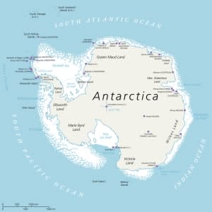
National Geographic did not invent the Southern Ocean, but it made it official this week, cartographically speaking, adding the body of water around Antarctica to its maps along with the Pacific, Atlantic, Indian, and Arctic oceans.
"Scientists have long known there's a distinct ecological region around Antarctica," National Geographic Society geographer Alex Tait told The Washington Post. National Oceanic and Atmospheric Administration (NOAA) recognized the Southern Ocean as a distinct body of water in 1999, but not all member nations of the International Hydrographic Organization agreed. Tait said National Geographic "thought it was important at this point to officially recognize it," because "people look to us for geographic fact: How many continents, how many countries, how many oceans?"
Enric Sala, National Geographic's "explorer in residence," described the Southern Ocean as an "oceanic ring at the end of the world that connects the Pacific, Atlantic, and Indian oceans," stretching from the shores of Antarctica to 60 degrees south latitude. Its distinctive feature, he told the Post, is the eastward-flowing Circumpolar Current, "perpetually chasing itself around Antarctica."
