National Hurricane Center continues tracking disturbance in Atlantic, 3 tropical waves
The National Hurricane Center is continuing to watch a disturbance in the eastern Atlantic.
The "complex" non-tropical area of low pressure has a 10 percent chance of development over the next 48 hours.
Forecasters also are keeping an eye on three tropical waves, including two in the Caribbean Sea.
The 2023 Atlantic hurricane season jumped into action with the formation of Tropical Storm Arlene June 2. The Atlantic hurricane season begins June 1.
While Arlene is the first named storm of the 2023 season, it's actually the second storm to form in the Atlantic basin, which encompasses the Atlantic north of the equator, Caribbean Sea and Gulf of Mexico.
A subtropical system formed in January in the North Atlantic. Since the designation came during a post-storm analysis, it was not given a name but will be recorded as an Unnamed Storm.
Do you live in an evacuation zone? How do you know if you live in an evacuation zone? We explain how to find your zone
NOAA's hurricane season forecast: NOAA predicts 'near normal' hurricane season with 12-17 named storms and 5-9 hurricanes
The next storm will be Bret.
Here's the latest update from the NHC as of 8 a.m. June 6:
What's out there and where are they?
Non-tropical area of low pressure: A complex, non-tropical area of low pressure located between the Azores and Canary Islands is producing disorganized showers and thunderstorms with winds to gale force over the northeastern Atlantic Ocean.
Tropical wave 1: The first tropical wave is located in the Central Atlantic between Cabo Verde and St. Lucia. It's moving west at 17 mph. Exact location: 40W, from 14N south.
Tropical wave 2: A tropical wave in the Caribbean is located northwest of Barbados, extending south. It's moving west at 13 mph. Exact location: 62W from 14N south.
Tropical wave 3: A second tropical wave in the Caribbean is located south of Haiti, extending south. It's moving west at 11 mph. Exact location: 73W from 14N south.
How likely are they to strengthen?
Non-tropical area of low pressure: This system could acquire some subtropical characteristics during the next day or so while it meanders to the east and southeast of the Azores. By late Wednesday, the system is forecast to move northeast over cooler waters, and further development is not expected.
Formation chance through 48 hours: low, 10 percent.
Formation chance through seven days: low, 10 percent.
Who is likely to be impacted?
The non-tropical area of low pressure in the eastern Atlantic is not expected to impact the U.S. Regardless of development, heavy rains and gusty winds will continue across portions of the Canary Islands, Madeira Island, and the Azores over the next day or so.
It's too early at this time to determine if there will be any impact to the U.S. from the tropical waves.
Forecasters urge all residents to continue monitoring the tropics and to always be prepared.
Weather watches and warnings issued for your area
If you can't see any local weather warnings here, you'll need to open this story in a web browser.
When is the Atlantic hurricane season?
The Atlantic hurricane season runs from June 1 through Nov. 30.
When is the peak of hurricane season?
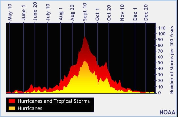
The peak of the season is Sept. 10, with the most activity happening between mid-August and mid-October, according to the Hurricane Center.
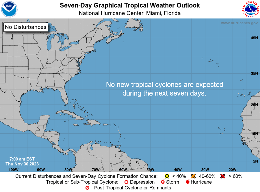
Tropical forecast over the next seven days
Excessive rainfall forecast
What's out there?
Systems currently being monitored by the National Hurricane Center.
What's next?
We will continue to update our tropical weather coverage daily. Download your local site's app to ensure you're always connected to the news. And look at our special subscription offers here.
This article originally appeared on Fort Myers News-Press: Tropics watch: NHC tracking Atlantic disturbance, 3 tropical waves

