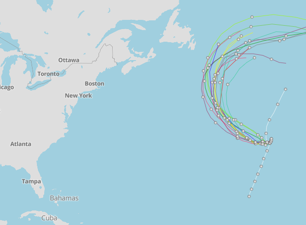
National Hurricane Center tracking Tropical Storm Don. New tropical wave appears on map
Tropical Storm Don picked up some speed and power, but it's still not expected to impact land, according to the latest advisory from the National Hurricane Center.
As Don turns more toward the west over the next couple of days, it should move over warmer waters, allowing some gradual strengthening.
Also in the Atlantic basin are three tropical waves, including one in the eastern Atlantic with a 20 percent chance of developing over the next seven days.
In the Pacific, Calvin has become a post-tropical cyclone as it pulls away from Hawaii. Maximum sustained winds are 40 mph.
Tropical storm warnings for Calvin have been discontinued.
Latest hurricane season forecast: What deranged heat and sea temps tell us about hurricane season
As Calvin moves away from Hawaii, additional rainfall totals of 1 to 3 inches are possible on the Big Island, with up to 2 inches possible on the other islands. Flooding is taking place on the Big Island, where more than 6 inches of rain have fallen over windward and southeast slopes.
Here's the latest update from the NHC as of 5 p.m. July 19:
Tropical Storm Don

Location: 795 miles west-southwest of the Azores
Maximum wind speed: 45 mph
Direction: west at 8 mph
What's out there and where are they?

Tropical Storm Don: At 5 p.m., center of Tropical Storm Don was 795 miles west-southwest of the Azores. Exact location: near latitude 33.8 North, longitude 40.3 West.
Eastern Atlantic tropical wave: Cloudiness and showers over the eastern tropical Atlantic centered a few hundred miles south of the Cabo Verde Islands are associated with a tropical wave.
Tropical wave 2: A tropical wave in the western Atlantic tropical wave is located east of Dominica. It's moving west at 17 to 23 mph. Exact location: near 55W from 15N southward.
Tropical wave 3: A tropical wave in the Caribbean extends from near the Cayman Islands through central Panama. It's moving west at 17 mph.
How likely is Tropical Storm Don to strengthen?
Maximum sustained winds have increased to 45 mph, with higher gusts. Gradual strengthening is indicated during the next couple of days, with little change in strength expected late this week.
Tropical-storm-force winds extend outward up to 60 miles from the center.
What are the chances of the eastern tropical wave strengthening?
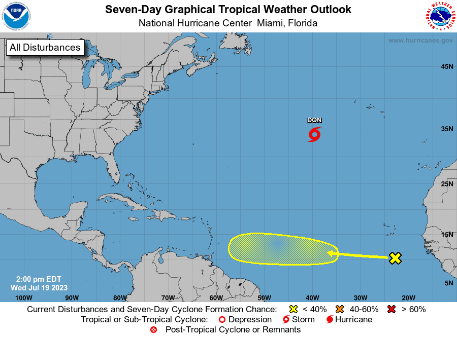
While dry air should prevent significant organization during the next few days, environmental conditionscould become more conducive for some development by this weekend while the wave moves westward across the central tropical Atlantic at 15 to 20 mph.
Formation chance through 48 hours: low, near 0 percent.
Formation chance through 7 days: low, 20 percent.
Who is likely to be impacted?
No impact to land is expected from Tropical Storm Don.
It's too early at this time to determine if there will be any impact to the U.S. from the tropical waves.
Forecasters urge all residents to continue monitoring the tropics and to always be prepared.
Weather watches and warnings issued in Florida
If you can't see any local weather warnings here, you'll need to open this story in a web browser.
When is the Atlantic hurricane season?
The Atlantic hurricane season runs from June 1 through Nov. 30.
When is the peak of hurricane season?

The peak of the season is Sept. 10, with the most activity happening between mid-August and mid-October, according to the Hurricane Center.
Tropical forecast over the next seven days
Excessive rainfall forecast
What's out there?
Systems currently being monitored by the National Hurricane Center.

What's next?
We will continue to update our tropical weather coverage daily. Download your local site's app to ensure you're always connected to the news. And look at our special subscription offers here.
This article originally appeared on Palm Beach Post: NHC tracking Tropical Storm Don, 3 tropical waves

