National Hurricane Center monitoring 4 tropical waves, including 2 in Caribbean
The National Hurricane Center is monitoring four tropical waves, including two in the Caribbean Sea, according to the latest advisory.
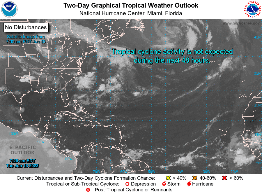
No tropical cyclone development is expected over the next seven days. In Florida, a non-tropical system is causing heat advisories for some parts of Florida.
AccuWeather meteorologists are tracking the potential for activity to increase in the western Caribbean and the Gulf of Mexico later this month.
Meteorologists said they are seeing signs that point to some potential trouble spots in the coming weeks.
"A robust train of disturbances emerging from Africa, may lead to development by the third week of June," according to AccuWeather. Meteorologists do believe that both the eastern Pacific and the Atlantic will remain quiet into at least Friday when it comes to tropical activity.
Florida's hot: What is a heat advisory? How to protect yourself from heat stroke
There may be some tropical development in waters surrounding Central America and southern Mexico beginning perhaps as early as this weekend and through the third and fourth weeks of June.
Tropical development historically happens close to North America and Central America in June.
While there is nothing is imminent, experts recommend residents and those with vacation plans in potential trouble spots to stay vigilant.
The next name for the 2023 Atlantic hurricane season will be Bret.
Here's the latest update from the NHC as of 8 a.m. June 13:
What's out there and where are they?
Tropical wave 1: A tropical wave in the eastern Atlantic tropical wave is located west of Liberia, extending south from the Guinea-Bissau coast. It's moving west at 11 mph. Exact location: Between 12W and 19W and from 04N to 10N.
Tropical wave 2: A tropical wave in the central Atlantic is located east of French Guiana. It's moving west at 13 mph. Exact location: Between 40W and 43W and from 04N to 08N.
Tropical wave 3: A Caribbean tropical wave is located south of Puerto Rico. It's moving west at 13 mph. Exact location: 65W and south of 13N.
Tropical wave 4: Another tropical wave in the Caribbean is located east of Nicaragua, extending through Panama and into the eastern Pacific. It's moving west at 13 mph. Exact location: Near 82W and extending south from 13N.
What is a tropical wave?
A tropical wave, also known as an easterly wave, is an elongated area of relatively low pressure that moves from east to west across the tropics. To the west of the system, there is often good weather. To the east, though, cloudiness and heavy rain are often found.
Tropical waves can lead to the formation of a tropical cyclone, according to NOAA.
Who is likely to be impacted?
It's too early at this time to determine if there will be any impact to the U.S. from the tropical waves.
Forecasters urge all residents to continue monitoring the tropics and to always be prepared.
What is El Niño?
El Niño is a natural climate pattern in which surface sea water temperatures in the central and eastern tropical Pacific Ocean are warmer than average. It occurs, on average, every two to seven years.
El Niño is back: NOAA says. Will it help fuel Earth's hottest year on record?
Here's what the return of El Niño means for hurricane season and Florida
El Niño usually helps to suppress Atlantic hurricane activity, experts say.
El Niño “tends to lead to an increase in vertical wind shear, which tends to reduce the number of hurricanes in the tropical Atlantic,” said David DeWitt, director of the Climate Prediction Center.
But this year, forecasters say that may not happen, because of record hot Atlantic water temperatures that would counteract the El Niño winds that normally decapitate many storms.
While El Niño can't completely prevent hurricanes in the Atlantic, it often serves to limit hurricane formation and reduce hurricane landfalls along the East Coast, giving Florida and other hurricane-prone areas a break.
NOAA hurricane season forecast: NOAA predicts 'near normal' hurricane season with 12-17 named storms and 5-9 hurricanes
Weather watches and warnings issued for your area
If you can't see any local weather warnings here, you'll need to open this story in a web browser.
When is the Atlantic hurricane season?
The Atlantic hurricane season runs from June 1 through Nov. 30.
When is the peak of hurricane season?
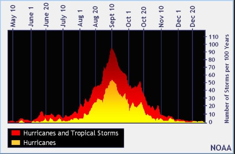
The peak of the season is Sept. 10, with the most activity happening between mid-August and mid-October, according to the Hurricane Center.
Tropical forecast over the next seven days
Excessive rainfall forecast
What's out there?
Systems currently being monitored by the National Hurricane Center.

What's next?
We will continue to update our tropical weather coverage daily. Download your local site's app to ensure you're always connected to the news. And look at our special subscription offers here.
Contributor: Doyle Rice
This article originally appeared on Tallahassee Democrat: Tropics watch: NHC tracking train of tropical waves. 2 in Caribbean

