National Hurricane Center tracking 2 systems, including one in Gulf of Mexico
The National Hurricane Center is tracking two systems, including one in the Gulf of Mexico.
Invest 92L is located in the eastern Atlantic and is expected to strengthen into a tropical depression this in the next couple of days.
The other system is located in the southwestern Gulf of Mexico. Chances for development are low.
However, depending on the nature of a developing area of low pressure, clouds and rain may expand to the northern Gulf coast and then perhaps by late week across Florida, according to AccuWeather.
Building seas and rough surf are likely in the Gulf of Mexico this week.
Here's the latest update from the NHC as of 2 p.m.:
What is out there and how likely are they to strengthen?
Area of low pressure: Shower and thunderstorm activity has changed little in organization in association with a small area of low pressure over the southwestern Gulf of Mexico.
Environmental conditions appear only marginally favorable for some additional development while thesystem moves slowly northward before the low merges with a frontal system over the western Gulf of Mexico by midweek.
Formation chance through 48 hours: low, 20 percent.
Formation chance through 7 days: low, 20 percent.
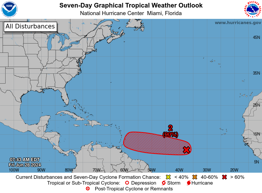
Invest 92L: A low-latitude tropical wave located several hundred miles south-southwest of the Cabo Verde Islands continues to produce a large area of showers and thunderstorms.
This activity has become a bit more concentrated this afternoon, and environmental conditions appear conducive for additional development of this system during the next several days.
A tropical depression is likely to form in the next couple of days while it moves west-northwestward ornorthwestward across the eastern tropical Atlantic.
Formation chance through 48 hours: high, 70 percent.
Formation chance through seven days: high, 80 percent.
Who is likely to be impacted?
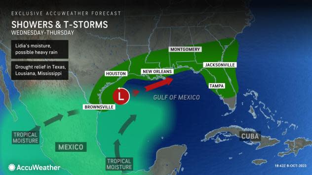
An area of low pressure is expected to develop across the northwestern Gulf of Mexico Tuesday night. It's expected move inland across north Florida Wednesday night and could bring scattered thunderstorms and strong winds, according the National Hurricane Center.
There is the likelihood of building seas and rough surf, according to AccuWeather.
Forecasters urge all residents to continue monitoring the tropics and to always be prepared.
Weather watches and warnings issued in Florida
When is the Atlantic hurricane season?
The Atlantic hurricane season runs from June 1 through Nov. 30.
When is the peak of hurricane season?
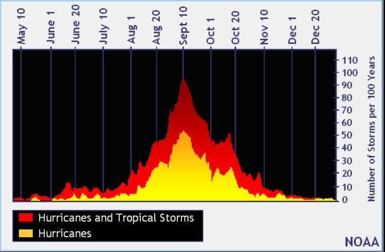
The peak of the season is Sept. 10, with the most activity happening between mid-August and mid-October, according to the Hurricane Center.
Tropical forecast over the next seven days
Excessive rainfall forecast
What's out there?
Systems currently being monitored by the National Hurricane Center.

Noaa
Embedded content: https://www.nhc.noaa.gov/xgtwo/two_atl_0d0.png?052051
What's next?
We will continue to update our tropical weather coverage daily. Download your local site's app to ensure you're always connected to the news. And look at our special subscription offers here.
This article originally appeared on Treasure Coast Newspapers: NHC tracking system in Gulf of Mexico, eastern Atlantic. Impacts, path

