National Hurricane Center tracking 3 systems. Chances increasing for 2 tropical depressions
The National Hurricane Center has designated two disturbances as invests and both could develop into tropical depressions in the coming days, according to the latest advisory.
Invest 98L and Invest 99L are both located in the Atlantic, well east of Florida. Both currently have a 60 percent chance for development over the next seven days.
Forecasters continue to watch a system in the Gulf of Mexico. It has a 20 percent chance for development over the next seven days as it moves toward the west.
The next named storm of the Atlantic hurricane season will be Emily.
Forecasters also are watching two tropical waves in the Atlantic basin, which consists of the Atlantic Ocean, Gulf of Mexico and Caribbean Sea.
Hurricane Hilary path: Storm could bring heavy rain to Southern California. Track it here.
In the eastern Pacific, Hurricane Hilary is expected to intensify and become a major hurricane later today. A major hurricane has maximum sustained winds of at least 111 mph.
As of 2 p.m., the Category 2 storm had maximum sustained winds of 105 mph.
The hurricane could potentially bring “significant impacts” to parts of Southwestern United States over the weekend, including heavy rain and flash flooding in the Baja California Peninsula and Southern California, according to the National Hurricane Center.
The busiest period of the hurricane season is here. On average, more storms develop from August through October, with Sept. 10 being the peak of the season.
Here's the latest update from the NHC as of 2 p.m.:
What is an invest?
An invest — which is short for investigation — is a designation used when an organization such as the National Hurricane Center is interested in collecting specialized data and/or running models, according to the National Weather Service.
The designation of a system as an invest does not necessarily mean it will develop into a tropical cyclone.
Weather terms explained: What's an invest, anyway? We explain and break down the weather forecaster's term
Tropics waking up: We've seen 278 days since a hurricane hit. But the tropics are waking up
What's out there and where are they?

Invest 99L: Disorganized showers and thunderstorms continue in association with an elongated trough of low pressure about 1000 miles west-southwest of the Cabo Verde Islands.
Invest 98L: A broad area of low pressure associated with a tropical wave is producing a large area of disorganized showers and thunderstorms near and to the southwest of the Cabo Verde Islands.
Disturbance 3: A broad area of low pressure could form in the central or western Gulf of Mexico by the beginning of next week.
Tropical wave 1: A tropical wave in the central Atlantic is located between Puerto Rico and Cabo Verde. It's moving west at 11 to 17 mph. Exact location: near 45W, south of 20N.
Tropical wave 2: A tropical wave is located in the eastern Caribbean. It's moving west at 11 to 17 mph.
How likely are they to strengthen?
Invest 99L: Environmental conditions appear conducive for gradual development of this system.
A tropical depression could form during the next several days while it moves west-northwestward at 10 to 15 mph across the central tropical Atlantic.
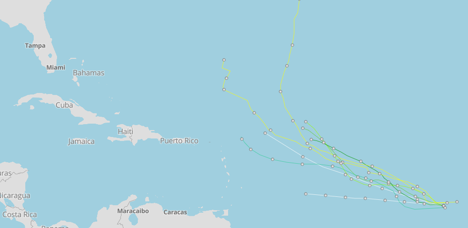
➤ Spaghetti models for Invest 99L
Formation chance through 48 hours: medium, 40 percent.
Formation chance through seven days: medium, 60 percent.

Invest 98L: Further development of this low is possible while it moves toward the west-northwest or northwest at around 10 mph across the eastern tropical Atlantic.
A tropical depression could form over the weekend before environmental conditions become unfavorable fordevelopment early next week.
➤ Spaghetti models for Invest 98L
Formation chance through 48 hours: medium, 40 percent.
Formation chance through seven days: medium, 60 percent.

Disturbance 3: Some slow development of this system is possible thereafter as it moves westward andapproaches the western Gulf of Mexico coastline by the middle of next week.
Formation chance through 48 hours: low, near 0 percent.
Formation chance through seven days: low, 30 percent.
Spaghetti models, forecast path for Invest 98L
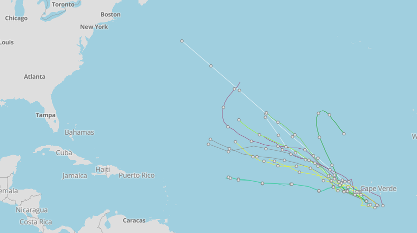
Spaghetti models, forecast path for Invest 99L
Who is likely to be impacted?
Disturbance 3: Regardless of development, areas of northeast Mexico and southeastern Texas could face an increase of tropical moisture from the middle to late part of next week, according to AccuWeather.
"This feature will not have much time to develop before it likely moves into Texas, though it will be moving across very warm water which can aid in rapid development," said AccuWeather Senior Meteorologist Dan Pydynowski.
It's too early at this time to determine if there will be any impact to the U.S. from the other two disturbances in the Atlantic or the tropical waves.
Forecasters urge all residents to continue monitoring the tropics and to always be prepared.
Weather watches and warnings issued in Florida
When is the Atlantic hurricane season?
The Atlantic hurricane season runs from June 1 through Nov. 30.
When is the peak of hurricane season?
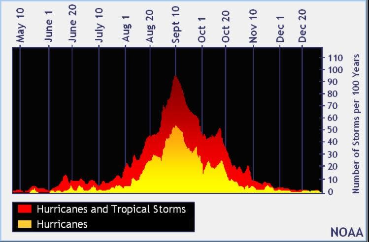
The peak of the season is Sept. 10, with the most activity happening between mid-August and mid-October, according to the Hurricane Center.
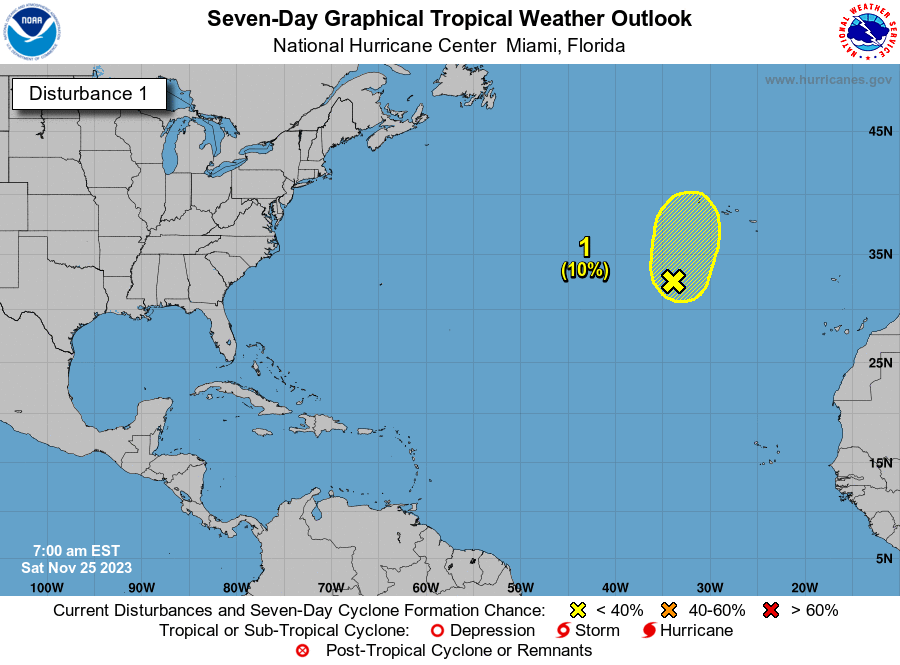
Tropical forecast over the next seven days
Excessive rainfall forecast
What's out there?
Systems currently being monitored by the National Hurricane Center.
What's next?
We will continue to update our tropical weather coverage daily. Download your local site's app to ensure you're always connected to the news. And look at our special subscription offers here.
This article originally appeared on Treasure Coast Newspapers: NHC tracking Invests 98L, 99L. Both may become tropical depressions

