National Hurricane Center tracking system in Gulf of Mexico expected to move across Florida
Editor's note: Here's the latest forecast on Invest 91L, which may become a tropical depression or storm soon.
Six hours after the tropics were looking quiet, the National Hurricane Center is now tracking a system in the Gulf of Mexico.
The system currently has a low chance for development over the coming days but is expected to move across Florida and into the Atlantic by early next week. Regardless of development, the system could bring heavy rain and gusty winds across portions of Florida, according to the forecasters with the Hurricane Center.
Forecasters also are tracking five tropical waves, including one in the Caribbean.
NOAA's forecast: When is hurricane season? Here's when hurricane season starts and what to expect in 2023
WeatherTiger: 2023 hurricane season will be 'once-in-a-generation slugfest' between tropical forces
How to prepare for hurricane season: On a budget? Here's 5 cheap ways to prepare your home for Florida's hurricane season
The Atlantic hurricane season officially begins June 1 and runs through Nov. 30. A sales tax holiday to help Florida residents purchase hurricane supplies runs through June 9. A second 14-day disaster preparedness tax holiday will run Aug. 26 through Sept. 8.
The first named storm of the 2023 season will be Arlene, although it will actually be the second storm of the season. A system in January was classified in May as a subtropical storm. Since the classification came during a post analysis, it did not get a name and will be documented as "Unnamed."
Here's the latest update from the NHC as of 2 p.m. May 30:
What's out there and where are they?
The National Hurricane Center is tracking a a system of low pressure in the Gulf of Mexico and five tropical waves in the Atlantic basin, which includes the Atlantic, Caribbean Sea and Gulf of Mexico.
Low-pressure system in Gulf of Mexico: An area of disorganized showers and thunderstorms is associated with a surface trough of low pressure interacting with an upper-level trough over the central Gulf of Mexico.
Tropical wave 1: A tropical wave in the eastern Atlantic is located off the coast of Africa southeast of Cabo Verde, west of Sierra Leone. It's moving west at 11mph. Exact location: 21W 11N to 03N.
Tropical wave 2: Another tropical wave is located southwest of Cabo Verde. It's moving west at 11 mph. Exact location: 33W 11N to 01N.
Tropical wave 3: A central Atlantic tropical wave is located off the coast of South America, east of French Guiana. It's moving west at 11 mph. Exact location: 46W 11N to 01N.
Tropical wave 4: A weak tropical wave in the western Atlantic is located of the coast of South America, southeast of Trinidad and Tobago. It's moving west at 11 mph. Exact location: 60W 11N to 01N.
Tropical wave 5: A tropical wave in the Caribbean is located north of Venezuela. Exact location: 72W 13N to 03N.
Chances for development of system in Gulf of Mexico
Environmental conditions appear only marginally favorable for additional development over the next several days as the system meanders over the eastern Gulf of Mexico. The system is then forecast to move across Florida this weekend and emerge into the southwestern Atlantic Ocean by early next week.
Formation chance through 48 hours: low, 10 percent.
Formation chance through 7 days: low, 20 percent.
Who is likely to be impacted?
Regardless of development, the system currently in the Gulf of Mexico could produce heavy rainfall and gusty winds over portions of Florida later this week.
It's too early at this time to determine if there will be any impact to the Florida or the U.S. from the tropical waves.
Forecasters urge all residents to continue monitoring the tropics and to always be prepared.
Weather watches and warnings issued for your area
If you can't see any local weather warnings here, you'll need to open this story in a web browser.
When is the Atlantic hurricane season?
The Atlantic hurricane season runs from June 1 through Nov. 30.
When is the peak of hurricane season?
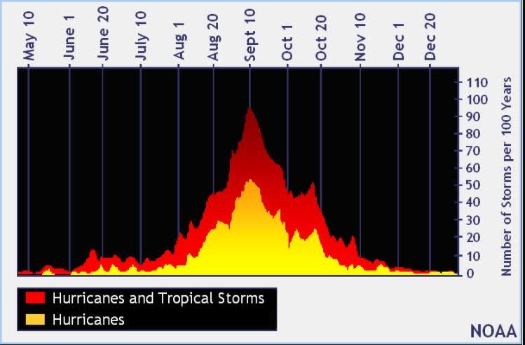
The peak of the season is Sept. 10, with the most activity happening between mid-August and mid-October, according to the Hurricane Center.
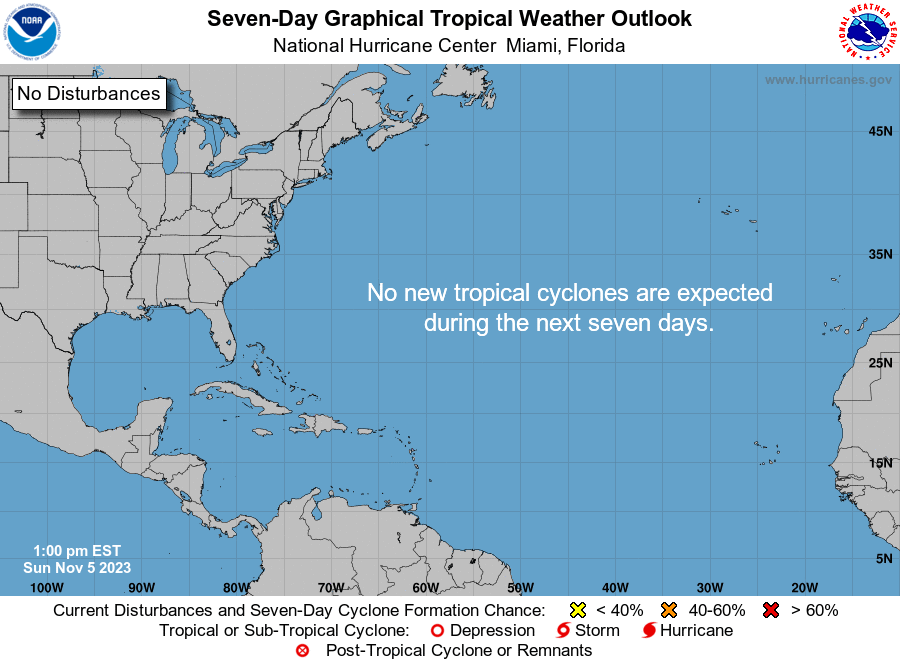
Tropical forecast over the next seven days
Excessive rainfall forecast
What's out there?
Systems currently being monitored by the National Hurricane Center.
What's next?
We will continue to update our tropical weather coverage daily. Download your local site's app to ensure you're always connected to the news. And look at our special subscription offers here.
This article originally appeared on Florida Today: Tropics watch: NHC tracking system in Gulf of Mexico, 5 tropical waves

