National Hurricane Center tracking 6 systems. Tropical Depression 12 forms in Atlantic
- Oops!Something went wrong.Please try again later.
Idalia text message updates: Sign up to receive updates on Hurricane Idalia and its aftermath from journalists across the USA TODAY network
Former Hurricane Idalia has continues to weaken over the Atlantic — although it may restrengthen over the Labor Day weekend.
Elsewhere, the National Hurricane Center is keeping an eye on newly formed Tropical Depression 12 in the eastern Atlantic, which may become Tropical Storm Katia later today.
On average, the 12th Atlantic storm forms on Oct. 11, according to Philip Klotzbach, Colorado State University meteorologist who specializes in hurricane forecasts.
And speaking of restrengthening, Gert is back as a tropical depression and could become a tropical storm again.
Gert became the sixth storm of the 2023 Atlantic hurricane season when it became a tropical storm Aug. 21. By the next day, it had already weakened into a tropical depression.
It's remnants have been hanging around the central Atlantic and developed into a tropical depression Friday morning.
There are six systems in the Atlantic Ocean this morning. Aside from what's now Post-Tropical Cyclone Idalia, Gert and Tropical Depression 12, there's also Hurricane Franklin and Tropical Storm Jose, and a tropical wave moving off the coast of Africa.
WeatherTiger Hurricane recap: Idalia exits Florida, shows line between blessings, disaster
The next named storms will be Katia, Lee and Margot.
Special note about NHC forecast cones and spaghetti models:
The forecast track shows the most likely path of the center of the storm. It does not illustrate the full width of the storm or its impacts, and the center of the storm is likely to travel outside the cone up to 33% of the time.
Spaghetti model illustrations include an array of forecast tools and models, and not all are created equal. The hurricane center uses only the top four or five highest performing models to help make its forecasts.
Here's the latest update from the NHC as of 2 p.m.:
Post Tropical Cyclone Idalia

Location: 155 miles west-southwest of Bermuda
Maximum wind speed: 50 mph
Direction: east-southeast at 17 mph
On the forecast track, the center of Idalia will move near or to the south of Bermuda on Saturday.
Satellite-derived wind data indicate that maximum sustained winds have decreased to near 50 mph, with higher gusts.
Additional weakening is forecast through early Saturday. Restrengthening is possible over the weekend, and Idalia could transition back to a tropical storm on Saturday.
Tropical-storm-force winds extend outward up to 240 miles from the center.
Hurricane Idalia damage: See photos of Category 3 hurricane as it makes landfall in Florida
Spaghetti models for Post Tropical Cyclone Idalia
Hurricane Franklin

Location: 680 miles northeast of Bermuda
Maximum wind speed: 75 mph
Direction: northeast at 18 mph
Maximum sustained winds are near 75 mph, with higher gusts. Some fluctuations in intensity are possible during the next day or so, followed by weakening through early next week. Franklin is forecast to become an extratropical cyclone by tonight.
Satellite wind data indicate that hurricane-force winds extend outward up to 60 miles from the center and tropical-storm-force winds extend outward up to 255 miles.
Spaghetti models for Hurricane Franklin
Tropical Storm Jose

Location: 835 miles east-northeast of Bermuda
Maximum sustained winds: 50 mph
Movement: north-northeast at 23 mph
Maximum sustained winds are near 50 mph, with higher gusts. Little change in strength is forecast, and Jose is expected to become absorbed by Franklin tonight or early Saturday.
Tropical-storm-force winds extend outward up to 45 miles.
Spaghetti models for Tropical Storm Jose
Tropical Depression Gert

Location: 635 miles east-southeast of Bermuda
Maximum sustained winds: 35 mph
Movement: east at 8 mph
Maximum sustained winds are near 35 mph, with higher gusts.
Some slight strengthening is possible today, and Gert could become a tropical storm once again. Gradual weakening is forecast to begin over the weekend.
Tropical Depression 12

Location: 375 miles northwest of Cabo Verde Islands
Maximum sustained winds: 35 mph
Movement: north-northwest at 8 mph
Maximum sustained winds are near 35 mph, with higher gusts.
Some strengthening is expected, and the depression is forecast to become a tropical storm later today or this evening. The system is likely to weaken early Sunday and degenerate to a remnant low by late Sunday.
Spaghetti models for Tropical Depression 12
What else is out there and how likely are they to strengthen?
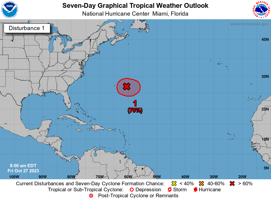
Disturbance 1: A tropical wave is expected to move off the west coast of Africa during the next day or so.
Environmental conditions appear conducive for some gradual development of this system during the early and middle parts of next week, and a tropical depression could form while it moves westward to west-northwestward over the eastern and central portions of the tropical Atlantic.
The Florida Public Radio Emergency Network tweeted this system will be one for Florida to watch, although "it'll stay well into the Atlantic at least 10 more days."
Formation chance through 48 hours: low, near 0 percent.
Formation chance through 7 days: medium, 50 percent.
Weather watches and warnings issued in Florida
When is the Atlantic hurricane season?
The Atlantic hurricane season runs from June 1 through Nov. 30.
When is the peak of hurricane season?
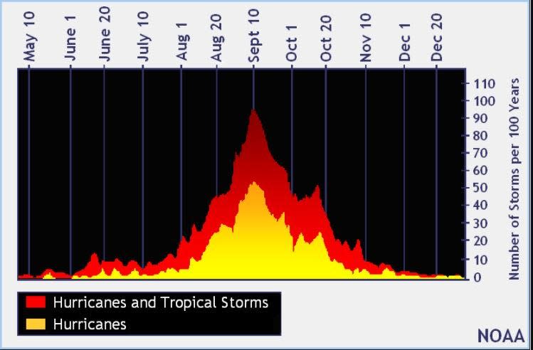
The peak of the season is Sept. 10, with the most activity happening between mid-August and mid-October, according to the Hurricane Center.
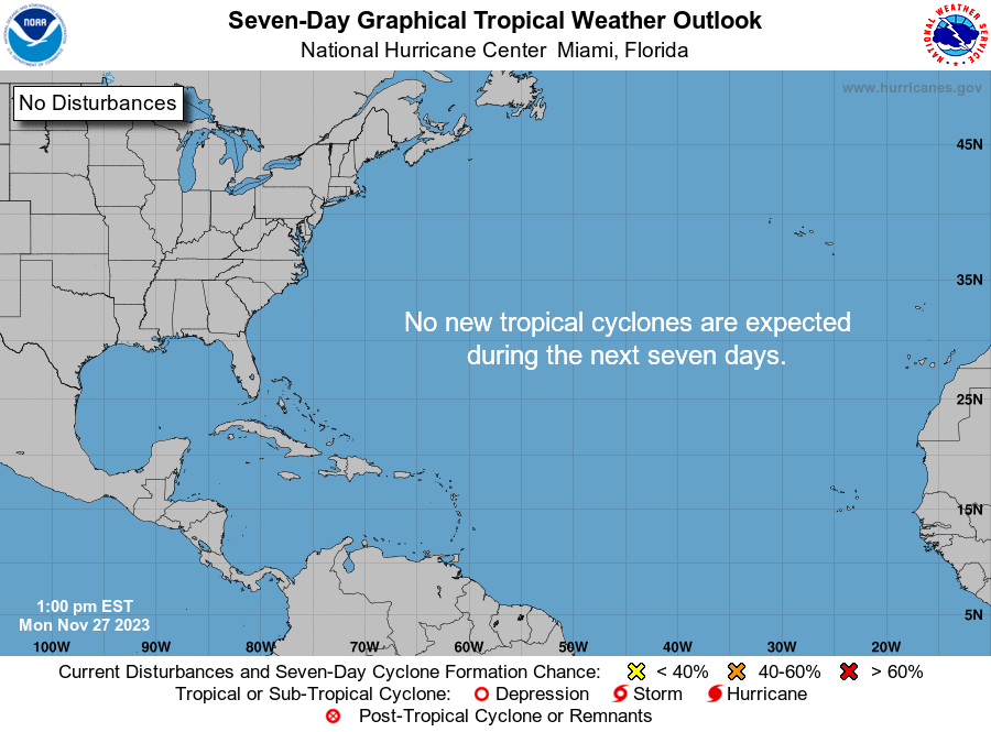
Tropical forecast over the next seven days
Excessive rainfall forecast
What's out there?
Systems currently being monitored by the National Hurricane Center.
What's next?
We will continue to update our tropical weather coverage daily. Download your local site's app to ensure you're always connected to the news. And look at our special subscription offers here.
This article originally appeared on Treasure Coast Newspapers: NHC tracking Idalia, Franklin, Jose, Gert and soon-to-be Katia

