National Hurricane Center tracking newly formed Tropical Storm Tammy. See spaghetti models
Tropical Storm Tammy formed late Wednesday afternoon, according to the latest advisory from the National Hurricane Center.
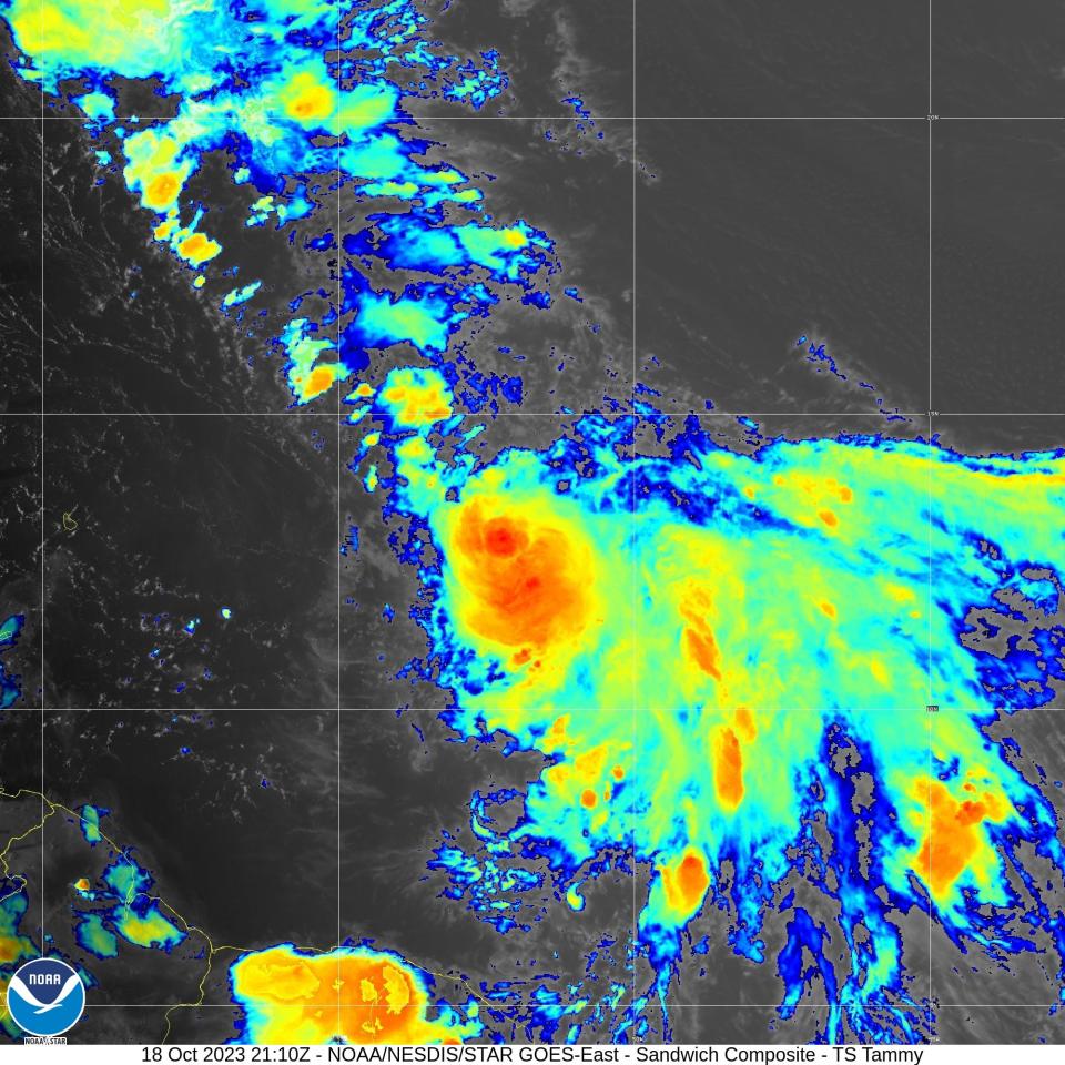
Tammy formed east of the Windward Islands as of the 5 p.m. advisory from the NHC.
Satellite-derived wind data indicated the system was producing tropical-storm-force winds hours before organizing into a tropical storm.
A tropical storm watch is in effect for Barbados, Dominica and Martinique and Guadaloupe.
Where Tammy will go depends on a system of high pressure over the northern Atlantic. Tammy could stay south and head toward the Lesser Antilles or turn toward the north and remain over open waters.
2023 hurricane season: Tammy is born and storm season odds shift in our favor; but a spooky pattern may emerge
Tammy is already farther south than its predecessor, Tropical Storm Sean, and that may lead to impacts in the eastern Caribbean, according to AccuWeather.
The Florida Division of Emergency Management said it is continuing to monitor Tammy for potential impacts to the state.
That leaves two names remaining on the 2023 list of storms: Vince and Whitney. Hurricane season doesn't end until Nov. 30, although storms can and do form any time.
This season has been above the historical average when it comes to named storms. During an average hurricane season, 14 named storms form in the Atlantic basin, which covers the Atlantic Ocean, Caribbean Sea and Gulf of Mexico.
Here's the latest update from the NHC as of 5 p.m.:
Tropical Storm Tammy

Location: 625 miles east of the Windward Islands
Maximum wind speed: 40 mph
Direction: west at 23 mph
At 5 p.m., the center of Tropical Storm Tammy was located near latitude 13.0 North, longitude 51.7 West. Tammy is moving to the west near 23 mph. A westward motion at a slower forward speed is expected through Thursday.
A turn toward the west-northwest is forecast by Thursday night, followed by a turn to the northwest Friday night or Saturday. On the forecast track, the center of Tammy will move near or over the Leeward Islands on Friday and Saturday.
Maximum sustained winds are near 40 mph with higher gusts. Gradual strengthening is forecast during the next couple of days.
Tropical storm-force winds extend outward up to 140 miles to the northeast of the center.
The estimated minimal central pressure is 1007 mb.
Spaghetti models for Tropical Storm Tammy
Special note about spaghetti models: Illustrations include an array of forecast tools and models, and not all are created equal. The hurricane center uses only the top four or five highest performing models to help make its forecasts.
Who is likely to be impacted?
No impacts to Florida or the rest of the U.S. are expected at this time from Tropical Storm Tammy.
Regardless of development, this system has the potential to bring gusty winds, heavy rainfall, and flash flooding to portions of the Lesser Antilles beginning on Friday.
Forecasters urge all residents to continue monitoring the tropics and to always be prepared.
Weather watches and warnings issued in Florida
When is the Atlantic hurricane season?
The Atlantic hurricane season runs from June 1 through Nov. 30.
When is the peak of hurricane season?
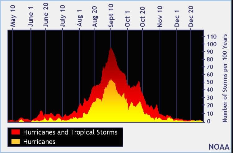
The peak of the season is Sept. 10, with the most activity happening between mid-August and mid-October, according to the Hurricane Center.
Tropical forecast over the next seven days
Excessive rainfall forecast
What's out there?
Systems currently being monitored by the National Hurricane Center.

Noaa
Embedded content: https://www.nhc.noaa.gov/xgtwo/two_atl_0d0.png?052051
What's next?
We will continue to update our tropical weather coverage daily. Download your local site's app to ensure you're always connected to the news. And look at our special subscription offers here.
This article originally appeared on Treasure Coast Newspapers: NHC tracking Tropical Storm Tammy: Florida impact

