NWS: Clinton County storm damage caused by straight-line winds, not tornado
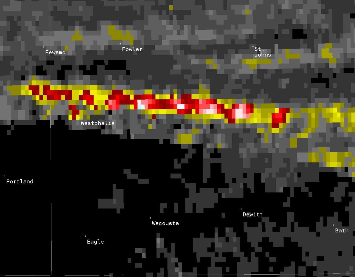
ST. JOHNS – Experts have ruled out a tornado as the cause of damage Monday night north of Lansing but said the same storm spawned a weak tornado on the east side of the state.
National Weather Service investigators searched parts of Clinton County Tuesday morning for evidence of a possible tornado, meteorologist Andrea Thielke said.
7/12/2022 4:00 PM: Here is the precip from the last 24 hours. Several bands of precipitation north of I 96 brought a half an inch to an inch of rain with lower amounts elsewhere. The indicated band of rain is from the storm that caused an EF-0 Near Fenton Lake, MI. pic.twitter.com/5lcZrXwVnR
— NWS Grand Rapids (@NWSGrandRapids) July 12, 2022
NWS issued a tornado warning about 10:15 p.m. Monday, reporting a severe thunderstorm six miles east of Portland moving east at 40 miles per hour.
Investigators searched northwest of Westphalia and the area between St. Johns and DeWitt, the weather service said. They found some tree damage but no evidence that a funnel cloud caused it.
"We're thinking that unless more information comes to light, (the damage) was most likely due to a downburst or straight-line winds," weather service meteorologist Cort Scholten said.
The storm weakened over Shiawassee County but strengthened into an EF-O tornado in southern Genesee County and northern Oakland County, the weather service said.
The tornado's path was 7.5 miles long, beginning near the east shore of Lake Fenton and continuing east to the Holly area. It significantly damaged about a dozen trees and also damaged a few structures, the agency said. The peak wind speed was about 65 m.p.h.
There's a slight chance of showers overnight Tuesday and a decent chance for showers or thunderstorms on Wednesday and Wednesday night, forecasters said.
Contact reporter Jared Weber at 517-582-3937 or jtweber@lsj.com.
This article originally appeared on Lansing State Journal: Clinton County storm damage caused by straight-line winds, not tornado, NWS says

