Tornadoes confirmed in Delaware, Champaign and Crawford counties by National Weather Service

COLUMBUS, Ohio (WCMH) – The National Weather Service (NWS) has confirmed three tornadoes touched down in central Ohio during Wednesday’s severe storms.
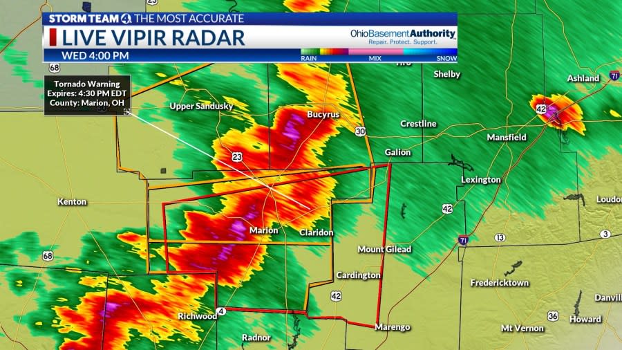
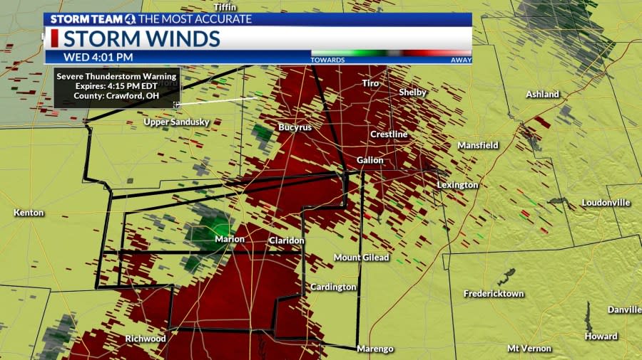
An EF1 tornado touched down on the southwest side of Bucyrus at 4:06 p.m., with maximum winds of 110 mph. The storm traveled 3.48 miles, with a path width up to 100 yards. Emergency crews were dispatched to assist residents, with multiple reports of downed power wires, fallen trees and severe property damage. No injuries were reported.
A weak EF0 storm touched down in eastern Champaign County north of U.S. 36. As the line of strong storms plowed through the Columbus area, an EF1 tornado with 90 mph struck along Fancher Road in southeast Delaware County, between New Albany and Johnstown. Several homes received wind damage.
In Crawford County, the NWS survey reported, “Several large hardwood trees were uprooted, a garage was destroyed, a small trailer rolled, three chimneys were blown down, several large trees were uprooted, and a shed was destroyed near the intersection of Ridge Avenue and Wise Street.”
As the intensifying storm continued northeast through Bucyrus, a house was pushed off its foundation and the post office had roof damage. In the downtown area, the roof of a convenience store collapsed, and the wall of an abandoned plant caved in.
Bucyrus Police Chief R. Thomas Walker said that areas lost power and residents were forced to seek shelter due to high winds, powerful rain and flying debris.
Donovan Lewis’ family sues Columbus police, city for ‘culture of excessive force’
Officers who spoke with residents said several witnesses observed rotation and the touchdown of a tornado. Police were told the tornado tracked from the southwest section of town as it traveled in a northeasterly path through Bucyrus.
Wednesday’s severe storms brought down several trees in Bucyrus, Crawford County. (NBC4) Wednesday’s severe storms brought down several trees in Bucyrus, Crawford County. (NBC4) Wednesday’s severe storms brought down several trees in Bucyrus, Crawford County. (NBC4) Hail fell in Gahanna, Ohio on April 17, 2024. (NBC4 Photo/Brian Hofmann)


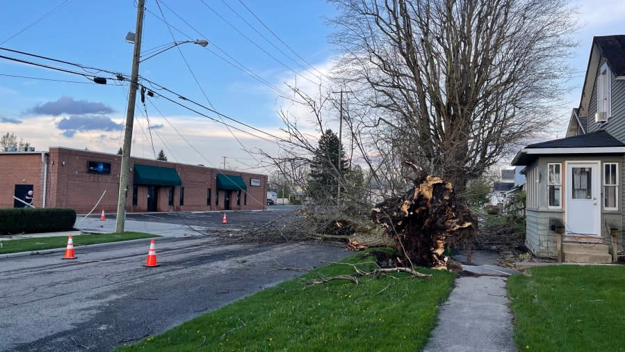


Bucyrus police asked residents not to tamper with power lines or attempt to remove tree limbs from the roads. City crews and American Electric Power teams are working to clear the streets and restore power. It remains unknown how long the process will take, though it was estimated that power would be restored sometime Thursday.
Northern Franklin and southern Delaware counties were under a severe thunderstorm warning until 6:15 p.m., along with portions of Madison and Union counties. A tornado warning was briefly issued for Licking County associated with the tornado that had touched down in southeastern Delaware County, as rotation strengthened west of Johnstown.
Tornadoes were also confirmed by the NWS office in Portage County at Windham (EF1), and in Trumbull County at Champion Heights (EF0) counties during the early evening, as a fierce line of storms barreled east around 50 mph ahead of a cold front.
The storms also produced quarter-sized hail and larger, and wind gusts of 65 mph at Marion and 59 mph at Ohio State University Airport in northwest Columbus.

North Franklinton residents evacuated, exit ramps closed after hazmat situation
This storm system added to an already record spring for severe weather. Thirty tornadoes were confirmed in Ohio between Feb. 28 and Apr. 2, plus at least five tornadoes so far on Apr. 17, as compared to the yearly average of 22.
Storm Team 4 Meteorologist Ben Gelber has experienced more than 40 Ohio springs in his lengthy career, and noted that this is the second year in a row with tornado events in late February and early March, which is unprecedented.
“We’ve never seen so many tornadoes so early in the season. And that is a byproduct of an unusually warm winter. Very mild ground, very warm water in the Gulf of Mexico, historic warmth. The Atlantic is as warm as it is in July, even though we’re only in April. So, you have all the ingredients or fuel for storms that we never see so early in the season,” Gelber said.
For the latest news, weather, sports, and streaming video, head to NBC4 WCMH-TV.

