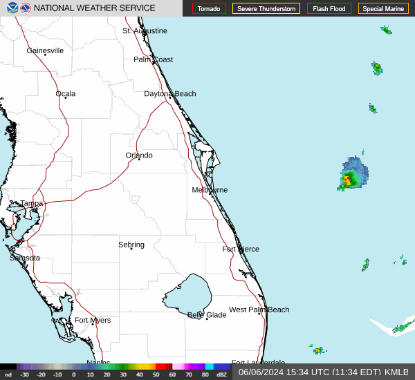
National Weather Service: Expect rain all week in Florida, possible severe thunderstorms
Ophelia skipped past Florida to flood the northeast coast. Philippe looks like it'll head north, and the probable tropical depression coming right behind it may or may not do the same.
But that doesn't mean we won't get wet this week. The entire state is expected to see rainfall through at least Friday, with a chance of severe thunderstorms and some severe thunderstorms "capable of containing intense rainfall rates and frequent lightning," according to the National Weather Service.
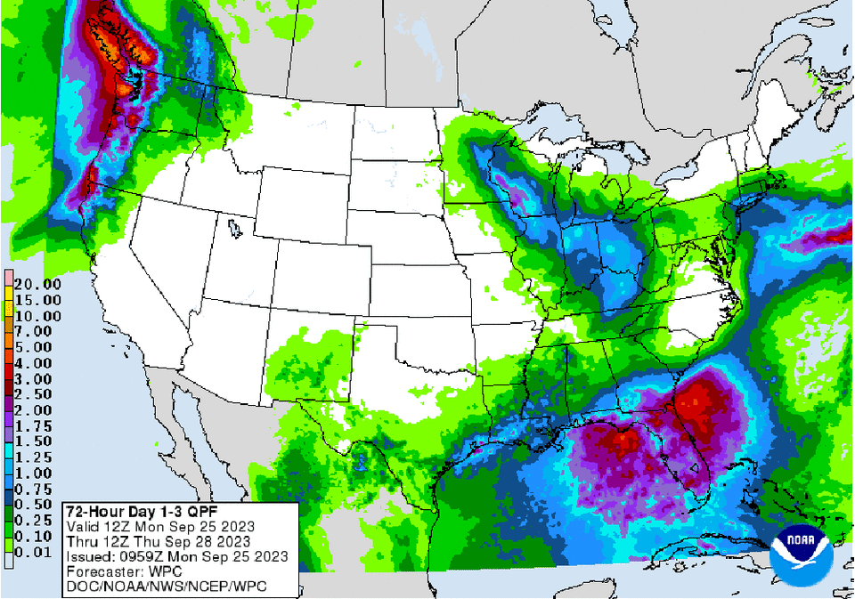
An "unsettled weather pattern" over the Gulf of Mexico and Florida is expected to become more pronounced as the week goes on, leading to shower and thunderstorm activity with a greater chance for excessive rainfall Tuesday and Wednesday over most of Florida and parts of southern Georgia, the NWS said.

Chance of rain, thunderstorms in the Panhandle
There's a slight chance of thunderstorms this evening in parts of north Florida, and then showers all week with a chance of more thunderstorms Wednesday night through Friday, forecasters said.
Northeast Florida weather: Rain, strong thunderstorms forecast
A prelude 2 the wet week ahead, scattered to numerous showers/storms possible over NE FL today. Marion, Putnam, St. Johns & Flagler counties have the highest chances for the strongest storms today. Tues/Wed expected to be the wettest days during the week ahead. #flwx #gawx #jaxwx pic.twitter.com/x0wuZpP9sD
— NWS Jacksonville (@NWSJacksonville) September 25, 2023
For Marion County, Putnam County, St. Johns County and Flagler County weather, those areas have the highest chances for strong storms Monday afternoon and evening, according to the National Weather Service in Jacksonville, and "heavy downpours and strong thunderstorms" Tuesday through Thursday "with 2 to 4" inches of rain and locally higher amounts expected. Duval County is forecast to get rain all week, with chances at 80% to 90%, but no thunderstorms are expected until possibly Friday.
Central Florida weather: Scattered showers, lightning storms
Scattered showers and lightning storms are expected in Central Florida on Monday afternoon and evening, with strong to severe storms possible, 40 mph to 60 mph winds, heavy rainfall, and "an isolated instance or two of large hail," the NWS said. Showers are forecast all week, with an 80% chance most days.
"Storms today will be capable of producing locally heavy rainfall of 2 to 3 inches within 1 to 2 hours," the NWS said "Localized ponding of water on some roadways and standing water in urban and poor drainage areas is possible, especially where repeated episodes of heavy rain occur."
Southeast Florida weather: Rain with possible flooding and hail
MON SEP 25 | The risk for flooding rainfall from storms will increase for all of ECFL this week. Rain chances increase to 60-70% today, and 80-90% Tuesday-Friday. 5-day rainfall totals will average 3-5", however some locations will see several inches more than that. pic.twitter.com/4m4GBBsnna
— NWS Melbourne (@NWSMelbourne) September 25, 2023
The National Weather Service in Melbourne is expecting 3-5 inches of rain in the southeast area through Friday, with locally higher amounts of over 6 inches and the possibility of localized flooding. A hazardous weather outlook for Palm Beach County down to Metropolitan Miami-Dade Monday forecasts scattered thunderstorms until the early evening hours that may bring gusty winds, heavy rain and frequent lightning, with a chance for stronger wind gusts and hail.
Southwest Florida weather forecast
The National Weather Service in Tampa Bay isn't expecting thunderstorms this week for the west coast, but you can expect scattered showers every day through at least Friday.
#flwx pic.twitter.com/yFljtidmTA
— NWS Tampa Bay (@NWSTampaBay) September 25, 2023
The Florida Keys weather: Scattered thunderstorms
Scattered thunderstorms are expected Monday through the evening, with cloud-to-surface lightningstrikes and gusty winds. Isolated to scattered thunderstorms will be possible through the end of the week.
This article originally appeared on The Daytona Beach News-Journal: Florida weather forecast? 'Intense' rain, lightning, possible flooding

