UPDATE: Severe thunderstorm watch for Tri-State into Thursday night
The National Weather Service has issued a severe thunderstorm watch for the Tri-State area into Thursday night and also a wind advisory for much of the area.
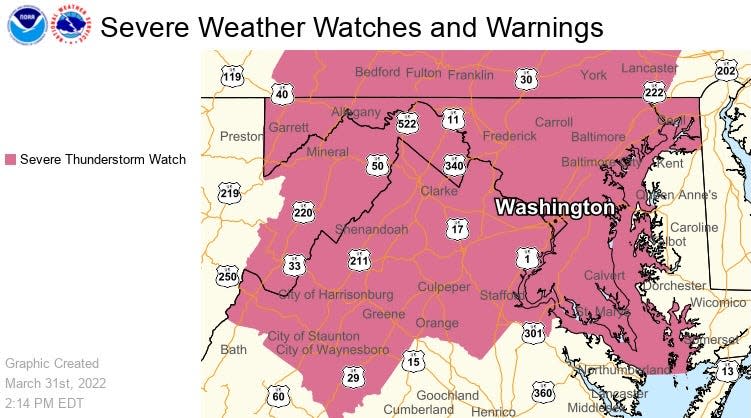
The severe thunderstorm watch is in effect until 10 p.m. Thursday.
A wind advisory, for winds 15 mph to 25 mph and gusts up to 50 mph, has been issued for the Maryland/West Virginia region, including Washington County and Berkeley, Jefferson and Morgan counties in West Virginia, according to the weather service. That advisory is in effect until 8 p.m. Thursday.
Wind gusts could result in isolated tree damage, power outages and unsecured objects being blown around, according to the advisory.
The greatest potential for severe storms is during the late afternoon commute, weather service meteorologists have said.
There's a smaller chance of tornadoes and hail, but the main focus is on the wind threat Thursday, said weather service meteorologists with the Baltimore/Washington and State College, Pa., forecast offices.
"Be alert today," said meteorologist Mike Colbert with the State College, Pa., forecast office.
The greatest potential for severe weather starts around 2 p.m. in the Tri-State area and lasts until around 9 or 10 p.m., meteorologists said.
But the maximum potential for severe weather, when a line of storms could be coming through, is around 4 p.m. to 5 p.m. for West Virginia's Eastern Panhandle and closer to 6 p.m. for the Hagerstown area, said Chesnea Skeen, a meteorologist with the Baltimore-Washington forecast office.
For Franklin and Fulton counties in Pennsylvania, the greatest potential for severe weather is around 6 p.m., Colbert said.
From late afternoon to early evening is when people should be their "most weather aware and on the lookout for any strong storms," Colbert said. It would be good to be able to receive weather warnings issued by the weather service, he said.
While tone alerts are sent to smartphones for tornado warnings and high-end flash flood warnings, those phones don't get warnings for severe thunderstorms unless they have a weather app that delivers warnings, Colbert said. There are many private-sector apps that use weather service data and issue warnings.
The potential for wind gusts is not limited to the thunderstorms.
Could be worse: A look back at blizzards, nor'easters and other major snowstorms in Maryland
On elections: County election board 'in limbo' thanks to redistricting map legal challenges
The Hagerstown area had already had a wind gust of 34 mph at 9:42 a.m., according to local weather observer Greg Keefer's website at i4weather.net.
Peak gusts outside of thunderstorms on Thursday could be from 30 mph to 40 mph, Skeen said. Any storms moving through the area could have localized higher wind gusts.
The weather service hadn't issued a wind advisory as of early Thursday morning. The threshold for a wind advisory is sustained winds of 31 to 39 mph for at least an hour and/or wind gusts of 46 mph to 57 mph, Skeen said.
While a hazardous weather outlook for the Baltimore/Washington region notes hail and a few tornadoes are possible, Skeen said around 9 a.m. that the threat of tornadoes and hail "isn't as significant at this time" as the wind threat. But the potential for a tornado cannot be ruled out, she said.
Colbert said the storm prediction center, as of early Thursday, put the chance of a tornado in Franklin or Fulton counties in Pennsylvania at 2%, but had it slightly higher at 5% for Adams County to the east.
The main concern for local Pennsylvania is wind and localized flooding, Colbert said.
This article originally appeared on The Herald-Mail: National Weather Service cautions of severe weather in Tri-State area

