Newport North End commission starts work. First step? Figuring out where they're working
NEWPORT – The realignment of the Newport Pell Bridge ramps is slated to end in 2024, opening up roughly 25 acres of land in Newport’s North End for possible redevelopment.
While the city has discussed the potential of this land since the ramp project began, there is still a lot that needs to happen before anything is done in that space. To begin with, the city needs to figure out exactly where the borders of this newly freed-up land even are.
“The main point is that we don’t know a lot either, but the pieces are there and we need to put them together,” Ad Hoc Pell Bridge Realignment Property Advisory Commission chair Colin Kane said.
The Newport City Council established the aforementioned commission through a resolution in July that could create a plan for what can be done with the land that is opened up once the Rhode Island Department of Transportation finishes the Pell Bridge project.
Who is on the Pell Bridge Realignment Property Advisory Commission
The commission is led by Kane, a founding member of the real estate advisory firm Peregrine Group and the former chairman of the I-195 Redevelopment Commission, which was established by the state in 2011 for a similar task when Interstate 195 was relocated, freeing up 19 acres of developable land in downtown Providence. The other members appointed to the commission by the City Council are Pawtucket Business Development Corporation Executive Director and former I-195 Commission Executive Director Jan Brodie, Former Rhode Island Infrastructure Bank CEO Jeffrey Diehl, former Newport Planning Board member Tom Gibson, U.S. Navy contractor Roy Lauth and FabNewport Program Director Ellen Pinnock.
Unclear what land is developable
At their second official meeting, which happened on Tuesday, Kane said there does not seem to be a comprehensive packet of information on the project from RIDOT, making it more difficult to assess exactly where the land they are hoping to work on is, and the lack of clarity was shared among the four members present at the meeting.
“I’ve tried to drive it, but I can’t figure out its edges,” Commission member Jan Brodie said.
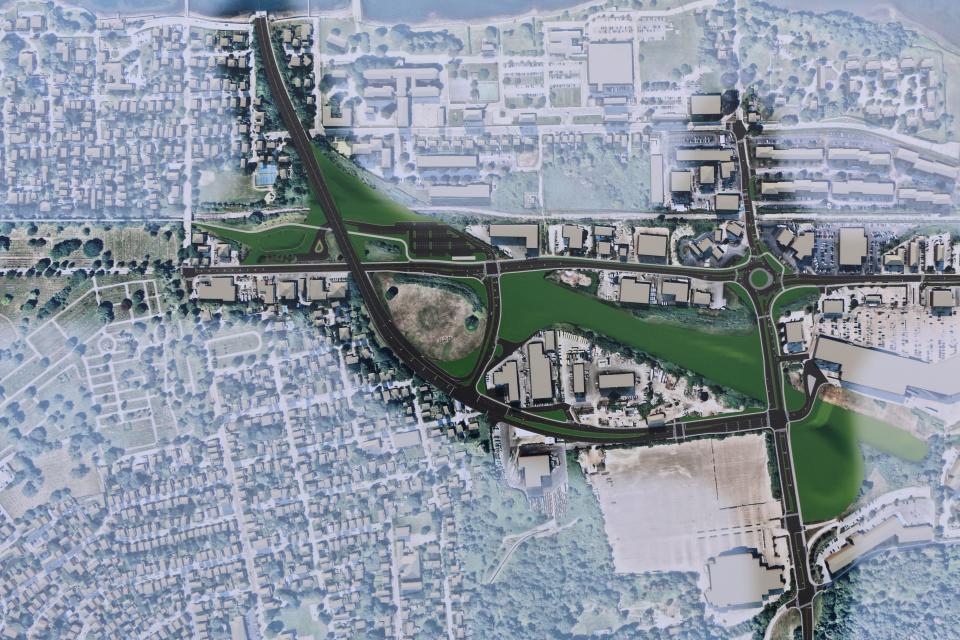
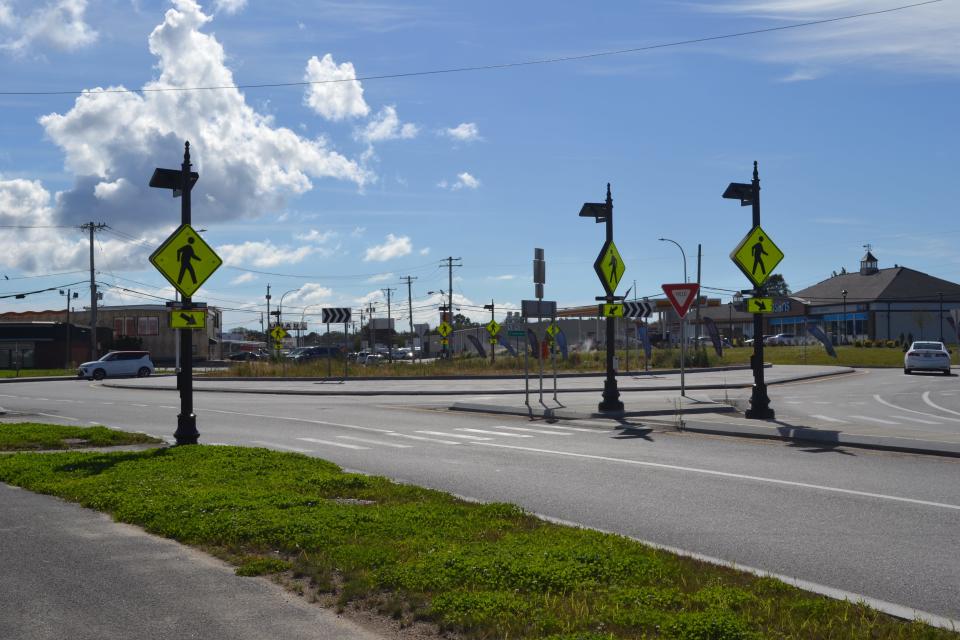
The former presentations RIDOT did on the topic provide some clues to where these boundaries might lie. A simplified rendering of the area highlights the area in front of The Wayfinder Hotel, the land surrounding Route 138’s “highway to nowhere,” a wedge of land in between the newly configured off-ramp and JT Connell Highway, a portion of land near the bridge on-ramp, and the land where the exit to downtown Newport used to be.
However, figuring out the exact plots of land that will be available once the project finishes is crucial to the other items on the commission’s to-do list, as they also need to better understand the condition the land is currently in. This would mean figuring out the history of each parcel and what sat there before the bridge was built in the 1960s. Lauth, who was there when the bridge was being built, said he recalled there were some residential uses, but also industrial buildings, such as an incinerator plant, which would complicate the environmental permitting process for the development of the land down the line.
Who will own available land?
Beyond dealing with the land itself, the commission is also tasked with understanding the legal conditions of the project. The land is currently owned by the state of Rhode Island through RIDOT, so assessing the developability of the property means also understanding what the state’s property disposition process is like and how it will work in this case. Kane said the commission needs to come up with a list of possible situations, including the state retaining ownership of the land or giving it to the city, so it can figure out how to navigate each scenario.
What to know: RIDOT to permanently close Downtown Newport exit from Pell Bridge
As a part of the council’s resolution, the commission is tasked with publishing monthly updates and is supposed to deliver a final Project Execution Plan by no later than June 30, 2025. Kane suggested the commission could give quarterly presentations on the group’s work at City Council meetings. The group will be conducting its own meetings every second Tuesday of the month in 2024.
This article originally appeared on Newport Daily News: Pell Bridge commission begins work on North End redevelopment

