Tropical Storm Debby slowly moving towards the Carolinas
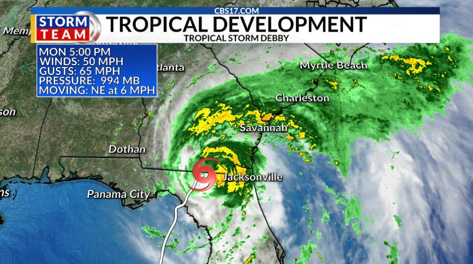
RALEIGH, N.C. (WNCN) — Tropical Storm Debby is a little weaker tonight with sustained winds of 45 miles per hour as of the 11 p.m. advisory from the National Hurricane Center. Debby made landfall in the Big Bend region of Florida as a Category 1 Hurricane with winds of 80 mph Monday morning.
Debby is still a slow-moving storm, now moving to the northeast at 7 miles per hour. Heavy rain from Debby is ongoing across southern Georgia, South Carolina, and the northern half of Florida. Debby is expected to slow down even more over the next day or two.
Rain bands from Debby could reach southeastern North Carolina as soon as Tuesday, but heavy flooding rains would begin later in the day Wednesday and could last through Friday, especially in coastal North Carolina.
It is looking likely that Debby will move back over the waters of the Atlantic off the coast of South Carolina Tuesday into Wednesday, before making a possible second landfall on the northern coast of South Carolina. The time over the water could allow for the storm to gradually strengthen into a strong tropical storm Thursday.
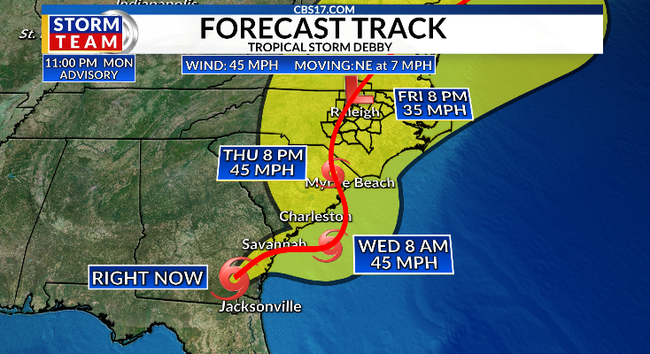
Debby will be a much weaker system when it arrives in Central North Carolina, but multiple days of heavy rainfall will likely result in widespread 2-8″ totals with locally higher amounts.
Soils are already saturated across much of the region, so flooding issues are likely, especially in the Sandhills, where more rain is expected.
Gusty winds could also bring down some trees and powerlines, so outages could become an issue. With all of that being said, the worst impacts will almost certainly be confined along the coast where higher wind speeds and greater rainfall totals will be centralized.

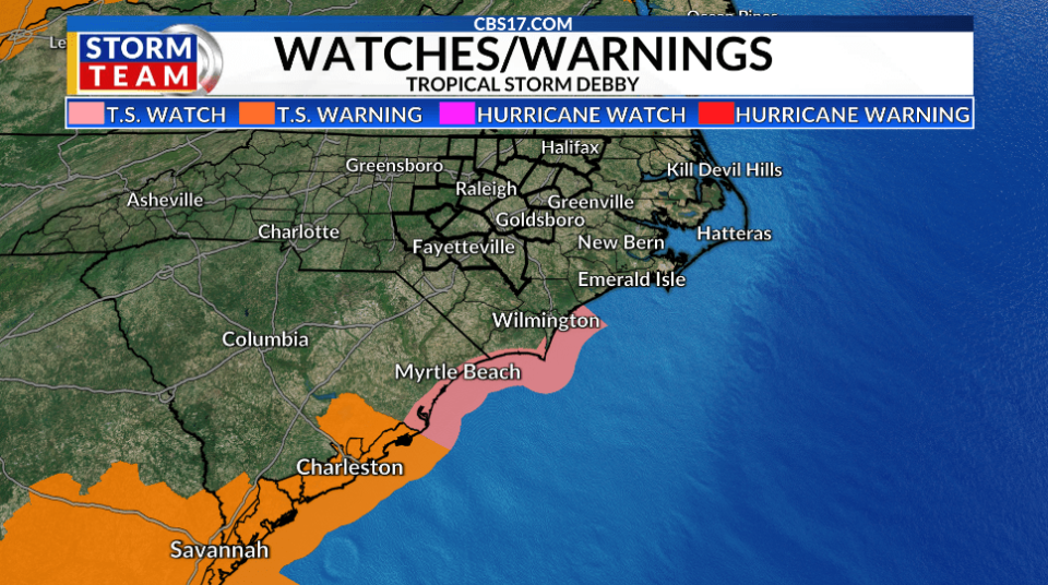
In addition to the rain issues, tropical storm conditions are possible along the coast of North Carolina. A Tropical Storm Watch has been issued for a part of the North Carolina coastline from around Surf City down toward the South Carolina border. A Tropical Storm Watch means tropical storm conditions of sustained winds of 39 to 73 miles per hour are possible within this area in the next 48 hours. A Storm Surge Watch has also been issued for the southern coast of North Carolina as 2 to 4 feet of surge is possible.
For residents in Central North Carolina, a good hurricane preparedness plan includes having an emergency kit ready. This kit could contain non-perishable food, water, medications, flashlights, batteries, and important documents. It’s also wise to have cash on hand, as power outages can make electronic transactions difficult.
Copyright 2024 Nexstar Media, Inc. All rights reserved. This material may not be published, broadcast, rewritten, or redistributed.
For the latest news, weather, sports, and streaming video, head to CBS17.com.

